Topografische kaarten - Frankrijk
De kaarten van IGN (kort voor Institute Geographique National), wandelkaarten voor Frankrijk, zijn van een ongekend hoog niveau. Met name de wandelkaarten 1:25.000 vinden wij geweldig: werkelijk alles staat erop, de kaarten bevatten zeer veel details en het kleurgebruik is fantastisch, waardoor alles ook nog eens heel goed leesbaar. Je hoort het: wij zijn fan van deze kaarten!
 Wandelkaart - Topografische kaart 3531ET Saint-Gervais-les-Bains | IGN - Institut Géographique National★★★★★
 Wandelkaart - Topografische kaart 3531OT Megève | IGN - Institut Géographique National★★★★★
 Wandelkaart - Topografische kaart 3532ET les Arcs - la Plagne | IGN - Institut Géographique National★★★★★
 Wandelkaart - Topografische kaart 3532OT Massif du Beaufortain | IGN - Institut Géographique National★★★★★
 Wandelkaart - Topografische kaart 3535OT Névache - Mont Thabor | IGN - Institut Géographique National★★★★★★★★★★
 Wandelkaart - Topografische kaart 3536OT Briançon | IGN - Institut Géographique National★★★★★★★★★★
 Wandelkaart - Topografische kaart 3537ET Guillestre | IGN - Institut Géographique National★★★★★
 Wandelkaart - Topografische kaart 3538ET Aiguille de Chamberyron | IGN - Institut Géographique National
 Wandelkaart - Topografische kaart 3540ET Haute Vallée du Var | IGN - Institut Géographique National★★★★★
 Wandelkaart - Topografische kaart 3540OT Barcelonnette | IGN - Institut Géographique National
 Wandelkaart - Topografische kaart 3541OT Annot | IGN - Institut Géographique National
 Wandelkaart - Topografische kaart 3542ET Haute Estéron | IGN - Institut Géographique National
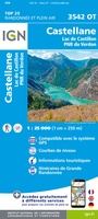 Wandelkaart - Topografische kaart 3542OT Castellane | IGN - Institut Géographique National
 Wandelkaart - Topografische kaart 3543ET Haute Siagne | IGN - Institut Géographique National★★★★★
 Wandelkaart - Topografische kaart 3543OT Draguignan | IGN - Institut Géographique National
 Topografische kaart - Wandelkaart 3544ET Fréjus - Saint-Raphaël | IGN - Institut Géographique National★★★★★
 Wandelkaart - Topografische kaart 3545OT Saint-Tropez - Sainte-Maxime | IGN - Institut Géographique National
 Wandelkaart - Topografische kaart 3613 SB - Serie Bleue Forbach - Sarreguemines | IGN - Institut Géographique National
 Wandelkaart - Topografische kaart 3613ET Sarreguemines | IGN - Institut Géographique National
 Wandelkaart - Topografische kaart 3614ET Sarre-Union - Phalsbourg | IGN - Institut Géographique National
Laatste reviews

Ik gebruik deze kaart omdat ik een reis wil volgen van meerdere personen. Heb er veel plezier van.
★★★★★ door Loes Vechtmann 15 april 2026 | Heeft dit artikel gekocht
Dit boek heeft me veel inzicht gegeven hoe om te gaan met jezelf in de wildernis. Een fijn, kwetsbaar en oprecht geschreven boek met veel …
★★★★★ door Arnold Jippes 15 april 2026 | Heeft dit artikel gekocht
The DK Eyewitness travel guide for Florence & Tuscany is an excellent guide with lots of details, including helpful photographs maps and diagrams of the …
★★★★★ door Andrew Wedgner 15 april 2026 | Heeft dit artikel gekocht
Wij zijn nu aan het reizen in zuid-west Australië. De kaart is heel goed te gebruiken. Blij mee!
★★★★★ door Wilma van der Maas 15 april 2026 | Heeft dit artikel gekocht