Topografische kaarten - Frankrijk
De kaarten van IGN (kort voor Institute Geographique National), wandelkaarten voor Frankrijk, zijn van een ongekend hoog niveau. Met name de wandelkaarten 1:25.000 vinden wij geweldig: werkelijk alles staat erop, de kaarten bevatten zeer veel details en het kleurgebruik is fantastisch, waardoor alles ook nog eens heel goed leesbaar. Je hoort het: wij zijn fan van deze kaarten!
 Wandelkaart - Topografische kaart 1919 SB - Serie Bleue St-Calais - Droué | IGN - Institut Géographique National
 Wandelkaart - Topografische kaart 1920 SB - Serie Bleue Vendome, Montoire-sur-le-Loir | IGN - Institut Géographique National
 Wandelkaart - Topografische kaart 1921 SB - Serie Bleue Château-Renault, St-Amand-Longpré | IGN - Institut Géographique National
 Wandelkaart - Topografische kaart 1922 SB - Serie Bleue Amboise, Montlouis-sur-Loire | IGN - Institut Géographique National
 Wandelkaart - Topografische kaart 1923 SB - Serie Bleue Bléré - Chenonceaux - Veigné | IGN - Institut Géographique National
 Wandelkaart - Topografische kaart 1924 SB - Serie Bleue Loches - Ligueil | IGN - Institut Géographique National
 Wandelkaart - Topografische kaart 1925 SB - Serie Bleue Preuilly-sur-Claise, le Grand-Pressigny | IGN - Institut Géographique National
 Wandelkaart - Topografische kaart 1926 SB - Serie Bleue Le Blanc, Pleumartin, La Roche-Posay | IGN - Institut Géographique National
 Wandelkaart - Topografische kaart 1927 SB - Serie Bleue La Trimouille | IGN - Institut Géographique National
 Wandelkaart - Topografische kaart 1928 SB - Serie Bleue Montmorillon, Lathus-St-Rémy | IGN - Institut Géographique National
 Wandelkaart - Topografische kaart 1929 SB - Serie Bleue Bellac - Adriers | IGN - Institut Géographique National
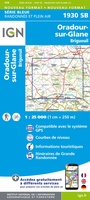 Wandelkaart - Topografische kaart 1930 SB - Serie Bleue Oradour-sur-Glane | IGN - Institut Géographique National
 Wandelkaart - Topografische kaart 1931 SB - Serie Bleue Rochechouart | IGN - Institut Géographique National
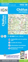 Wandelkaart - Topografische kaart 1932 SB - Serie Bleue Châlus - St-Mathieu | IGN - Institut Géographique National
 Wandelkaart - Topografische kaart 1933 SB - Serie Bleue Thiviers, St-Pardoux-la-Rivière | IGN - Institut Géographique National
 Wandelkaart - Topografische kaart 1934 SB - Serie Bleue Excideuil - Périgueux | IGN - Institut Géographique National
 Wandelkaart - Topografische kaart 1935 SB - Serie Bleue Vergt | IGN - Institut Géographique National
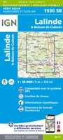 Wandelkaart - Topografische kaart 1936 SB - Serie Bleue Lalinde, le Buisson-de-Cadouin | IGN - Institut Géographique National
 Wandelkaart - Topografische kaart 1936ET Les Eyzies, St.-Cyprien, le Bugue, Beynac | IGN - Institut Géographique National★★★★★
 Wandelkaart - Topografische kaart 1937 SB - Serie Bleue Belves, Beaumont-du-Périgord | IGN - Institut Géographique National★★★★★
Laatste reviews

Review van mijn vriendin. Heel mooi boek met gedetailleerde informatie over waar je op welk moment de foto's kan maken die je zou willen. Zelfs …
★★★★★ door Tony Everaert 17 januari 2026 | Heeft dit artikel gekocht
Precies wat ik zocht
★★★★★ door Hans Linneman 16 januari 2026 | Heeft dit artikel gekocht
Het is een zeer gedetailleerde landkaart, zoals ook door de Zwerver duidelijk omschreven. Zal voor mijn vakantie met een huurauto zeer nuttig zijn. De levering …
★★★★★ door Jeroen 16 januari 2026 | Heeft dit artikel gekocht
Mooi uitgevoerd en fijn. Bij elke wandeling niet alleen een kaartje en routebeschrijving, maar ook achtergrondinformatie en informatie over de natuur. Bevat dus echt korte …
★★★★★ door Arjan de Jong 15 januari 2026 | Heeft dit artikel gekocht