Topografische kaarten - Frankrijk
De kaarten van IGN (kort voor Institute Geographique National), wandelkaarten voor Frankrijk, zijn van een ongekend hoog niveau. Met name de wandelkaarten 1:25.000 vinden wij geweldig: werkelijk alles staat erop, de kaarten bevatten zeer veel details en het kleurgebruik is fantastisch, waardoor alles ook nog eens heel goed leesbaar. Je hoort het: wij zijn fan van deze kaarten!
 Wandelkaart - Topografische kaart 1844 SB - Serie Bleue Mirande - Masseube | IGN - Institut Géographique National
 Wandelkaart - Topografische kaart 1845 SB - Serie Bleue Boulogne-sur-Gesse | IGN - Institut Géographique National
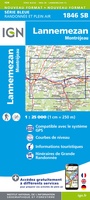 Wandelkaart - Topografische kaart 1846 SB - Serie Bleue Lannemezan | IGN - Institut Géographique National
 Wandelkaart - Topografische kaart 1847OT Saint Bertrand de Comminges, Arreau | IGN - Institut Géographique National
 Wandelkaart - Topografische kaart 1848OT Bagnères de Luchon, | IGN - Institut Géographique National★★★★★
 Topografische kaart - Wandelkaart 1909OT St-Valery-en-Caux | IGN - Institut Géographique National★★★★★★★★★★
 Wandelkaart - Topografische kaart 1910 SB - Serie Bleue Yvetot | IGN - Institut Géographique National
 Wandelkaart - Topografische kaart 1911ET Rouen, Forets Rouennaises, PNR | IGN - Institut Géographique National
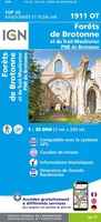 Wandelkaart - Topografische kaart 1911OT Forets De Brotonne | IGN - Institut Géographique National
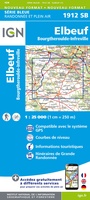 Topografische kaart - Wandelkaart 1912 SB - Serie Bleue Elbeuf | IGN - Institut Géographique National
 Wandelkaart - Topografische kaart 1913 SB - Serie Bleue Evreux - Conches-en-Ouche | IGN - Institut Géographique National
 Wandelkaart - Topografische kaart 1914 SB - Serie Bleue Breteuil – La Neuve-Lyre | IGN - Institut Géographique National
 Wandelkaart - Topografische kaart 1915 SB - Serie Bleue Verneuil-sur-Avre, Bourth | IGN - Institut Géographique National
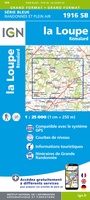 Wandelkaart - Topografische kaart 1916 SB - Serie Bleue La Loupe - Rémalard | IGN - Institut Géographique National
 Wandelkaart - Topografische kaart 1917 SB - Serie Bleue Nogent-le-Rotrou, Thiron-Gardais | IGN - Institut Géographique National
 Wandelkaart - Topografische kaart 1918 SB - Serie Bleue Authon-du-Perche, La Bazoche-Gouet | IGN - Institut Géographique National
 Wandelkaart - Topografische kaart 1919 SB - Serie Bleue St-Calais - Droué | IGN - Institut Géographique National
 Wandelkaart - Topografische kaart 1920 SB - Serie Bleue Vendome, Montoire-sur-le-Loir | IGN - Institut Géographique National
 Wandelkaart - Topografische kaart 1921 SB - Serie Bleue Château-Renault, St-Amand-Longpré | IGN - Institut Géographique National
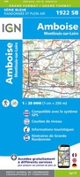 Wandelkaart - Topografische kaart 1922 SB - Serie Bleue Amboise, Montlouis-sur-Loire | IGN - Institut Géographique National
Laatste reviews

Snelle levering, prima verpakt, en de atlas van Duitsland is precies wat ik had verwacht, heel erg goed.
★★★★★ door Wil Van der Vlist 01 april 2026 | Heeft dit artikel gekocht
Vlotte service en prima kaart van Slovenie
★★★★★ door Bert van Jaarsveld 31 maart 2026 | Heeft dit artikel gekocht
132 dagen GR20 in het voorjaar en alles zelf meenemen, betekent dat iedere gram telt. Deze kaart geeft een mooi overzicht van de hele route …
★★★★★ door Martin-Jan Strebe 31 maart 2026 | Heeft dit artikel gekocht
Vandaag bijkomen van de Fishermanstrail! Heb het boekje regelmatig erbij gepakt. De route staat duidelijk aangegeven en daarvoor het boek niet nodig. Wat prettig is …
★★★★★ door Inge Hendriks 31 maart 2026 | Heeft dit artikel gekocht