Topografische kaarten - Frankrijk
De kaarten van IGN (kort voor Institute Geographique National), wandelkaarten voor Frankrijk, zijn van een ongekend hoog niveau. Met name de wandelkaarten 1:25.000 vinden wij geweldig: werkelijk alles staat erop, de kaarten bevatten zeer veel details en het kleurgebruik is fantastisch, waardoor alles ook nog eens heel goed leesbaar. Je hoort het: wij zijn fan van deze kaarten!
 Topografische kaart - Wandelkaart 2818 SB - Serie Bleue Bouilly | IGN - Institut Géographique National
 Topografische kaart - Wandelkaart 2819 SB - Serie Bleue Chaource | IGN - Institut Géographique National
 Wandelkaart - Topografische kaart 282 Martigny | Swisstopo
 Topografische kaart - Wandelkaart 2820 SB - Serie Bleue Tonnerre | IGN - Institut Géographique National
 Topografische kaart - Wandelkaart 2821 SB - Serie Bleue L'Isle-sur-Serein | IGN - Institut Géographique National★★★★★
 Topografische kaart - Wandelkaart 2823ET Saulieu - Lac de Settons | IGN - Institut Géographique National★★★★★
 Wandelkaart - Topografische kaart 2824OT Autun - Mont Beuvray | IGN - Institut Géographique National★★★★★
 Wandelkaart - Topografische kaart 2826 SB - Serie Bleue Luzy, Toulon-sur-Arroux | IGN - Institut Géographique National
 Wandelkaart - Topografische kaart 2827 SB - Serie Bleue Paray-le-Monial | IGN - Institut Géographique National
 Wandelkaart - Topografische kaart 2828 SB - Serie Bleue Charolles | IGN - Institut Géographique National★★★★★
 Wandelkaart - Topografische kaart 2829 SB - Serie Bleue Charlieu – Chauffailles | IGN - Institut Géographique National
 Wandelkaart - Topografische kaart 2830 SB - Serie Bleue Roanne – Thizy-les-Bourgs | IGN - Institut Géographique National
 Wandelkaart - Topografische kaart 2831 SB - Serie Bleue Feurs – Boën-sur-Lignon | IGN - Institut Géographique National
 Wandelkaart - Topografische kaart 2832 SB - Serie Bleue Montbrison - Veauche | IGN - Institut Géographique National
 Wandelkaart - Topografische kaart 2833 SB - Serie Bleue Firminy, St-Bonnet-le-Château | IGN - Institut Géographique National
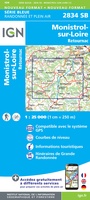 Wandelkaart - Topografische kaart 2834 SB - Serie Bleue Monistrol-sur-Loire, Retournac | IGN - Institut Géographique National
 Wandelkaart - Topografische kaart 2837OT Lac d'Issarlès - Thueyts | IGN - Institut Géographique National
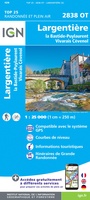 Wandelkaart - Topografische kaart 2838OT Largentière | IGN - Institut Géographique National★★★★★
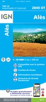 Wandelkaart - Topografische kaart 2840OT Ales | IGN - Institut Géographique National
 Wandelkaart - Topografische kaart 2841OT SB - Serie Bleue Vézénobres | IGN - Institut Géographique National
Laatste reviews

Rother wandelgidsen stellen nooit teleur. Mooie routes, goede opgave kilometers, hoogtemeters en horeca. Een aanrader!
★★★★★ door Anita Geel 13 januari 2026 | Heeft dit artikel gekocht
Mooi boek met prachtige foto’s! Voldoet helemaal aan mijn verwachtingen.
★★★★★ door Hans Eldering 13 januari 2026 | Heeft dit artikel gekocht
het product voldeed aan mijn verwachtingen en was geplastificeerd wat natuurlijk perfect is voor kaart die veel wordt geraadpleegd!
★★★★★ door Peter Lantinga 13 januari 2026 | Heeft dit artikel gekocht
Ik heb de wegenkaart Maleisië aangeschaft om zelf een rondreis per huurauto te kunnen plannen. Deze kaart heeft daar heel goed bij geholpen doordat er …
★★★★★ door M. Rizvi 13 januari 2026 | Heeft dit artikel gekocht