Topografische kaarten - Frankrijk
De kaarten van IGN (kort voor Institute Geographique National), wandelkaarten voor Frankrijk, zijn van een ongekend hoog niveau. Met name de wandelkaarten 1:25.000 vinden wij geweldig: werkelijk alles staat erop, de kaarten bevatten zeer veel details en het kleurgebruik is fantastisch, waardoor alles ook nog eens heel goed leesbaar. Je hoort het: wij zijn fan van deze kaarten!
 Topografische kaart - Wandelkaart 0515ET St-Pol-de-Léon | IGN - Institut Géographique National
 Wandelkaart - Topografische kaart 0517OT Plougastel, Daoulas, Le Faou, PNR D'Armorique | IGN - Institut Géographique National
 Wandelkaart - Topografische kaart 0518OT Chateaulin, Douarnenez, Locronan, Ménez Hom, Le Faou | IGN - Institut Géographique National
 Wandelkaart - Topografische kaart 0519ET Quimper, Concarneau, Fouesnant, Beg-Meil, iles de Glénan | IGN - Institut Géographique National
 Wandelkaart - Topografische kaart 0519OT Pont l Abbé, Pointe de Penmarc h, Plogastel-St.-Germain, Plonéour-Lanvern | IGN - Institut Géographique National★★★★★
 Wandelkaart - Topografische kaart 0615ET Morlaix, Lanmeur, Plougasnou, Taule, Plestin-les-Greves | IGN - Institut Géographique National★★★★★
 Wandelkaart - Topografische kaart 0620ET Quimperlé, Pont-Aven, Tregunc, Bannalec, Clohars-Carnoët | IGN - Institut Géographique National★★★★★
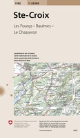 Wandelkaart - Topografische kaart 1182 Ste-Croix | Swisstopo
 Wandelkaart - Topografische kaart 1201 Mouthe | Swisstopo
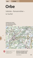 Wandelkaart - Topografische kaart 1202 Orbe | Swisstopo
 Wandelkaart - Topografische kaart 1210OT Cherbourg-en-Cotentin, Cap de la Hague | IGN - Institut Géographique National
 Wandelkaart - Topografische kaart 1211OT Les Pieux, Barneville, Carteret | IGN - Institut Géographique National
 Topografische kaart - Wandelkaart 1212ET La Haye-du-Puits / Lessay | IGN - Institut Géographique National
 Wandelkaart - Topografische kaart 1214ET Granville, Coutances, Iles Chausey | IGN - Institut Géographique National
 Wandelkaart - Topografische kaart 1217 SB - Serie Bleue Combourg – St-Aubin-d'Aubigné | IGN - Institut Géographique National
 Wandelkaart - Topografische kaart 1219 SB - Serie Bleue Bruz - Janzé | IGN - Institut Géographique National
 Wandelkaart - Topografische kaart 1221 SB - Serie Bleue Guémené – Penfao – Nozay | IGN - Institut Géographique National
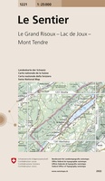 Wandelkaart - Topografische kaart 1221 Le Sentier | Swisstopo
 Wandelkaart - Topografische kaart 1222 SB - Serie Bleue Blain - Nort-sur-Erdre | IGN - Institut Géographique National
 Topografische kaart - Wandelkaart 1223 SB - Serie Bleue Nantes - St Herblain | IGN - Institut Géographique National
Laatste reviews

Deze gids bevat een schat an informatie over talloze rondwandelingen langs de Jurassic Coast, met veel aandacht voor de geologische aspecten van deze kust. De …
★★★★★ door Raymond Franssen 13 juni 2026 | Heeft dit artikel gekocht
In deze nieuwe uitgave ontbreekt de routebeschrijving. Het bevat daar ipv veel info over de omgeving. Dat is leuk. De route is goed te wandelen …
★★★★★ door Irma Smit 13 juni 2026 | Heeft dit artikel gekocht
Duidelijke kaart voor gebied te verkennen met Moto
★★★★★ door Van Puymbroeck René 12 juni 2026 | Heeft dit artikel gekocht
Goede leesbare kaart inclusief route suggesties. Heb alleen op de kaart gelopen, zonder mobiele apparatuur. Heel goed te doen.
★★★★★ door Nick 10 juni 2026 | Heeft dit artikel gekocht