Winkelwagen
Geen items in winkelwagen
Ga naar winkelwagen
Topografische kaarten - Frankrijk
De kaarten van IGN (kort voor Institute Geographique National), wandelkaarten voor Frankrijk, zijn van een ongekend hoog niveau. Met name de wandelkaarten 1:25.000 vinden wij geweldig: werkelijk alles staat erop, de kaarten bevatten zeer veel details en het kleurgebruik is fantastisch, waardoor alles ook nog eens heel goed leesbaar. Je hoort het: wij zijn fan van deze kaarten!
 Wandelkaart - Topografische kaart 0419ET Audierne, Pointe du Raz, Pont-Croix,Plouhinec, Plozévet | IGN - Institut Géographique National
 Topografische kaart - Wandelkaart 0515ET St-Pol-de-Léon | IGN - Institut Géographique National
 Wandelkaart - Topografische kaart 0517OT Plougastel, Daoulas, Le Faou, PNR D'Armorique | IGN - Institut Géographique National
 Wandelkaart - Topografische kaart 0518OT Chateaulin, Douarnenez, Locronan, Ménez Hom, Le Faou | IGN - Institut Géographique National
 Wandelkaart - Topografische kaart 0519ET Quimper, Concarneau, Fouesnant, Beg-Meil, iles de Glénan | IGN - Institut Géographique National
 Wandelkaart - Topografische kaart 0519OT Pont l Abbé, Pointe de Penmarc h, Plogastel-St.-Germain, Plonéour-Lanvern | IGN - Institut Géographique National★★★★★
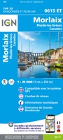 Wandelkaart - Topografische kaart 0615ET Morlaix, Lanmeur, Plougasnou, Taule, Plestin-les-Greves | IGN - Institut Géographique National★★★★★
 Wandelkaart - Topografische kaart 0620ET Quimperlé, Pont-Aven, Tregunc, Bannalec, Clohars-Carnoët | IGN - Institut Géographique National★★★★★
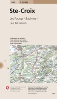 Wandelkaart - Topografische kaart 1182 Ste-Croix | Swisstopo
 Wandelkaart - Topografische kaart 1201 Mouthe | Swisstopo
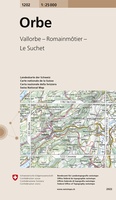 Wandelkaart - Topografische kaart 1202 Orbe | Swisstopo
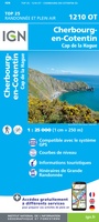 Wandelkaart - Topografische kaart 1210OT Cherbourg-en-Cotentin, Cap de la Hague | IGN - Institut Géographique National
 Wandelkaart - Topografische kaart 1211OT Les Pieux, Barneville, Carteret | IGN - Institut Géographique National
 Topografische kaart - Wandelkaart 1212ET La Haye-du-Puits / Lessay | IGN - Institut Géographique National
 Wandelkaart - Topografische kaart 1214ET Granville, Coutances, Iles Chausey | IGN - Institut Géographique National
 Wandelkaart - Topografische kaart 1215ET Avranches, Granville, Le Mont Saint Michel | IGN - Institut Géographique National
 Wandelkaart - Topografische kaart 1215OT Le Mont St.-Michel, Dol-de-Bretagne | IGN - Institut Géographique National
 Wandelkaart - Topografische kaart 1216 SB - Serie Bleue Dol-de-Bretagne | IGN - Institut Géographique National
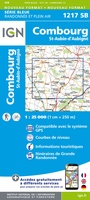 Wandelkaart - Topografische kaart 1217 SB - Serie Bleue Combourg – St-Aubin-d'Aubigné | IGN - Institut Géographique National
 Wandelkaart - Topografische kaart 1219 SB - Serie Bleue Bruz - Janzé | IGN - Institut Géographique National
Laatste reviews

Super!
Super, en snel verzonden !
★★★★★ door Miriam 23 juni 2026 | Heeft dit artikel gekocht
Kwaliteit zoals verwacht
Eens met de beschrijving van het product. De schaal van 1:150.000 vind ik zeer prettig als automobilist. Als fietser zou ik een kleinere schaal prefereren. …
★★★★★ door Joop van Meer 23 juni 2026 | Heeft dit artikel gekocht
Super handig om mijn stad te verkennen
Super handig om mijn stad te verkennen met al zijn opbrekingen erop!
★★★★★ door Yolande Selter 23 juni 2026 | Heeft dit artikel gekocht
Prima kaart van baltische landen
Prima kaart van Baltische landen gekocht. Erg jammer dat de winkel dicht is!
★★★★★ door Henk 21 juni 2026 | Heeft dit artikel gekocht