Topografische kaarten - Frankrijk
De kaarten van IGN (kort voor Institute Geographique National), wandelkaarten voor Frankrijk, zijn van een ongekend hoog niveau. Met name de wandelkaarten 1:25.000 vinden wij geweldig: werkelijk alles staat erop, de kaarten bevatten zeer veel details en het kleurgebruik is fantastisch, waardoor alles ook nog eens heel goed leesbaar. Je hoort het: wij zijn fan van deze kaarten!
 Wandelkaart - Topografische kaart 2214ET Versailles, Forêts de Marly et de St-Germain | IGN - Institut Géographique National
 Wandelkaart - Topografische kaart 2216ET Etampes, Dourdan | IGN - Institut Géographique National
 Wandelkaart - Topografische kaart 2217 SB - Serie Bleue Méréville - Sainville | IGN - Institut Géographique National
 Wandelkaart - Topografische kaart 2218 SB - Serie Bleue Pithiviers, Neuville-aux-Bois, Artenay | IGN - Institut Géographique National
 Wandelkaart - Topografische kaart 2219 SB - Serie Bleue Orléans - Fay aux Loges | IGN - Institut Géographique National
 Wandelkaart - Topografische kaart 222 Clos du Doubs | Swisstopo
 Wandelkaart - Topografische kaart 2220 SB - Serie Bleue Jargeau, Olivet, La Ferté-St-Aubin | IGN - Institut Géographique National
 Wandelkaart - Topografische kaart 2221 SB - Serie Bleue Lamotte-Beuvron | IGN - Institut Géographique National
 Topografische kaart - Wandelkaart 2222 SB - Serie Bleue Salbris | IGN - Institut Géographique National
 Wandelkaart - Topografische kaart 2224 SB - Serie Bleue Vatan, Charost | IGN - Institut Géographique National
 Wandelkaart - Topografische kaart 2008OT Dieppe - Envermeu - Fresnoy - Folny | IGN - Institut Géographique National★★★★★★★★★★
 Topografische kaart - Wandelkaart 2009OT Forêt d'Eawy, Neufchâtel-en-Bray | IGN - Institut Géographique National★★★★★
 Wandelkaart - Topografische kaart 2010 SB - Serie Bleue Saint-Saëns | IGN - Institut Géographique National
 Wandelkaart - Topografische kaart 2011 SB - Serie Bleue Fleury-sur-Andelle | IGN - Institut Géographique National
 Wandelkaart - Topografische kaart 2012OT Foret De Bord-Louviers | IGN - Institut Géographique National
 Wandelkaart - Topografische kaart 2013 SB - Serie Bleue Evreux - Vernon - Pacy-sur-Eure | IGN - Institut Géographique National★★★★★
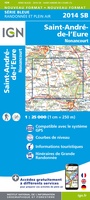 Wandelkaart - Topografische kaart 2014 SB - Serie Bleue Saint-André-de-l'Eure, Nonancourt | IGN - Institut Géographique National
 Wandelkaart - Topografische kaart 2015 SB - Serie Bleue Dreux - Nonancourt | IGN - Institut Géographique National
 Wandelkaart - Topografische kaart 2016 SB - Serie Bleue Chartres, Courville-sur-Eure | IGN - Institut Géographique National
 Wandelkaart - Topografische kaart 2017 SB - Serie Bleue Illiers-Combray, Bailleau-le-Pin | IGN - Institut Géographique National
Laatste reviews

Snelle levering, prima verpakt, en de atlas van Duitsland is precies wat ik had verwacht, heel erg goed.
★★★★★ door Wil Van der Vlist 01 april 2026 | Heeft dit artikel gekocht
Vlotte service en prima kaart van Slovenie
★★★★★ door Bert van Jaarsveld 31 maart 2026 | Heeft dit artikel gekocht
132 dagen GR20 in het voorjaar en alles zelf meenemen, betekent dat iedere gram telt. Deze kaart geeft een mooi overzicht van de hele route …
★★★★★ door Martin-Jan Strebe 31 maart 2026 | Heeft dit artikel gekocht
Vandaag bijkomen van de Fishermanstrail! Heb het boekje regelmatig erbij gepakt. De route staat duidelijk aangegeven en daarvoor het boek niet nodig. Wat prettig is …
★★★★★ door Inge Hendriks 31 maart 2026 | Heeft dit artikel gekocht