Topografische kaarten - Frankrijk
De kaarten van IGN (kort voor Institute Geographique National), wandelkaarten voor Frankrijk, zijn van een ongekend hoog niveau. Met name de wandelkaarten 1:25.000 vinden wij geweldig: werkelijk alles staat erop, de kaarten bevatten zeer veel details en het kleurgebruik is fantastisch, waardoor alles ook nog eens heel goed leesbaar. Je hoort het: wij zijn fan van deze kaarten!
 Wandelkaart - Topografische kaart 3224 Dole | IGN - Institut Géographique National
 Wandelkaart - Topografische kaart 3225 SB - Serie Bleue Poligny, Chaussin | IGN - Institut Géographique National
 Topografische kaart - Wandelkaart 3226ET Lons-le-Saunier / Poligny / Reculée de Baume | IGN - Institut Géographique National
 Wandelkaart - Topografische kaart 3227OT Saint Amour | IGN - Institut Géographique National
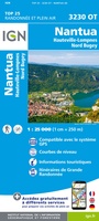 Wandelkaart - Topografische kaart 3230OT Nantua - Hauteville-Lompnes - Nord Bugey | IGN - Institut Géographique National
 Wandelkaart - Topografische kaart 3231OT Ambérieu-en-Bugey | IGN - Institut Géographique National
 Wandelkaart - Topografische kaart 3232 SB - Serie Bleue la Tour-du-Pin | IGN - Institut Géographique National
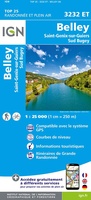 Wandelkaart - Topografische kaart 3232ET Belley | IGN - Institut Géographique National
 Wandelkaart - Topografische kaart 3235OT Autrans | IGN - Institut Géographique National★★★★★
 Wandelkaart - Topografische kaart 3237OT Glandasse | IGN - Institut Géographique National
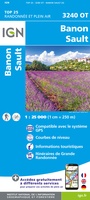 Wandelkaart - Topografische kaart 3240OT Banon - Sault | IGN - Institut Géographique National★★★★★
 Wandelkaart - Topografische kaart 3242OT Apt | IGN - Institut Géographique National
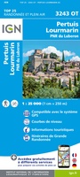 Wandelkaart - Topografische kaart 3243OT Pertuis - Lourmarin | IGN - Institut Géographique National★★★★★
 Wandelkaart - Topografische kaart 3244ET Montagne - Sainte-Victoire | IGN - Institut Géographique National★★★★★
 Topografische kaart - Wandelkaart 3245ET Aubagne - La Ciotat | IGN - Institut Géographique National★★★★★
 Wandelkaart - Topografische kaart 2225 SB - Serie Bleue Issoudun, Neuvy-Paillouxt | IGN - Institut Géographique National
 Wandelkaart - Topografische kaart 2226 SB - Serie Bleue Ardentes - La Berthenoux | IGN - Institut Géographique National
 Wandelkaart - Topografische kaart 2227 SB - Serie Bleue La Châtre, Neuvy-St-Sépulchre | IGN - Institut Géographique National★★★★★
 Wandelkaart - Topografische kaart 2228 SB - Serie Bleue Châtelus-Malvaleix, Aigurande | IGN - Institut Géographique National
 Wandelkaart - Topografische kaart 2229 SB - Serie Bleue Ahun - Gueret | IGN - Institut Géographique National
Laatste reviews

Snelle levering, prima verpakt, en de atlas van Duitsland is precies wat ik had verwacht, heel erg goed.
★★★★★ door Wil Van der Vlist 01 april 2026 | Heeft dit artikel gekocht
Vlotte service en prima kaart van Slovenie
★★★★★ door Bert van Jaarsveld 31 maart 2026 | Heeft dit artikel gekocht
132 dagen GR20 in het voorjaar en alles zelf meenemen, betekent dat iedere gram telt. Deze kaart geeft een mooi overzicht van de hele route …
★★★★★ door Martin-Jan Strebe 31 maart 2026 | Heeft dit artikel gekocht
Vandaag bijkomen van de Fishermanstrail! Heb het boekje regelmatig erbij gepakt. De route staat duidelijk aangegeven en daarvoor het boek niet nodig. Wat prettig is …
★★★★★ door Inge Hendriks 31 maart 2026 | Heeft dit artikel gekocht