Topografische kaarten - Frankrijk
De kaarten van IGN (kort voor Institute Geographique National), wandelkaarten voor Frankrijk, zijn van een ongekend hoog niveau. Met name de wandelkaarten 1:25.000 vinden wij geweldig: werkelijk alles staat erop, de kaarten bevatten zeer veel details en het kleurgebruik is fantastisch, waardoor alles ook nog eens heel goed leesbaar. Je hoort het: wij zijn fan van deze kaarten!
 Wandelkaart - Topografische kaart 3438ET Embrun | IGN - Institut Géographique National★★★★★
 Wandelkaart - Topografische kaart 3439ET Seyne | IGN - Institut Géographique National
 Topografische kaart - Wandelkaart 3440ET Digne-les-Bains | IGN - Institut Géographique National★★★★★
 Wandelkaart - Topografische kaart 3442OT Gorges du Verdon | IGN - Institut Géographique National
 Wandelkaart - Topografische kaart 3443OT Aups | IGN - Institut Géographique National
 Wandelkaart - Topografische kaart 3444OT Brignoles - le Luc | IGN - Institut Géographique National
 Wandelkaart - Topografische kaart 3445OT Cuers | IGN - Institut Géographique National
 Wandelkaart - Topografische kaart 3446ET Le Lavandou | IGN - Institut Géographique National
 Wandelkaart - Topografische kaart 3446OT Hyères | IGN - Institut Géographique National
 Wandelkaart - Topografische kaart 2731 SB - Serie Bleue Noirétable | IGN - Institut Géographique National
 Wandelkaart - Topografische kaart 2732 SB - Serie Bleue Ambert | IGN - Institut Géographique National
 Wandelkaart - Topografische kaart 2733 SB - Serie Bleue St-Anthème, Arlanc | IGN - Institut Géographique National
 Wandelkaart - Topografische kaart 2734 SB - Serie Bleue Allègre, La Chaise-Dieu, Craponne-sur-Arzon | IGN - Institut Géographique National
 Wandelkaart - Topografische kaart 2735 SB - Serie Bleue Loudes, Le Puy-en-Velay | IGN - Institut Géographique National
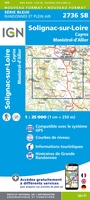 Wandelkaart - Topografische kaart 2736 SB - Serie Bleue Monistrol d'Allier, Solignac-sur-Loire, Cayres | IGN - Institut Géographique National
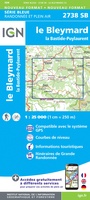 Wandelkaart - Topografische kaart 2738 SB - Serie Bleue Le Bleymard | IGN - Institut Géographique National
 Wandelkaart - Topografische kaart 2740ET Corniche des Cevennes | IGN - Institut Géographique National
 Wandelkaart - Topografische kaart 2741ET Saint-Hippolyte-du-Fort | IGN - Institut Géographique National
 Wandelkaart - Topografische kaart 2742ET St.-Martin-de-Londres, Ganges | IGN - Institut Géographique National
 Wandelkaart - Topografische kaart 2806 SB - Serie Bleue Jeumont - Maubeuge | IGN - Institut Géographique National
Laatste reviews

Ik gebruik deze kaart omdat ik een reis wil volgen van meerdere personen. Heb er veel plezier van.
★★★★★ door Loes Vechtmann 15 april 2026 | Heeft dit artikel gekocht
Dit boek heeft me veel inzicht gegeven hoe om te gaan met jezelf in de wildernis. Een fijn, kwetsbaar en oprecht geschreven boek met veel …
★★★★★ door Arnold Jippes 15 april 2026 | Heeft dit artikel gekocht
The DK Eyewitness travel guide for Florence & Tuscany is an excellent guide with lots of details, including helpful photographs maps and diagrams of the …
★★★★★ door Andrew Wedgner 15 april 2026 | Heeft dit artikel gekocht
Wij zijn nu aan het reizen in zuid-west Australië. De kaart is heel goed te gebruiken. Blij mee!
★★★★★ door Wilma van der Maas 15 april 2026 | Heeft dit artikel gekocht