Winkelwagen
Geen items in winkelwagen
Ga naar winkelwagen
Topografische kaarten - Gironde
 Wandelkaart - Topografische kaart 1336ET Lac de Lacanau & Le Porge | IGN - Institut Géographique National
 Wandelkaart - Topografische kaart 1337ET Bassin D'Arcachon | IGN - Institut Géographique National★★★★★
 Wandelkaart - Topografische kaart 1339ET Biscarrosse | IGN - Institut Géographique National
 Wandelkaart - Topografische kaart 1433 SB - Serie Bleue Lesparre-Médoc | IGN - Institut Géographique National
 Wandelkaart - Topografische kaart 1433OT Soulac-Sur-Mer & Montalivet Pointe De Grave | IGN - Institut Géographique National
 Topografische kaart - Wandelkaart 1434OT Hourtin, Lacs d'Hourtin Et De Carcans | IGN - Institut Géographique National
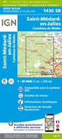 Wandelkaart - Topografische kaart 1436 SB - Serie Bleue St-Médard-en-Jalles | IGN - Institut Géographique National
 Wandelkaart - Topografische kaart 1437 SB - Serie Bleue Saint-Jean-d'Illac | IGN - Institut Géographique National
 Wandelkaart - Topografische kaart 1438 SB - Serie Bleue Belin-Béliet | IGN - Institut Géographique National
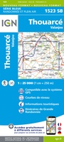 Wandelkaart - Topografische kaart 1523 SB - Serie Bleue Thouarcé | IGN - Institut Géographique National
 Topografische kaart - Wandelkaart 1534 SB - Serie Bleue Montendre, St-Ciers-sur-Girond | IGN - Institut Géographique National
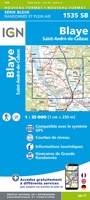 Wandelkaart - Topografische kaart 1535 SB - Serie Bleue Blaye | IGN - Institut Géographique National
 Topografische kaart - Wandelkaart 1536OT Bordeaux / Sud Médoc | IGN - Institut Géographique National
 Topografische kaart - Wandelkaart 1537 SB - Serie Bleue Pessac | IGN - Institut Géographique National
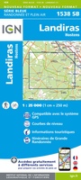 Wandelkaart - Topografische kaart 1538 SB - Serie Bleue Landiras | IGN - Institut Géographique National
 Wandelkaart - Topografische kaart 1635 SB - Serie Bleue Guîtres - Coutras | IGN - Institut Géographique National
 Wandelkaart - Topografische kaart 1636 SB - Serie Bleue Libourne, Saint-Emilion | IGN - Institut Géographique National★★★★★
 Wandelkaart - Topografische kaart 1637 SB - Serie Bleue Podensac | IGN - Institut Géographique National
 Topografische kaart - Wandelkaart 1638 La Réole - Langon | IGN - Institut Géographique National
 Wandelkaart - Topografische kaart 1639 SB - Serie Bleue Grignols - Bazas | IGN - Institut Géographique National
Laatste reviews

mooi en duidelijk
Mooie gids met duidelijk drukwerk en goede kaarten. Een ringband is wellicht handiger of zelfs een uitneembaar systeem per etappe.
★★★★★ door A.F.Muller 03 maart 2026 | Heeft dit artikel gekocht
Duidelijke en gedetailleerde kaart
Duidelijke en gedetailleerde kaart
★★★★★ door Annette 03 maart 2026 | Heeft dit artikel gekocht
Top
Ik weet niet waar ik het anders moet halen. Altijd weer top en kaarten die ik echt nergens anders kan krijgen. Bedankt en tot de …
★★★★★ door Guido 03 maart 2026 | Heeft dit artikel gekocht
Beste reisgids voor self-drive Zimbabwe
Simpelweg de beste reisgids voor self-drives naar Zimbabwe.
★★★★★ door Saskia 03 maart 2026 | Heeft dit artikel gekocht