Winkelwagen
Geen items in winkelwagen
Ga naar winkelwagen
Gironde
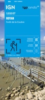 Wandelkaart 1332ET Royan / Forêt de la Coubre | IGN - Institut Géographique National
 Wandelkaart - Topografische kaart 1336ET Lac de Lacanau & Le Porge | IGN - Institut Géographique National
 Wandelkaart - Topografische kaart 1337ET Bassin D'Arcachon | IGN - Institut Géographique National★★★★★
 Wandelkaart - Topografische kaart 1339ET Biscarrosse | IGN - Institut Géographique National
 Wandelkaart - Topografische kaart 1433 SB - Serie Bleue Lesparre-Médoc | IGN - Institut Géographique National
 Wandelkaart - Topografische kaart 1433OT Soulac-Sur-Mer & Montalivet Pointe De Grave | IGN - Institut Géographique National
 Wandelkaart 1434 SB - Serie Bleue Lesparre-Médoc | IGN - Institut Géographique National
 Topografische kaart - Wandelkaart 1434OT Hourtin, Lacs d'Hourtin Et De Carcans | IGN - Institut Géographique National
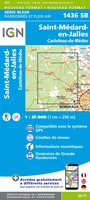 Wandelkaart - Topografische kaart 1436 SB - Serie Bleue St-Médard-en-Jalles | IGN - Institut Géographique National
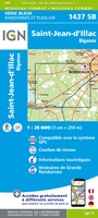 Wandelkaart - Topografische kaart 1437 SB - Serie Bleue Saint-Jean-d'Illac | IGN - Institut Géographique National
 Wandelkaart - Topografische kaart 1438 SB - Serie Bleue Belin-Béliet | IGN - Institut Géographique National
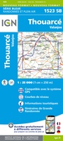 Wandelkaart - Topografische kaart 1523 SB - Serie Bleue Thouarcé | IGN - Institut Géographique National
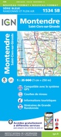 Topografische kaart - Wandelkaart 1534 SB - Serie Bleue Montendre, St-Ciers-sur-Girond | IGN - Institut Géographique National
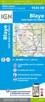 Wandelkaart - Topografische kaart 1535 SB - Serie Bleue Blaye | IGN - Institut Géographique National
 Topografische kaart - Wandelkaart 1536OT Bordeaux / Sud Médoc | IGN - Institut Géographique National
 Topografische kaart - Wandelkaart 1537 SB - Serie Bleue Pessac | IGN - Institut Géographique National
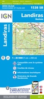 Wandelkaart - Topografische kaart 1538 SB - Serie Bleue Landiras | IGN - Institut Géographique National
 Wandelkaart - Topografische kaart 1635 SB - Serie Bleue Guîtres - Coutras | IGN - Institut Géographique National
 Wandelkaart - Topografische kaart 1636 SB - Serie Bleue Libourne, Saint-Emilion | IGN - Institut Géographique National★★★★★
 Wandelkaart - Topografische kaart 1637 SB - Serie Bleue Podensac | IGN - Institut Géographique National
Laatste reviews

Compact gidsje
Ben nog niet het veld in geweest met de gids maar de eerste indruk is veel informatie om een meerdaagse tocht uit te stippelen.
★★★★★ door Henk 04 juli 2026 | Heeft dit artikel gekocht
Beschikbaarheid en snelheid
Prima in orde!
★★★★★ door Marko 04 juli 2026 | Heeft dit artikel gekocht
Lekker analoog
Fijn boekje met veel informatie, behalve knooppunten Utrecht af en toe incorrect. Wat heerlijk om offline te navigeren, lekker analoog. Zodra je het systeem begrijpt …
★★★★★ door Daan 03 juli 2026 | Heeft dit artikel gekocht
Aanrader
Als je van geschiedenis, Groningen en kaarteen houdt, is dit echt een aanrader!
★★★★★ door Reinout 03 juli 2026 | Heeft dit artikel gekocht