Winkelwagen
Geen items in winkelwagen
Ga naar winkelwagen
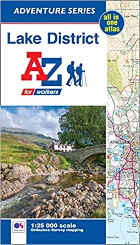
Wandelatlas Adventure Atlas Lake District | A-Z Map Company (9781782573203)
- ISBN / CODE: 9781782573203
- Editie: 2019
- Aantal blz.: 88
- Schaal: 1:25000
- Auteur(s): HarperCollins Publishers
- Uitgever: A-Z Map Company
- Soort: Wandelatlas
- Serie: Adventure Atlas
- Taal: Engels
- Hoogte: 23.9 cm
- Breedte: 13.4 cm
- Dikte: 0.7 cm
- Bindwijze: -
- Uitvoering: -
- Schrijf als eerste een review
-
€ 13,95
Dit artikel is (tijdelijk) niet leverbaar
-
Overzicht National trails AZ Adventure Atlas

Producten op deze overzichtskaart:
Klik op een product om naar de pagina van dat product te gaan.
- Wandelatlas 1 Adventure Atlas South West Coast Path North Devon & Somerset | A-Z Map Company
- Wandelatlas 2 Adventure Atlas South West Coast Path North Cornwall | A-Z Map Company
- Wandelatlas 3 Adventure Atlas South West Coast Path South Cornwall | A-Z Map Company
- Wandelatlas 4 Adventure Atlas South West Coast Path South Devon | A-Z Map Company
- Wandelatlas 5 Adventure Atlas South West Coast Path - Dorset | A-Z Map Company
- Wandelkaart Adventure Atlas Hadrian's Wall Path | A-Z Map Company
- Wandelatlas Adventure Atlas Lake District | A-Z Map Company
- Wandelatlas Adventure Atlas Minehead to Brean Down - England Coast Path | A-Z Map Company
- Wandelatlas Adventure Atlas Norfolk Coast Path Peddars Way | A-Z Map Company
- Wandelatlas Adventure Atlas South Downs Way | A-Z Map Company
Overzichtskaarten
Beschrijving
AZ heeft de meest gedetailleerde wandelkaarten van het zuidelijke deel van het Lake District gebundeld in een atlasje. Daardoor is het heel handig qua formaat. De kaarten zelf zijn perfect voor het wandelen.
The A-Z Adventure Series of maps combines the best of OS and A-Z, creating the perfect companion for walkers, off-road cyclists, horse riders and anyone wishing to explore the great outdoors. The Lake District is a National Park and a Unesco World Heritage Site in northwest England. It is a region rich in natural beauty with breathtaking views of striking lakes and stunning mountains, including England's deepest lake (Wastwater) and highest mountain (Scafell Pike).
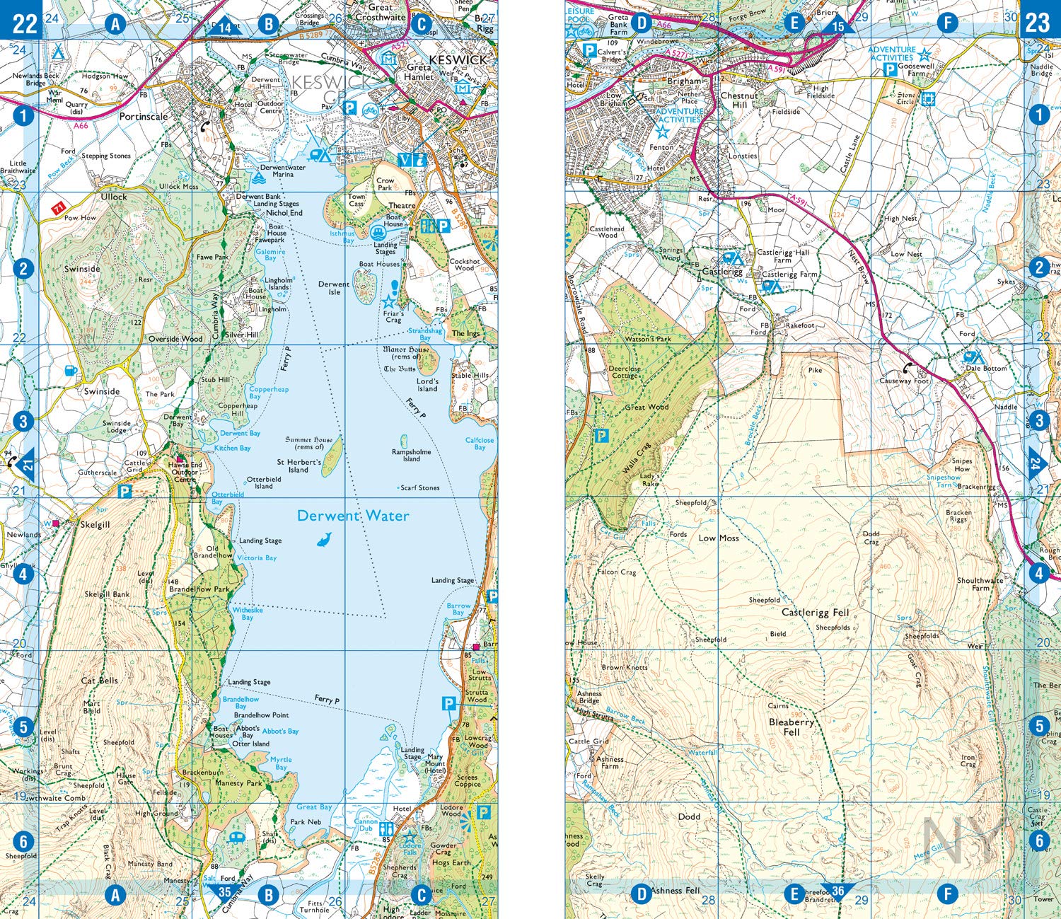
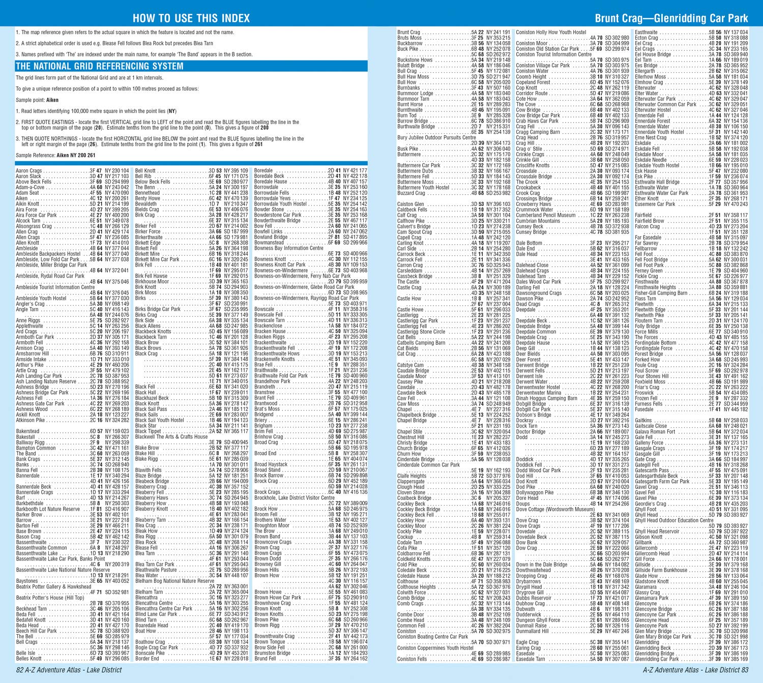
It is no surprise that walkers are drawn here to experience the many and varied routes available, from low-level walking to long hikes into the mountains, as well as the many other activities and attractions. This A-Z Adventure Atlas of the Lake District features 76 pages of continuous Ordnance Survey 1:25 000 mapping covering the popular core area of the National Park with all the notable lakes and celebrated Lakeland fells in a single publication. Unlike original OS sheets, there is a comprehensive index to towns, villages, hamlets and locations, natural features, nature reserves, car parks and youth hostels.
Each index entry has a page reference and a six figure National Grid Reference. With a book size of 240mm x 134mm, it is the same size as the standard folded OS map. Also included is safety and security advice when walking and a selection of QR codes to access useful websites with your smartphone.
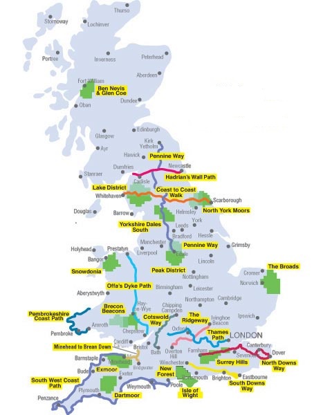
Other National Parks available within the A-Z Adventure series include: The Broads, Brecon Beacons, Dartmoor, Exmoor, New Forest, North York Moors, Peak District and Snowdonia.
Reviews
Geen reviews gevonden voor dit product.
Schrijf een review
Graag horen wij wat u van dit artikel vindt. Vindt u het goed, leuk, mooi, slecht, lelijk, onbruikbaar of erg handig: schrijf gerust alles op! Het is niet alleen leuk om te doen maar u informeert andere klanten er ook nog mee!
Alle gerelateerde rubrieken >
Ook interessant voor europa/engeland/lake-district
-

Wandelkaart Lake District Noord | Ha
€ 24,95Wandelkaarten ♦ Lake District Nationaal Park -

Fietsgids Cycling in the Lake Distri
€ 23,50Fietsgidsen ♦ Lake District Nationaal Park -

Mountainbikegids Mountain Biking in
€ 19,95Mountainbikegidsen ♦ Lake District Nationaal Park -

Reisgids Pocket Lake District | Lone
€ 12,95Reisgidsen ♦ Lake District Nationaal Park -

Wandelgids 71 Pathfinder Guides The
€ 18,50Wandelgidsen ♦ Lake District Nationaal Park