Wandelatlas 5 Adventure Atlas South West Coast Path - Dorset | A-Z Map Company (9781782571544)

- ISBN / CODE: 9781782571544
- Editie: 2015
- Aantal blz.: 50
- Schaal: 1:25000
- Uitgever: A-Z Map Company
- Soort: Wandelatlas
- Serie: Adventure Atlas
- Taal: Engels
- Schrijf als eerste een review
-
€ 12,95
Op voorraad. Voor 17.00 uur op werkdagen besteld, morgen in huis in Nederland Levertijd Belgie
Gratis verzending in Nederland vanaf €35,-
_1.jpg)
-
Overzicht National trails AZ Adventure Atlas

Producten op deze overzichtskaart:
Klik op een product om naar de pagina van dat product te gaan.
- Wandelatlas 1 Adventure Atlas South West Coast Path North Devon & Somerset | A-Z Map Company
- Wandelatlas 2 Adventure Atlas South West Coast Path North Cornwall | A-Z Map Company
- Wandelatlas 3 Adventure Atlas South West Coast Path South Cornwall | A-Z Map Company
- Wandelatlas 4 Adventure Atlas South West Coast Path South Devon | A-Z Map Company
- Wandelatlas 5 Adventure Atlas South West Coast Path - Dorset | A-Z Map Company
- Wandelkaart Adventure Atlas Hadrian's Wall Path | A-Z Map Company
- Wandelatlas Adventure Atlas Lake District | A-Z Map Company
- Wandelatlas Adventure Atlas Minehead to Brean Down - England Coast Path | A-Z Map Company
- Wandelatlas Adventure Atlas Norfolk Coast Path Peddars Way | A-Z Map Company
- Wandelatlas Adventure Atlas South Downs Way | A-Z Map Company
Overzichtskaarten
Beschrijving
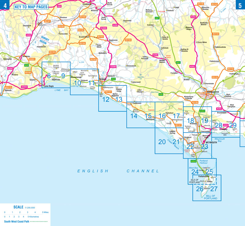
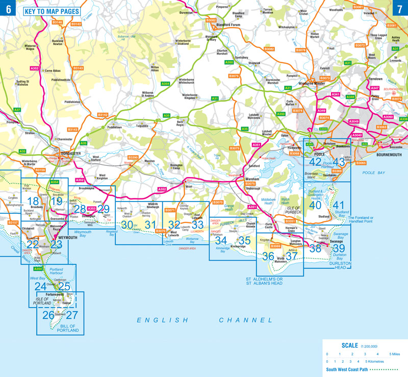
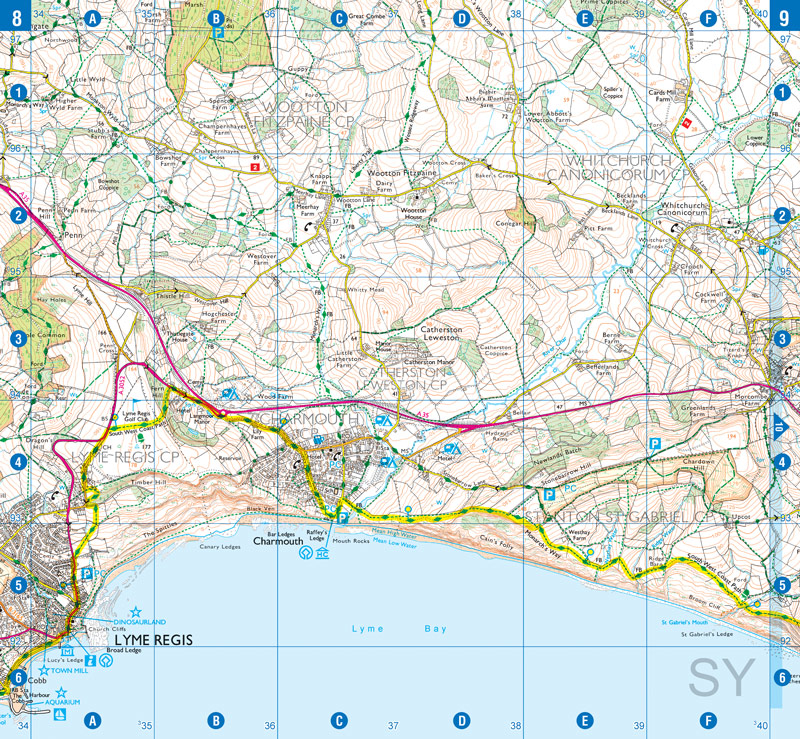
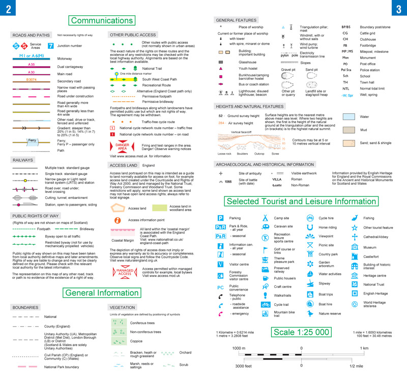
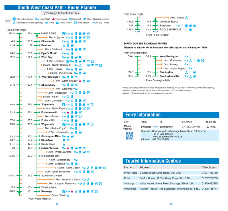
AZ heeft de meest gedetailleerde wandelkaarten van delen van het South West Coast Path gebundeld in een atlasje. Daardoor is het heel handig qua formaat. De kaarten zelf zijn perfect voor het wandelen. Schaal 1:25.000
Reviews
Geen reviews gevonden voor dit product.
Schrijf een review
Graag horen wij wat u van dit artikel vindt. Vindt u het goed, leuk, mooi, slecht, lelijk, onbruikbaar of erg handig: schrijf gerust alles op! Het is niet alleen leuk om te doen maar u informeert andere klanten er ook nog mee!
Ook interessant voor europa/engeland/South-West-England
-

Reisgids Eyewitness Travel England's
€ 19,95Reisgidsen South West England -

Wandelgids 11 Pathfinder Guides Dors
€ 18,50Wandelgidsen South West England -

Wandelkaart - Topografische kaart 16
€ 19,50Topografische kaarten South West England -

Wegenkaart - landkaart 2 Road Map Br
€ 9,95Wegenkaarten South West England -

Campergids Met de Camper door Zuid-E
€ 14,95Campergidsen South West England