Winkelwagen
Geen items in winkelwagen
Ga naar winkelwagen
IGN - Institut Géographique National
IGN is de officiële instantie voor geografische informatie in Frankrijk ofwel Institut Géographique National. Ze staan bekend om de zeer goede wandelkaarten op schaal 1:25.000 (Serie Bleue en Top 25) van Frankrijk. De wandelkaarten zijn dan ook zeer uitgebreid. De wandelaar vindt hier alle wandelpaden, campings en langeafstandswandelpaden, ook wel GR-paden (Grande Randonnée) genoemd. Kleine weggetjes en paden, maar ook de verschillende types landschappen en bebouwingen, populaire gebieden en onontdekte parels: de wandelaar in Frankrijk vindt alles terug op deze betrouwbare kaarten van IGN.
Naast wandelkaarten geeft het IGN ook goede fiets- c.q. wegenkaarten op schaal 1:100.000 (serie Top 100) en fietskaarten op schaal 1:75.000 (serie Top 75) uit.
 Wandelkaart - Topografische kaart 3443OT Aups | IGN - Institut Géographique National
 Wandelkaart - Topografische kaart 3444OT Brignoles - le Luc | IGN - Institut Géographique National
 Wandelkaart - Topografische kaart 3445OT Cuers | IGN - Institut Géographique National
 Wandelkaart - Topografische kaart 3446ET Le Lavandou | IGN - Institut Géographique National
 Wandelkaart - Topografische kaart 3446OT Hyères | IGN - Institut Géographique National
 Wandelkaart - Topografische kaart 3512 SB - Serie Bleue Bouzonville | IGN - Institut Géographique National
 Wandelkaart - Topografische kaart 3513 SB - Serie Bleue Saint-Avold / Faulquemont | IGN - Institut Géographique National
 Wandelkaart - Topografische kaart 3514 SB - Serie Bleue Dieuze / Albestroff | IGN - Institut Géographique National
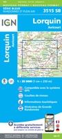 Wandelkaart - Topografische kaart 3515 SB - Serie Bleue Lorquin - Avricourt | IGN - Institut Géographique National
 Wandelkaart - Topografische kaart 3516 SB - Serie Bleue Lunéville / Baccarat | IGN - Institut Géographique National
 Wandelkaart - Topografische kaart 3517 SB - Serie Bleue Rambervillers | IGN - Institut Géographique National
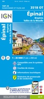 Wandelkaart - Topografische kaart 3518OT Epinal | IGN - Institut Géographique National
 Wandelkaart - Topografische kaart 3519OT Remiremont | IGN - Institut Géographique National★★★★★
 Wandelkaart - Topografische kaart 3520 SB - Serie Bleue Mélisey - Lure | IGN - Institut Géographique National
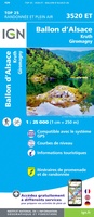 Wandelkaart - Topografische kaart 3520ET Ballon d'Alsace | IGN - Institut Géographique National★★★★★★★★★★
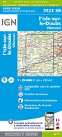 Wandelkaart - Topografische kaart 3522 SB - Serie Bleue L'Isle-sur-le-Doubs, Villersexel | IGN - Institut Géographique National
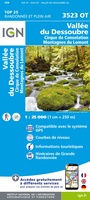 Wandelkaart - Topografische kaart 3523OT Vallee-du-Desoubre | IGN - Institut Géographique National
 Wandelkaart - Topografische kaart 3524OT Morteau | IGN - Institut Géographique National
 Wandelkaart - Topografische kaart 3528ET Morzine | IGN - Institut Géographique National★★★★★
 Wandelkaart - Topografische kaart 3528ETR Morzine | IGN - Institut Géographique National★★★★★
Laatste reviews

Compact gidsje
Ben nog niet het veld in geweest met de gids maar de eerste indruk is veel informatie om een meerdaagse tocht uit te stippelen.
★★★★★ door Henk 04 juli 2026 | Heeft dit artikel gekocht
Beschikbaarheid en snelheid
Prima in orde!
★★★★★ door Marko 04 juli 2026 | Heeft dit artikel gekocht
Lekker analoog
Fijn boekje met veel informatie, behalve knooppunten Utrecht af en toe incorrect. Wat heerlijk om offline te navigeren, lekker analoog. Zodra je het systeem begrijpt …
★★★★★ door Daan 03 juli 2026 | Heeft dit artikel gekocht
Aanrader
Als je van geschiedenis, Groningen en kaarteen houdt, is dit echt een aanrader!
★★★★★ door Reinout 03 juli 2026 | Heeft dit artikel gekocht