Winkelwagen
Geen items in winkelwagen
Ga naar winkelwagen
IGN - Institut Géographique National
IGN is de officiële instantie voor geografische informatie in Frankrijk ofwel Institut Géographique National. Ze staan bekend om de zeer goede wandelkaarten op schaal 1:25.000 (Serie Bleue en Top 25) van Frankrijk. De wandelkaarten zijn dan ook zeer uitgebreid. De wandelaar vindt hier alle wandelpaden, campings en langeafstandswandelpaden, ook wel GR-paden (Grande Randonnée) genoemd. Kleine weggetjes en paden, maar ook de verschillende types landschappen en bebouwingen, populaire gebieden en onontdekte parels: de wandelaar in Frankrijk vindt alles terug op deze betrouwbare kaarten van IGN.
Naast wandelkaarten geeft het IGN ook goede fiets- c.q. wegenkaarten op schaal 1:100.000 (serie Top 100) en fietskaarten op schaal 1:75.000 (serie Top 75) uit.
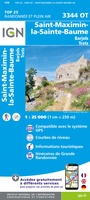 Wandelkaart - Topografische kaart 3344OT Saint-Maximin-la-Sainte-Baume | IGN - Institut Géographique National
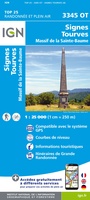 Wandelkaart - Topografische kaart 3345OT Signes – Tourves | IGN - Institut Géographique National
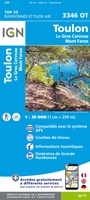 Wandelkaart - Topografische kaart 3346OT Toulon | IGN - Institut Géographique National
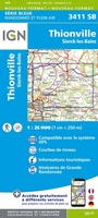 Wandelkaart - Topografische kaart 3411 SB - Serie Bleue Thionville | IGN - Institut Géographique National
 Wandelkaart - Topografische kaart 3412 SB - Serie Bleue Woippy | IGN - Institut Géographique National
 Wandelkaart - Topografische kaart 3413 SB - Serie Bleue Metz | IGN - Institut Géographique National
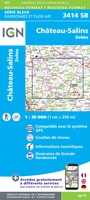 Wandelkaart - Topografische kaart 3414 SB - Serie Bleue Château-Salins | IGN - Institut Géographique National★★★★★
 Wandelkaart - Topografische kaart 3415 SB - Serie Bleue Saint-Nicolas-de-Port | IGN - Institut Géographique National
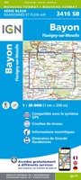 Wandelkaart 3416 SB - Serie Bleue Bayon / Flavigny-sur-Moselle | IGN - Institut Géographique National
 Wandelkaart - Topografische kaart 3417 SB - Serie Bleue Mirecourt - Charmes | IGN - Institut Géographique National
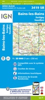 Wandelkaart - Topografische kaart 3419 Bains-les-Bains | IGN - Institut Géographique National
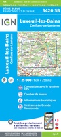 Wandelkaart - Topografische kaart 3420 SB - Serie Bleue Luxeuil-les-Bains, Conflans-sur-Lanterne | IGN - Institut Géographique National
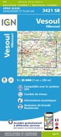 Wandelkaart - Topografische kaart 3421 SB - Serie Bleue Vesoul | IGN - Institut Géographique National
 Wandelkaart - Topografische kaart 3422 SB - Serie Bleue Baume-les-Dames | IGN - Institut Géographique National
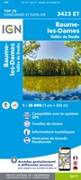 Wandelkaart - Topografische kaart 3423ET Baumes-les-Dames, Vallee du Doubs | IGN - Institut Géographique National
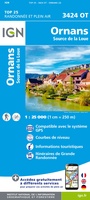 Wandelkaart - Topografische kaart 3424OT Ornans, Source de la Loue | IGN - Institut Géographique National
 Wandelkaart - Topografische kaart 3425OT Pontarlier | IGN - Institut Géographique National★★★★★
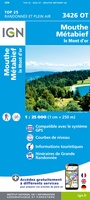 Wandelkaart - Topografische kaart 3426OT Mouthe - Métabief | IGN - Institut Géographique National★★★★★
 Wandelkaart - Topografische kaart 3428ET Thonon les Bains - Évian les Bains | IGN - Institut Géographique National
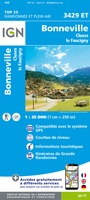 Wandelkaart - Topografische kaart 3429ET Bonneville | IGN - Institut Géographique National
Laatste reviews

Compact gidsje
Ben nog niet het veld in geweest met de gids maar de eerste indruk is veel informatie om een meerdaagse tocht uit te stippelen.
★★★★★ door Henk 04 juli 2026 | Heeft dit artikel gekocht
Beschikbaarheid en snelheid
Prima in orde!
★★★★★ door Marko 04 juli 2026 | Heeft dit artikel gekocht
Lekker analoog
Fijn boekje met veel informatie, behalve knooppunten Utrecht af en toe incorrect. Wat heerlijk om offline te navigeren, lekker analoog. Zodra je het systeem begrijpt …
★★★★★ door Daan 03 juli 2026 | Heeft dit artikel gekocht
Aanrader
Als je van geschiedenis, Groningen en kaarteen houdt, is dit echt een aanrader!
★★★★★ door Reinout 03 juli 2026 | Heeft dit artikel gekocht