Winkelwagen
Geen items in winkelwagen
Ga naar winkelwagen
Top 25
De kaarten van IGN (kort voor Institute Geographique National), wandelkaarten voor Frankrijk, zijn van een ongekend hoog niveau. Met name de wandelkaarten 1:25.000 vinden wij geweldig: werkelijk alles staat erop, de kaarten bevatten zeer veel details en het kleurgebruik is fantastisch, waardoor alles ook nog eens heel goed leesbaar. Je hoort het: wij zijn fan van deze kaarten!
 Wandelkaart - Topografische kaart 0822OT Belle-Ile - Ile d'Houat et d'Hoëdic Bretagne | IGN - Institut Géographique National★★★★★
 Wandelkaart - Topografische kaart 0916ET Erquy - le Val-André | IGN - Institut Géographique National
 Wandelkaart - Topografische kaart 0916OT Saint-Brieuc | IGN - Institut Géographique National★★★★★
 Wandelkaart - Topografische kaart 0921OT Vannes | IGN - Institut Géographique National★★★★★
 Wandelkaart - Topografische kaart 0921OTR Vannes / Golfe du Morbihan | IGN - Institut Géographique National
 Wandelkaart - Topografische kaart 1016ET St.-Cast-le-Guildo - Cap Fréhel | IGN - Institut Géographique National
 Wandelkaart - Topografische kaart 1022ET Saint-Nazaire & Parc Naturel Regional de Briere | IGN - Institut Géographique National
 Wandelkaart - Topografische kaart 1022OT La Roche-Bernard & Parc Naturel Regional de Briere | IGN - Institut Géographique National
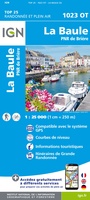 Topografische kaart - Wandelkaart 1023OT La Baule & Parc Naturel Regional de Briere | IGN - Institut Géographique National
 Wandelkaart - Topografische kaart 1116ET Saint-Malo – Dinard – Dinan – Rothéneuf – Cancale – Châteauneuf-d'ille-Vilaine | IGN - Institut Géographique National
 Wandelkaart - Topografische kaart 1123OT Saint-Nazaire - Pornic – Cote de Jade | IGN - Institut Géographique National
 Wandelkaart - Topografische kaart 1125OT Ile de Noirmoutier, Beauvoir-sur-Mer & Bourgneuf-en-Ret | IGN - Institut Géographique National
 Wandelkaart - Topografische kaart 1126OT Ile d'Yeu, Saint-Gilles-Croix-de-Vie & Saint-Jean-de-Mont | IGN - Institut Géographique National
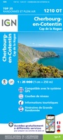 Wandelkaart - Topografische kaart 1210OT Cherbourg-en-Cotentin, Cap de la Hague | IGN - Institut Géographique National
 Wandelkaart - Topografische kaart 1211OT Les Pieux, Barneville, Carteret | IGN - Institut Géographique National
 Topografische kaart - Wandelkaart 1212ET La Haye-du-Puits / Lessay | IGN - Institut Géographique National
 Wandelkaart - Topografische kaart 1214ET Granville, Coutances, Iles Chausey | IGN - Institut Géographique National
 Wandelkaart - Topografische kaart 1215ET Avranches, Granville, Le Mont Saint Michel | IGN - Institut Géographique National
 Wandelkaart - Topografische kaart 1215OT Le Mont St.-Michel, Dol-de-Bretagne | IGN - Institut Géographique National
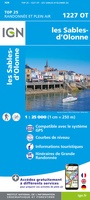 Wandelkaart 1227OT Les Sables-d'Olonne | IGN - Institut Géographique National
Laatste reviews

Duidelijk, overzichtelijk en geplastificeerde wandelkaart
Uitstekend
★★★★★ door Nelly van Ginkel 24 juli 2026 | Heeft dit artikel gekocht
Handige kaart
Fijne kaart waterafstootend.
★★★★★ door Nicole 21 juli 2026 | Heeft dit artikel gekocht
Mooie kaart.
Mooie helder kaart, netjes bezorgd
★★★★★ door Michael Rijke 21 juli 2026 | Heeft dit artikel gekocht
Mooie wandelkaart, lekker stevig ook!
Fijne wandelkaart, gedetailleerd en met veel extra info. Super fijn om m voor onze vakantie al te kunnen kopen, zo kon de voorpret al beginnen …
★★★★★ door Wille Groenewolt 21 juli 2026 | Heeft dit artikel gekocht