Winkelwagen
Geen items in winkelwagen
Ga naar winkelwagen
Top 25
De kaarten van IGN (kort voor Institute Geographique National), wandelkaarten voor Frankrijk, zijn van een ongekend hoog niveau. Met name de wandelkaarten 1:25.000 vinden wij geweldig: werkelijk alles staat erop, de kaarten bevatten zeer veel details en het kleurgebruik is fantastisch, waardoor alles ook nog eens heel goed leesbaar. Je hoort het: wij zijn fan van deze kaarten!
 Wandelkaart 4411MT Sada / Mlima Bénara / Mlima Choungui / Mayotte | IGN - Institut Géographique National
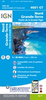 Wandelkaart 4601GT Nord Grande-Terre (Guadeloupe) | IGN - Institut Géographique National
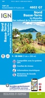 Wandelkaart 4602GT Nord Basse-Terre (Guadeloupe) | IGN - Institut Géographique National
 Wandelkaart 4603GT Pointe-à-Pitre / Ste-Anne (Guadeloupe) | IGN - Institut Géographique National
 Wandelkaart 4604GT St-François / Marie-Galante / La Désirade (Guadeloupe) | IGN - Institut Géographique National
 Wandelkaart 4605GT Basse-Terre / La Soufrière / Les Saintes (Guadeloupe) | IGN - Institut Géographique National
 Wandelkaart - Wegenkaart - landkaart 4606GT Ile St-Martin - Sint Maarten | IGN - Institut Géographique National★★★★★★★★★★
 Topografische kaart - Wandelkaart 4901 Wallis (Ile) | IGN - Institut Géographique National
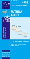 Topografische kaart - Wandelkaart 4902 Futuna (Ile) - Alofi (Ile) | IGN - Institut Géographique National
Laatste reviews

Duidelijk, overzichtelijk en geplastificeerde wandelkaart
Uitstekend
★★★★★ door Nelly van Ginkel 24 juli 2026 | Heeft dit artikel gekocht
Handige kaart
Fijne kaart waterafstootend.
★★★★★ door Nicole 21 juli 2026 | Heeft dit artikel gekocht
Mooie kaart.
Mooie helder kaart, netjes bezorgd
★★★★★ door Michael Rijke 21 juli 2026 | Heeft dit artikel gekocht
Mooie wandelkaart, lekker stevig ook!
Fijne wandelkaart, gedetailleerd en met veel extra info. Super fijn om m voor onze vakantie al te kunnen kopen, zo kon de voorpret al beginnen …
★★★★★ door Wille Groenewolt 21 juli 2026 | Heeft dit artikel gekocht