Winkelwagen
Geen items in winkelwagen
Ga naar winkelwagen
Lowlands | Schotse Laaglanden en grenzen
 Fietsgids - Mountainbikegids Mountain Biking in Southern and Central Scotland | Cicerone
 Wegenkaart - landkaart Pocket Map Dumfries & Galloway | Collins
 Wandelgids Forth to Farne Way | Rucksack Readers
 Wandelgids The Borders Abbeys Ways | Cicerone
 Wandelgids West Lothian | Pocket Mountains
 Wandelgids Weekend Walks Angus And Dundee | Pocket Mountains
 Wandelgids Angus | Hallewell Publications
 Wandelkaart Arran | Harvey Maps
 Wandelgids Walking in the Scottish Borders | Cicerone
 Wandelgids Borders Abbeys Way | Rucksack Readers
 Wandelgids Fife Coastal Path | Rucksack Readers
 Wandelkaart Speyside Walk (Schotland) | Harvey Maps
 Wandelgids Ayrshire and Arran Coastal Paths | Cicerone
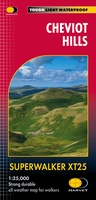 Wandelkaart Cheviot Hills | Harvey Maps
 Wandelgids John Muir Way | Rucksack Readers
 Wandelkaart Ochil Hills | Harvey Maps
 Wandelgids The Dumfriesshire Dales | Pocket Mountains
 Wandelgids Walking the Galloway Hills | Cicerone
 Reisgids PassePartout Centraal Schotland | Edicola
 Wandelkaart Southern Upland Way | Harvey Maps
Laatste reviews

Goede kaart, maar weinig meerwaarde boven de 1:200.000-kaart
Op zich een goede kaart, maar het is eigenlijk gewoon een uitvergroting van de bekende 1:200.000-kaarten, dus weinig tot geen extra informatie. Wel wat duidelijker …
★★★★★ door FGM Ballhaus 13 mei 2026 | Heeft dit artikel gekocht
Iets te grote schaal voor wandelen, maar verder een goede kaart voor wandelen en fietsen
Duidelijke kaart, goed voor fietsen, iets minder voor wandelen door de schaal, maar er is heel weinig kaartmateriaal voor dit gebied dus daarom toch dik …
★★★★★ door FGM Ballhaus 13 mei 2026 | Heeft dit artikel gekocht
Goede fietskaart voor nét over de grens
Fietskaart is een goede aanvulling op de Nederlandse fietskaarten, laat de Achterhoek zien maar ook een heel stuk Duitsland in (naar het oosten). Kwalitatief ook …
★★★★★ door FGM Ballhaus 13 mei 2026 | Heeft dit artikel gekocht
Leuk informatief boek, precieze route goed weergegeven.
Keurig verpakt, snel verzonden. Boek voldoet aan mijn verwachtingen!
★★★★★ door Beatrice 12 mei 2026 | Heeft dit artikel gekocht