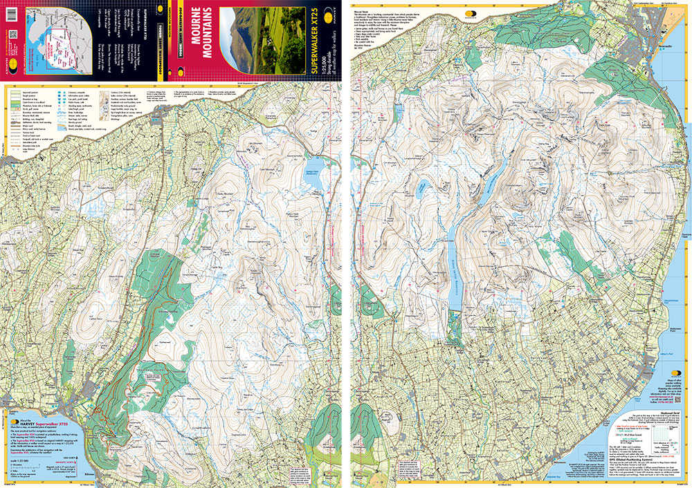
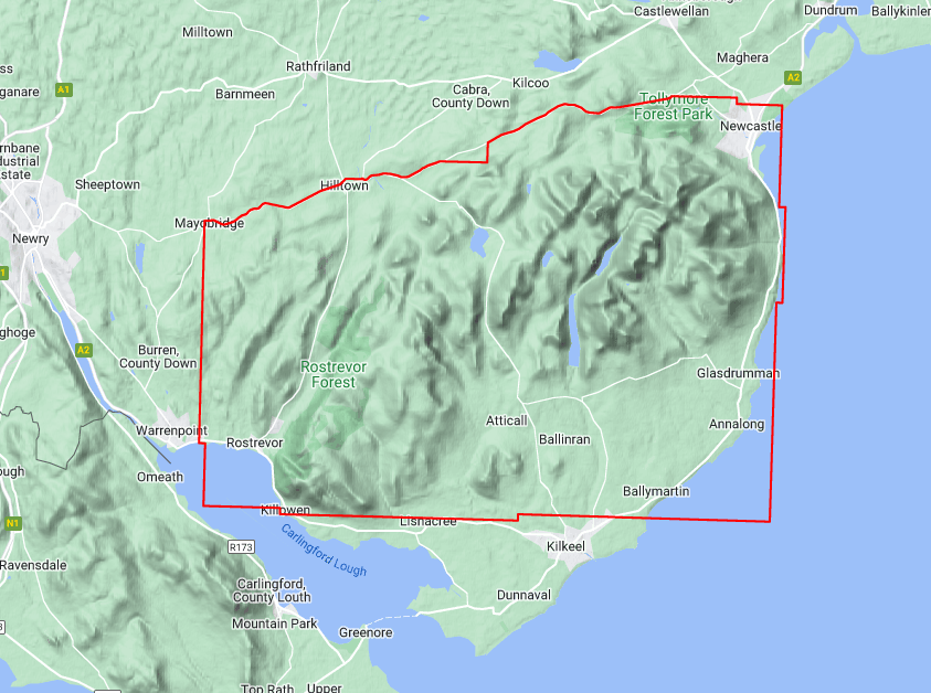
Wandelkaart Mourne Mountains | Harvey Maps (9781851376124)

- ISBN / CODE: 9781851376124
- Editie: 01-12-2023
- Aantal blz.: 1
- Schaal: 1:25000
- Uitgever: Harvey Maps
- Soort: Wandelkaart
- Serie: Superwalker XT25 maps
- Taal: Engels
- Hoogte: 25.0 cm
- Breedte: 14.0 cm
- Gewicht: 46.0 g
- Bindwijze: -
- Uitvoering: Scheur- en watervast
- Schrijf als eerste een review
-
€ 26,95
Leverbaar in 3 - 5 werkdagen in huis in Nederland Levertijd Belgie
Gratis verzending in Nederland vanaf €50,-

-
Overzicht Superwalker Maps Harvey Maps
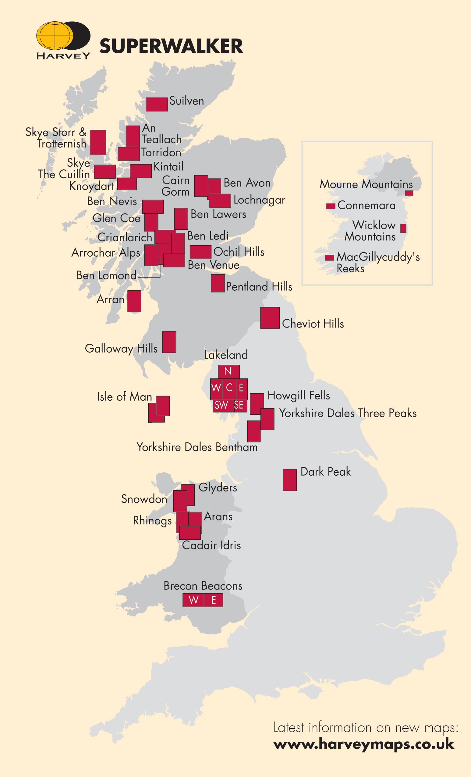
Producten op deze overzichtskaart:
Klik op een product om naar de pagina van dat product te gaan.
- Wandelkaart An Teallach | Harvey Maps
- Wandelkaart Arran including Arran Coastal Way | Harvey Maps
- Wandelkaart Arrochar Alps | Harvey Maps
- Wandelkaart Ben Alder | Harvey Maps
- Wandelkaart Ben Lawers & Schiehallion | Harvey Maps
- Wandelkaart Ben Nevis | Harvey Maps
- Wandelkaart Brecon Beacons Oost | Harvey Maps
- Wandelkaart Brecon Beacons West | Harvey Maps
- Wandelkaart Cairn Gorm | Harvey Maps
- Wandelkaart Cannock Chase XT25 | Harvey Maps
- Wandelkaart Cheviot Hills | Harvey Maps
- Wandelkaart Connemara | Harvey Maps
- Wandelkaart Crieff & Comrie, Doune, Dunblane | Harvey Maps
- Wandelkaart Dartmoor Noord | Harvey Maps
- Wandelkaart Dartmoor Zuid | Harvey Maps
- Wandelkaart Exmoor | Harvey Maps
- Wandelkaart Fannichs Seana Bhraigh & Ben Wyvis | Harvey Maps
- Wandelkaart Foinaven & Ben Hope | Harvey Maps
- Wandelkaart Forest of Bowland XT25 | Harvey Maps
- Wandelkaart Galloway Hills | Harvey Maps
- Wandelkaart Glen Coe | Harvey Maps
- Wandelkaart Superwalker XT25 maps Glenfinnan - Moidart & Gulvain XT25 | Harvey Maps
- Wandelkaart Isle of Man | Harvey Maps
- Wandelkaart Jura - Schotland | Harvey Maps
- Wandelkaart Knoydart / Kintail / Glen Shiel harvey | Harvey Maps
- Wandelkaart Lake District East | Harvey Maps
- Wandelkaart Lake District Noord | Harvey Maps
- Wandelkaart Lake District West | Harvey Maps
- Wandelkaart Lake District Zuid Oost | Harvey Maps
- Wandelkaart Loch Lomond & The Trossachs | Harvey Maps
- Wandelkaart Macgillycuddy's Reeks | Harvey Maps
- Wandelkaart Malvern Hills | Harvey Maps
- Wandelkaart Mourne Mountains | Harvey Maps
- Wandelkaart Mull - Iona - Ulva | Harvey Maps
- Wandelkaart Ochil Hills | Harvey Maps
- Wandelkaart Peak District Central | Harvey Maps
- Wandelkaart Peak District Noord | Harvey Maps
- Wandelkaart Peak District South | Harvey Maps
- Wandelkaart Pentland Hills | Harvey Maps
- Wandelkaart Pitlochry Loch Tummel & Blair Atholl | Harvey Maps
- Wandelkaart Rum, Eigg, Canna, Muck | Harvey Maps
- Wandelkaart Skye The Cuillin | Harvey Maps
- Wandelkaart Skye Trotternish | Harvey Maps
- Wandelkaart Snowdonia Noord /Snowdon,Glyders,Carnedds | Harvey Maps
- Wandelkaart Suilven / Stac Pollaidh & Ben More Assynt harve | Harvey Maps
- Wandelkaart Torridon | Harvey Maps
- Wandelkaart Trossachs Noord / Loch Lyon / Crianlarich | Harvey Maps
- Wandelkaart Wicklow Mountains | Harvey Maps
- Wandelkaart Yorkshire Dales Noord-Oost | Harvey Maps
- Wandelkaart Yorkshire Dales Noord-West | Harvey Maps
- Wandelkaart Yorkshire Dales Zuid-Oost | Harvey Maps
- Wandelkaart Yorkshire Dales Zuid-West | Harvey Maps
Overzichtskaarten
Beschrijving
Reviews
Geen reviews gevonden voor dit product.
Schrijf een review
Graag horen wij wat u van dit artikel vindt. Vindt u het goed, leuk, mooi, slecht, lelijk, onbruikbaar of erg handig: schrijf gerust alles op! Het is niet alleen leuk om te doen maar u informeert andere klanten er ook nog mee!
Ook interessant voor europa/noord-ierland
-

Wandelgids Irland mit Nordirland | R
€ 20,95Wandelgidsen Ierland -

Wandelkaart 20 Discoverer Craigavon
€ 19,50Wandelkaarten Noord-Ierland -

Wegenkaart - landkaart Ierland, Dubl
€ 14,95Wegenkaarten Belfast -

Reisgids Camping Road Trips: Britain
€ 27,95Reisgidsen Wales -

Campergids Take the Slow Road Ierlan
€ 30,99Campergidsen Ierland