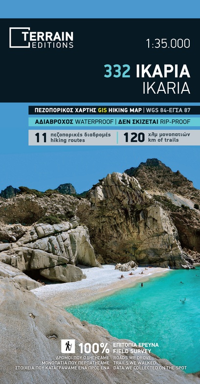
Wandelkaart - Wegenkaart - landkaart 332 Ikaria | Terrain maps (9789609456128)
- ISBN / CODE: 9789609456128
- Editie: 01-06-2019
- Aantal blz.: 1
- Schaal: 1:35000
- Uitgever: Terrain maps
- Soort: Wandelkaart, Wegenkaart
- Taal: Engels, andere talen
- Hoogte: 25.0 cm
- Breedte: 13.0 cm
- Gewicht: 77.0 g
- Uitvoering: Scheur- en watervast
- Beoordeling: 5,0 ★★★★★ (1 review) Schrijf een review
-
€ 13,95
Op voorraad. Voor 17.00 uur op werkdagen besteld, morgen in huis in Nederland Levertijd Belgie
Gratis verzending in Nederland vanaf €50,-
-
Overzicht Wandelkaarten Terrain Maps Griekse Eilanden
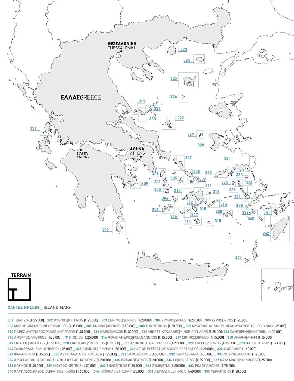
Producten op deze overzichtskaart:
Klik op een product om naar de pagina van dat product te gaan.
- Wandelkaart 301 Tzia ( Kea ) | Terrain maps
- Wandelkaart 302 Kythnos | Terrain maps
- Wandelkaart 303 Serifos | Terrain maps
- Wandelkaart 304 Sifnos | Terrain maps
- Wandelkaart 306 Milos - Kimolos | Terrain maps
- Wandelkaart 307 Andros | Terrain maps
- Wandelkaart - Wegenkaart - landkaart 308 Tinos | Terrain maps
- Wandelkaart 309 Mykonos - Delos - Rinia | Terrain maps
- Wandelkaart 310 Paros - Antiparos | Terrain maps
- Wandelkaart 311 Naxos | Terrain maps
- Wandelkaart 312 Minor Cyclades | Terrain maps
- Wandelkaart 313 Santorini | Terrain maps
- Wandelkaart 314 Amorgos | Terrain maps
- Wandelkaart 315 Ios | Terrain maps
- Wandelkaart 316 Folegandros | Terrain maps
- Wandelkaart 318 Anafi | Terrain maps
- Wandelkaart - Wegenkaart - landkaart 319 Skiathos | Terrain maps
- Wandelkaart 320 Skopelos | Terrain maps
- Wandelkaart 321 Alonissos | Terrain maps
- Wandelkaart - Wegenkaart - landkaart 322 Skyros | Terrain maps
- Wandelkaart 323 Thasos - Thassos | Terrain maps
- Wandelkaart 324 Samothrace - Samothraki | Terrain maps
- Wandelkaart 325 Lemnos | Terrain maps
- Wandelkaart 326 Aghios Efstratios | Terrain maps
- Wandelkaart 328 Chios - Hios | Terrain maps
- Wandelkaart 329 Psara | Terrain maps
- Wandelkaart 330 Astypalaea | Terrain maps
- Wandelkaart 331 Samos | Terrain maps
- Wandelkaart - Wegenkaart - landkaart 332 Ikaria | Terrain maps
- Wandelkaart 333 Fourni | Terrain maps
- Wandelkaart 334 Arki - Lipsi - Aghathonisi | Terrain maps
- Wandelkaart 335 Patmos | Terrain maps
- Wandelkaart - Wegenkaart - landkaart 336 Leros | Terrain maps
- Wandelkaart 337 Kalymnos | Terrain maps
- Wandelkaart - Wegenkaart - landkaart 338 Kos | Terrain maps
- Wandelkaart 339 Nisyros | Terrain maps
- Wandelkaart 340 Tilos | Terrain maps
- Wandelkaart 341 Symi | Terrain maps
- Wandelkaart - Wegenkaart - landkaart 342 Rhodes - Rhodos | Terrain maps
- Wandelkaart 345 Karpathos - Kasos | Terrain maps
- Wandelkaart 346 Kythera - Kythira | Terrain maps
- Wandelkaart 346A Kythera hiking | Terrain maps
- Wandelkaart 351 Lefkada | Terrain maps
- Wandelkaart 355 Zakynthos | Terrain maps
- Wandelkaart 359 Hydra | Terrain maps
Overzichtskaarten
Beschrijving
Gedetailleerde wegenkaart en wandelkaart met alle kleine wegen, wandelpaden, hoogtelijnen en toeristische informatie aangegeven. Alle tekst is tweetalig in Engels en Grieks en de waterproof kaart is geschikt voor gebruik met GPS.
THIS IS THE BEST MAP OF IKARIA BECAUSE:
• It is the only map of Ikaria made with data collected 100% through field survey.
• It comes in a more detailed scale than other map in the market.
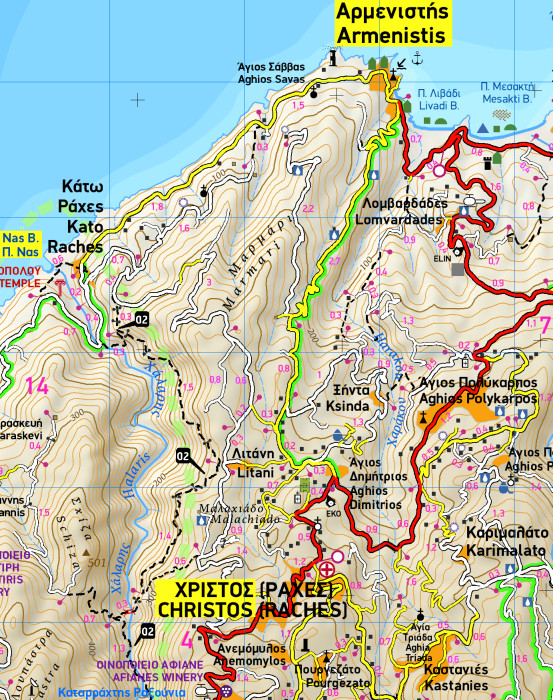
• For the first time, the entire trail network of Ikaria is shown with absolute accuracy. All trails have been measured in kilometers, so you can estimate the duration of your hike. On the back side you ‘ll find detailed descriptions of 11 of the best hikes in Ikaria. These are distinctly labeled on the map, so you can easily locate them.
• It features the most complete road network, with scenic routes marked in green.
• It is printed on Polyart plastic “paper”, making it totally waterproof and rip-proof. You can fold it and unfold it a hundred times, fold it in irregular ways, dunk it in the sea or leave it out in the rain. This map is indestructible!
• The island’s entire coastline is mapped for the first time with TERRAIN’s specially equipped and staffed cartographic vessel. This means that you can locate all beaches of the island, down to the tiniest cove! In fact, the special features of every single beach are recorded: whether it is sandy or pebbled, whether it features natural tree shade, water, a beach bar or organized water sports, whether the seabed in front of the beach is sandy or rocky (so that you will know where to anchor).
• It indicates the boundaries of NATURA 2000 areas so that you will know which parts of the island are of special environmental interest and beauty – thus you can enjoy traveling through them, but also take care to protect them.
• It features a detailed town plan of Aghios Kirikos, in the scale 1:2.500.
• Mountain-bike routes are indicated, for the first time.
• The reverse side features an illustrated mini travel guide, with information on the island’s myths and history, geography and natural environment, sights and major attractions.
Reviews
Handige wandelkaart met aanduiding van de belangrijkste wandeltochten op Ikaria. De kaart is ook waterproof.
★★★★★ door MARC VAN DE WOESTYNE 24 oktober 2025 | Heeft dit artikel gekochtVond u dit een nuttige review? (login om te beoordelen)
Schrijf een review
Graag horen wij wat u van dit artikel vindt. Vindt u het goed, leuk, mooi, slecht, lelijk, onbruikbaar of erg handig: schrijf gerust alles op! Het is niet alleen leuk om te doen maar u informeert andere klanten er ook nog mee!
Ook interessant voor europa/griekenland/eilandenegeischenoordoost
-

Wegenkaart - landkaart 323 Kalymnos
€ 7,95Wegenkaarten Dodecanesos (zuid -oost) -

Reisgids Thassos natuurlijk | Boeksc
€ 21,95Reisgidsen Egeische Eilanden Noord-oost -

Wandelkaart 303 Serifos | Terrain ma
€ 13,95Wandelkaarten Cycladen Zuid -

Wegenkaart - landkaart 337 Chios | O
€ 7,95Wegenkaarten ♦ Chios -

Topografische kaart - Wegenkaart - l
€ 7,95Topografische kaarten Saronische Eilanden - Golf van Egina