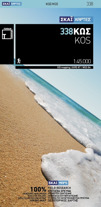
Wandelkaart - Wegenkaart - landkaart 338 Kos | Terrain maps (9789606845741)
- ISBN / CODE: 9789606845741
- Editie: 01-06-2009
- Aantal blz.: 1
- Schaal: 1:45000
- Uitgever: Terrain maps
- Soort: Wandelkaart, Wegenkaart
- Taal: Engels, andere talen
- Hoogte: 25.0 cm
- Breedte: 13.0 cm
- Gewicht: 81.0 g
- Uitvoering: Scheur- en watervast
- Bindwijze: -
- Beoordeling: 3,7 ★★★★★ ★★★★★ (3 reviews) Schrijf een review
-
€ 13,95
Op voorraad
Op werkdagen vóór 17:00 besteld = dezelfde dag verzonden
Bezorging meestal binnen 1–2 werkdagen. Levertijd BelgieGratis verzending in Nederland vanaf €50,-
-
Overzicht Wandelkaarten Terrain Maps Griekse Eilanden
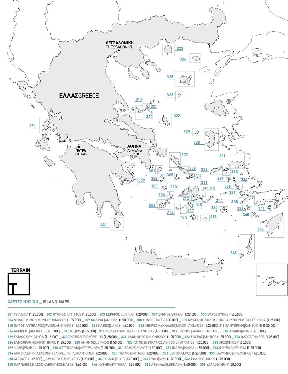
Producten op deze overzichtskaart:
Klik op een product om naar de pagina van dat product te gaan.
- Wandelkaart 301 Tzia ( Kea ) | Terrain maps
- Wandelkaart 302 Kythnos | Terrain maps
- Wandelkaart 303 Serifos | Terrain maps
- Wandelkaart 304 Sifnos | Terrain maps
- Wandelkaart 306 Milos - Kimolos | Terrain maps
- Wandelkaart 307 Andros | Terrain maps
- Wandelkaart - Wegenkaart - landkaart 308 Tinos | Terrain maps
- Wandelkaart 309 Mykonos - Delos - Rinia | Terrain maps
- Wandelkaart 310 Paros - Antiparos | Terrain maps
- Wandelkaart 311 Naxos | Terrain maps
- Wandelkaart 312 Minor Cyclades | Terrain maps
- Wandelkaart 313 Santorini | Terrain maps
- Wandelkaart 314 Amorgos | Terrain maps
- Wandelkaart 315 Ios | Terrain maps
- Wandelkaart 316 Folegandros | Terrain maps
- Wandelkaart 318 Anafi | Terrain maps
- Wandelkaart - Wegenkaart - landkaart 319 Skiathos | Terrain maps
- Wandelkaart 320 Skopelos | Terrain maps
- Wandelkaart 321 Alonissos | Terrain maps
- Wandelkaart - Wegenkaart - landkaart 322 Skyros | Terrain maps
- Wandelkaart 323 Thasos - Thassos | Terrain maps
- Wandelkaart 324 Samothrace - Samothraki | Terrain maps
- Wandelkaart 325 Lemnos | Terrain maps
- Wandelkaart 326 Aghios Efstratios | Terrain maps
- Wandelkaart 328 Chios - Hios | Terrain maps
- Wandelkaart 329 Psara | Terrain maps
- Wandelkaart 330 Astypalaea | Terrain maps
- Wandelkaart 331 Samos | Terrain maps
- Wandelkaart - Wegenkaart - landkaart 332 Ikaria | Terrain maps
- Wandelkaart 333 Fourni | Terrain maps
- Wandelkaart 334 Arki - Lipsi - Aghathonisi | Terrain maps
- Wandelkaart 335 Patmos | Terrain maps
- Wandelkaart - Wegenkaart - landkaart 336 Leros | Terrain maps
- Wandelkaart 337 Kalymnos | Terrain maps
- Wandelkaart - Wegenkaart - landkaart 338 Kos | Terrain maps
- Wandelkaart 339 Nisyros | Terrain maps
- Wandelkaart 340 Tilos | Terrain maps
- Wandelkaart 341 Symi | Terrain maps
- Wandelkaart - Wegenkaart - landkaart 342 Rhodes - Rhodos | Terrain maps
- Wandelkaart 345 Karpathos - Kasos | Terrain maps
- Wandelkaart 346 Kythera - Kythira | Terrain maps
- Wandelkaart 346A Kythera hiking | Terrain maps
- Wandelkaart 351 Lefkada | Terrain maps
- Wandelkaart 355 Zakynthos | Terrain maps
- Wandelkaart 359 Hydra | Terrain maps
Overzichtskaarten
Beschrijving
Gedetailleerde wegenkaart en wandelkaart met alle kleine wegen, wandelpaden, hoogtelijnen en toeristische informatie aangegeven. Alle tekst is tweetalig in Engels en Grieks en de waterproof kaart is geschikt voor gebruik met GPS.
This is a great map because:
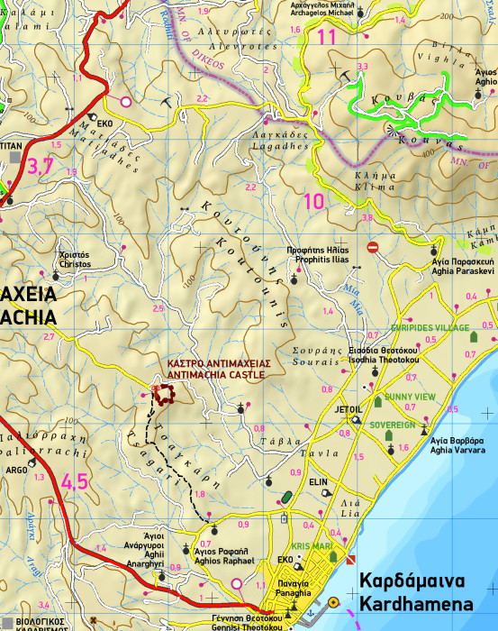
- It is the first GIS map of the island, meaning that this is the first time Kos is mapped with a topographic precision in proportion to the map scale.
- The road network of Kos is featured so completely for the first time. Every road, down to the secondary dirt roads and dead-ends, is illustrated on the map with precision. Naturally the main road network is clearly depicted, along with residential areas, the airport, the ports and the entire tourist infrastructure of Kos.
- It is waterproof and rip-proof. You can fold and unfold it a thousand times, fold it in irregular ways, dunk it in the sea or leave it out in the rain. This map is indestructible!
- It is remarkably detailed, as its scale is much larger (i.e. more detailed) than the competition’s, which makes everything crystal clear!
- It is the first time the island’s entire coastline is mapped. Cartography was done with TERRAIN’s specially equipped and staffed cartographic vessel. This means that you can locate all beaches of the island, down to the tiniest cove! In fact, the special features of every single beach are recorded: whether it is sandy or pebbled, whether it features natural tree shade, water, a beach bar or organized water sports, whether the seabed in front of the beach is sandy or rocky (so that you will know where to anchor).
Reviews
Ondanks de mooie schaal, blijkt de werkelijkheid anders dan de getekende kaart. Verloop van wegen enz. is vaak vereenvoudigd, waardoor het herkennen in het landschap lastig. Op een aantal punten ook echt onjuist of verouderd. (Verharde) Wegen (ik heb het niet eens op paden) ontbreken, ook voor cruciale verbindingen. Dus voldoende voor een globaal overzicht, onvoldoende op op te wandelen
★★★★★ door J. Peeters 28 september 2023 | Heeft dit artikel gekochtVond u dit een nuttige review? (login om te beoordelen)
Weer volkomen happy met een nieuwe kaart. Ditmaal het eiland Kos 1:45.000. Zeer gedetailleerd en op achterzijde voorzien van (engelse) tips over geschiedenis, geografie en bezienswaardigheden. Voor de liefhebber een genot om te bestuderen.
★★★★★ door J.Postuma 3 mei 2018Vond u dit een nuttige review? (login om te beoordelen)
Het was een fijne kaart voor auto en fiets. Voor wandelen niet gedetailleerd genoeg. Ook staat er dat de kaart waterproof is, maar dat betwijfel ik
★★★★★ door Kim 3 augustus 2015Vond u dit een nuttige review? (login om te beoordelen)
Schrijf een review
Graag horen wij wat u van dit artikel vindt. Vindt u het goed, leuk, mooi, slecht, lelijk, onbruikbaar of erg handig: schrijf gerust alles op! Het is niet alleen leuk om te doen maar u informeert andere klanten er ook nog mee!
Ook interessant voor europa/griekenland/eilandendodecanesoszuidoost
-

Wegenkaart - landkaart - Fietskaart
€ 8,95Fietskaarten ♦ Korfoe -

Wegenkaart - landkaart 326 Kos | Ora
€ 8,95Wegenkaarten ♦ Kos -

Wegenkaart - landkaart 335 Limnos |
€ 7,95Wegenkaarten Egeische Eilanden Noord-oost -

Wandelkaart 339 Nisyros | Terrain ma
€ 13,95Wandelkaarten Dodecanesos (zuid -oost) -

Campergids 01 Mit dem Wohnmobil nach
€ 28,95Campergidsen Griekenland