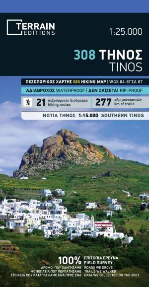
Wandelkaart - Wegenkaart - landkaart 308 Tinos | Terrain maps (9786185160241)
- ISBN / CODE: 9786185160241
- Editie: 2023
- Schaal: 1:25000
- Uitgever: Terrain maps
- Soort: Wandelkaart, Wegenkaart
- Taal: Engels
- Hoogte: 25.0 cm
- Breedte: 12.5 cm
- Dikte: 79.0 cm
- Gewicht: 0.5 g
- Uitvoering: Scheur- en watervast
- Bindwijze: -
- Beoordeling: 5,0 ★★★★★ (1 review) Schrijf een review
-
€ 12,50
Op voorraad. Voor 17.00 uur op werkdagen besteld, morgen in huis in Nederland Levertijd Belgie
Gratis verzending in Nederland vanaf €35,-
-
Overzicht Wandelkaarten Terrain Maps Griekse Eilanden
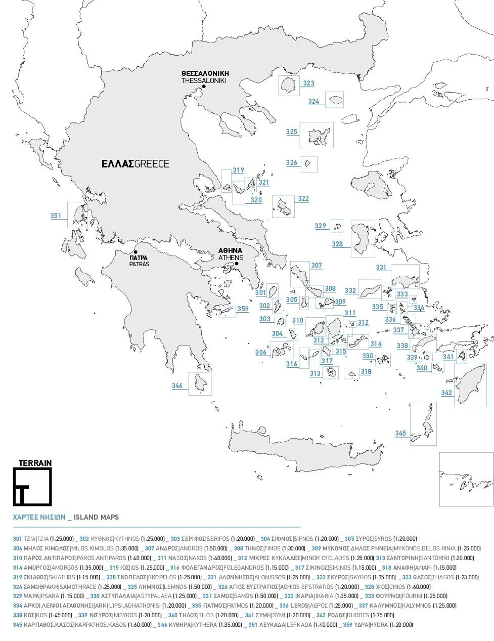
Producten op deze overzichtskaart:
Klik op een product om naar de pagina van dat product te gaan.
- Wandelkaart 301 Tzia ( Kea ) | Terrain maps
- Wandelkaart 302 Kythnos | Terrain maps
- Wandelkaart 303 Serifos | Terrain maps
- Wandelkaart 304 Sifnos | Terrain maps
- Wandelkaart 305 Syros | Terrain maps
- Wandelkaart 306 Milos - Kimolos | Terrain maps
- Wandelkaart 307 Andros | Terrain maps
- Wandelkaart - Wegenkaart - landkaart 308 Tinos | Terrain maps
- Wandelkaart 309 Mykonos - Delos - Rinia | Terrain maps
- Wandelkaart 310 Paros - Antiparos | Terrain maps
- Wandelkaart 311 Naxos | Terrain maps
- Wandelkaart 312 Minor Cyclades | Terrain maps
- Wandelkaart 313 Santorini | Terrain maps
- Wandelkaart 314 Amorgos | Terrain maps
- Wandelkaart 315 Ios | Terrain maps
- Wandelkaart 316 Folegandros | Terrain maps
- Wandelkaart 317 Sikinos | Terrain maps
- Wandelkaart 318 Anafi | Terrain maps
- Wandelkaart - Wegenkaart - landkaart 319 Skiathos | Terrain maps
- Wandelkaart 320 Skopelos | Terrain maps
- Wandelkaart 321 Alonissos | Terrain maps
- Wandelkaart - Wegenkaart - landkaart 322 Skyros | Terrain maps
- Wandelkaart 323 Thasos - Thassos | Terrain maps
- Wandelkaart 324 Samothrace - Samothraki | Terrain maps
- Wandelkaart 325 Lemnos | Terrain maps
- Wandelkaart 326 Aghios Efstratios | Terrain maps
- Wandelkaart 328 Chios - Hios | Terrain maps
- Wandelkaart 329 Psara | Terrain maps
- Wandelkaart 330 Astypalaea | Terrain maps
- Wandelkaart 331 Samos | Terrain maps
- Wandelkaart - Wegenkaart - landkaart 332 Ikaria | Terrain maps
- Wandelkaart 333 Fourni | Terrain maps
- Wandelkaart 334 Arki - Lipsi - Aghathonisi | Terrain maps
- Wandelkaart 335 Patmos | Terrain maps
- Wandelkaart - Wegenkaart - landkaart 336 Leros | Terrain maps
- Wandelkaart 337 Kalymnos | Terrain maps
- Wandelkaart - Wegenkaart - landkaart 338 Kos | Terrain maps
- Wandelkaart 339 Nisyros | Terrain maps
- Wandelkaart 340 Tilos | Terrain maps
- Wandelkaart 341 Symi | Terrain maps
- Wandelkaart - Wegenkaart - landkaart 342 Rhodes - Rhodos | Terrain maps
- Wandelkaart 345 Karpathos - Kasos | Terrain maps
- Wandelkaart 346 Kythera - Kythira | Terrain maps
- Wandelkaart 351 Lefkada | Terrain maps
- Wandelkaart 355 Zakynthos | Terrain maps
- Wandelkaart 359 Hydra | Terrain maps
Overzichtskaarten
Beschrijving
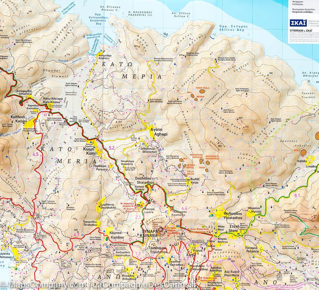
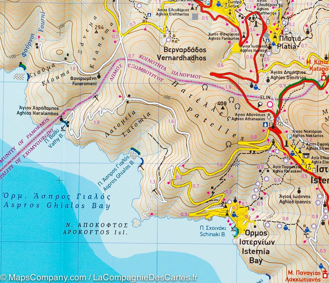
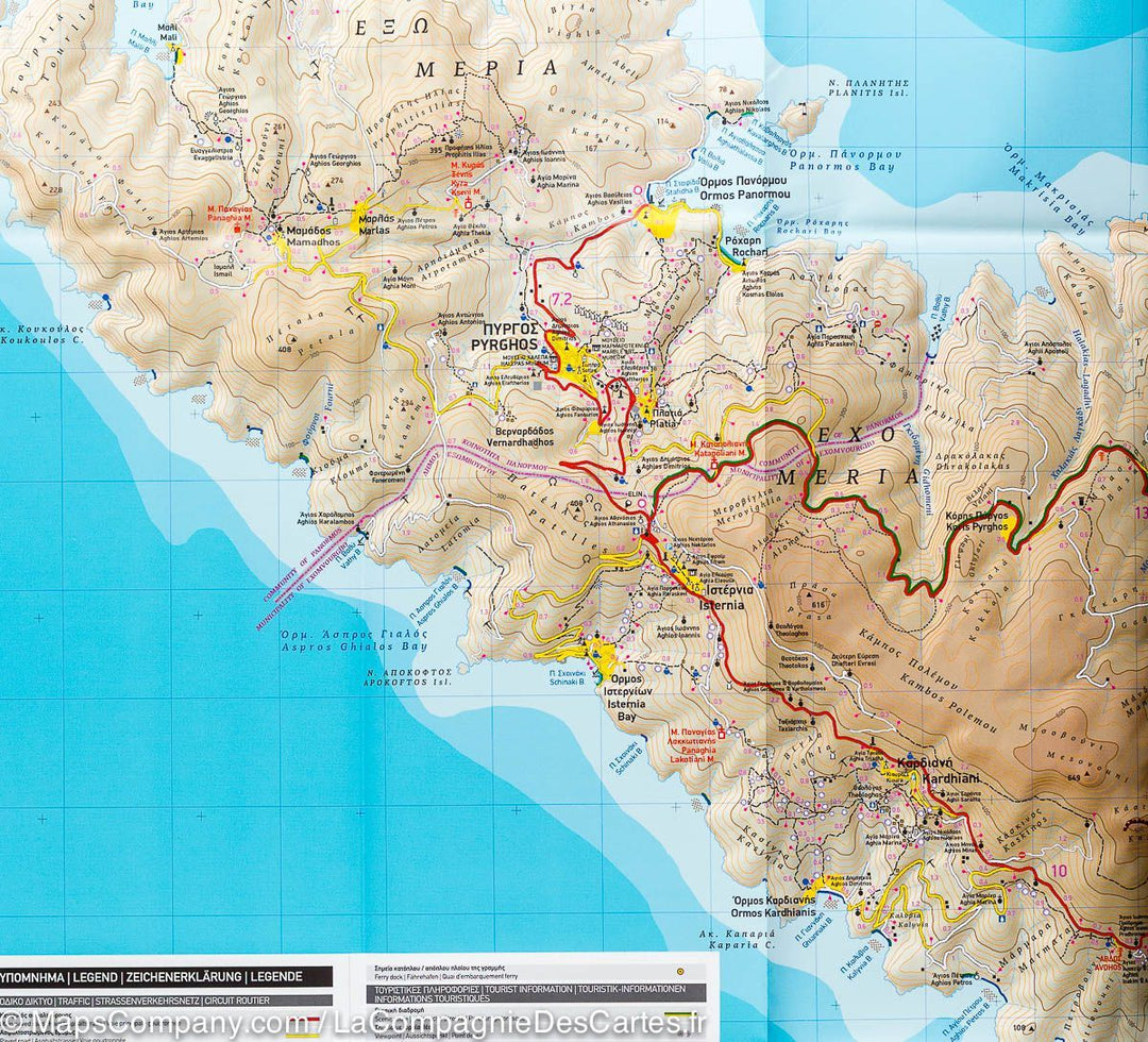
Gedetailleerde wegenkaart en wandelkaart met alle kleine wegen, wandelpaden, hoogtelijnen en toeristische informatie aangegeven. Alle tekst is tweetalig in Engels en Grieks en de waterproof kaart is geschikt voor gebruik met GPS.
Reviews
Mooie grote plattegrond van het eiland Tinos in Griekenland. Een goed gedetailleerde kaart.
★★★★★ door Helga 29 januari 2013Vond u dit een nuttige review? (login om te beoordelen)
Schrijf een review
Graag horen wij wat u van dit artikel vindt. Vindt u het goed, leuk, mooi, slecht, lelijk, onbruikbaar of erg handig: schrijf gerust alles op! Het is niet alleen leuk om te doen maar u informeert andere klanten er ook nog mee!
Ook interessant voor europa/griekenland/eilandencycladenzuid
-

Wandelgids Naxos and the Small Cycla
€ 19,50Wandelgidsen Cycladen Zuid -

Wandelkaart 10.23 Paros | Anavasi
€ 9,95Wandelkaarten Cycladen Zuid -

Wandelkaart 303 Serifos | Terrain ma
€ 11,95Wandelkaarten Cycladen Zuid -

Wegenkaart - landkaart 059 Cyclades
€ 10,25Wegenkaarten Cycladen Zuid -

Reisgids Merian live Mykonos | Delta
€ 15,95Reisgidsen Cycladen Zuid