Winkelwagen
Geen items in winkelwagen
Ga naar winkelwagen
Topografische kaarten - Ardeche - Rhone Vallei
Overzichtskaarten
-
Topografische kaarten IGN 25.000 Ardeche - Rhone vallei Noord
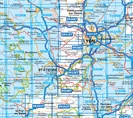
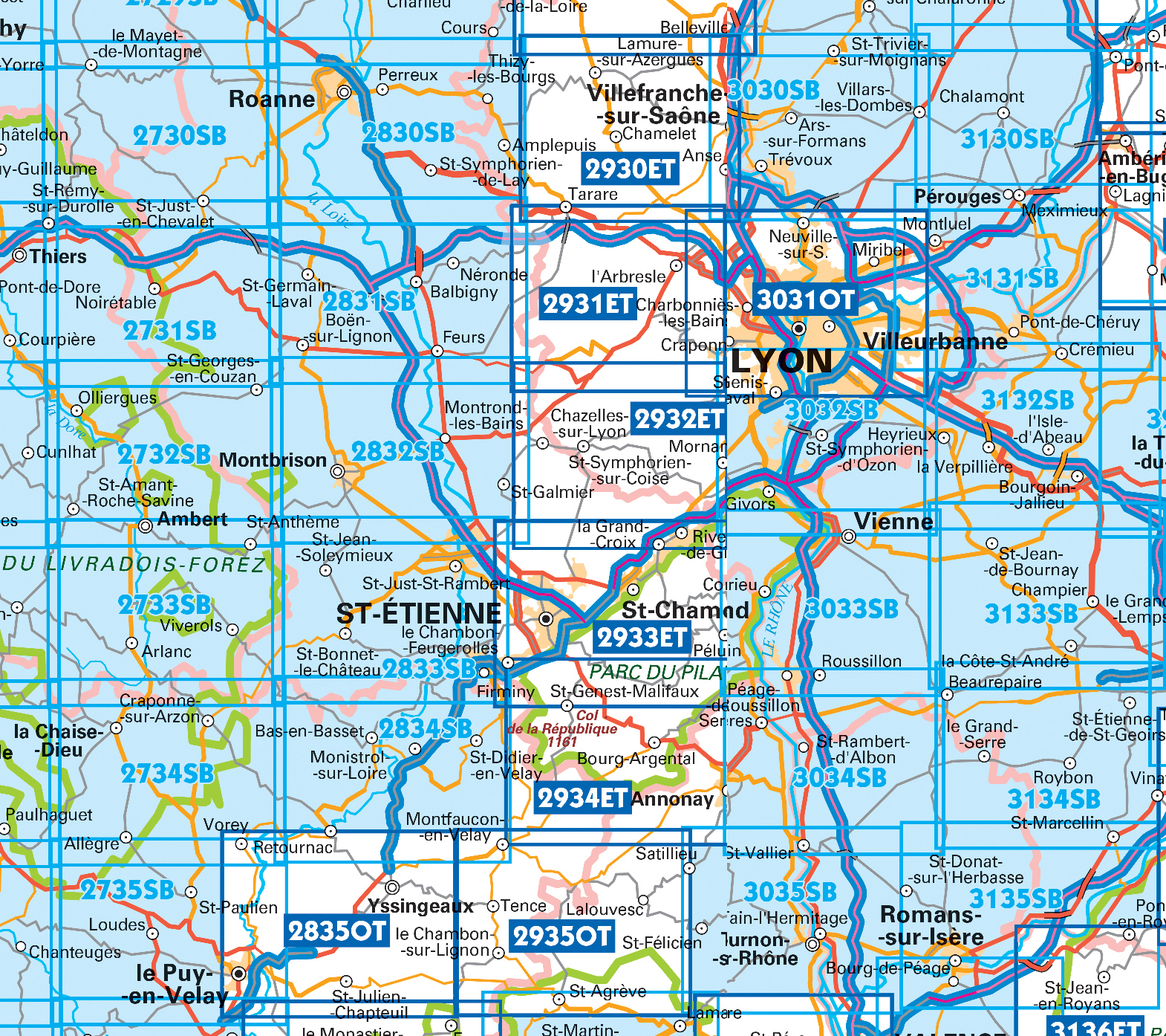
Producten op deze overzichtskaart:
Klik op een product om naar de pagina van dat product te gaan.
- Wandelkaart - Topografische kaart 2733 SB - Serie Bleue St-Anthème, Arlanc | IGN - Institut Géographique National
- Wandelkaart - Topografische kaart 2831 SB - Serie Bleue Feurs – Boën-sur-Lignon | IGN - Institut Géographique National
- Wandelkaart - Topografische kaart 2832 SB - Serie Bleue Montbrison - Veauche | IGN - Institut Géographique National
- Wandelkaart - Topografische kaart 2833 SB - Serie Bleue Firminy, St-Bonnet-le-Château | IGN - Institut Géographique National
- Wandelkaart - Topografische kaart 2834 SB - Serie Bleue Monistrol-sur-Loire, Retournac | IGN - Institut Géographique National
- Wandelkaart - Topografische kaart 2930ET Villefranche-sur-Saône | IGN - Institut Géographique National
- Wandelkaart - Topografische kaart 2931ET L'Arbresle - Monts de Tarare – Col de la Luère – Rhônevallei - Bourgondië | IGN - Institut Géographique National
- Wandelkaart - Topografische kaart 2932ET Monts du Lyonnais | IGN - Institut Géographique National
- Wandelkaart - Topografische kaart 2933ET Massif du Pilat - St-Etienne - St-Chamond - PNR du Pilat Ardéche | IGN - Institut Géographique National
- Wandelkaart - Topografische kaart 2934ET Bourg-Argental - Col de la République - PNR du Pilat Ardéche | IGN - Institut Géographique National
- Wandelkaart - Topografische kaart 3030 Villars-les-Dombes – Villefranche-sur-Saône | IGN - Institut Géographique National
- Wandelkaart - Topografische kaart 3031OT Lyon - Villeurbanne - Mont d'Or | IGN - Institut Géographique National
- Wandelkaart - Topografische kaart 3032 SB - Serie Bleue Vénissieux, Oullins, Givors | IGN - Institut Géographique National
- Wandelkaart - Topografische kaart 3033 SB - Serie Bleue Roussillon, Vienne | IGN - Institut Géographique National
- Wandelkaart - Topografische kaart 3035 SB - Serie Bleue Tounon-sur-Rhône – Satillieu | IGN - Institut Géographique National
- Wandelkaart - Topografische kaart 3130 SB - Serie Bleue Ambérieu-en-Bugey | IGN - Institut Géographique National
- Wandelkaart - Topografische kaart 3131 SB - Serie Bleue Meyzieu | IGN - Institut Géographique National
- Wandelkaart - Topografische kaart 3132 SB - Serie Bleue Bourgoin-Jallieu - La Velpillere | IGN - Institut Géographique National
- Wandelkaart - Topografische kaart 3133 SB - Serie Bleue La Côte-St-André – St-Jean-de-Bournay | IGN - Institut Géographique National
- Topografische kaart - Wandelkaart 3135 Romans-sur-Isère, St-Marcellin | IGN - Institut Géographique National
-
Topografische kaarten IGN 25.000 Ardeche - Rhone vallei Zuid

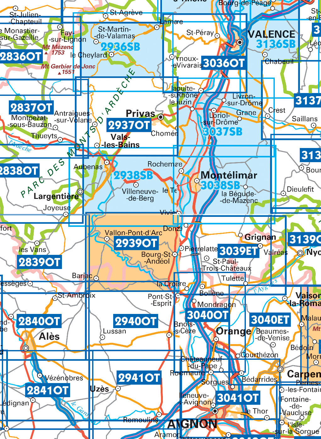
Producten op deze overzichtskaart:
Klik op een product om naar de pagina van dat product te gaan.
- Wandelkaart - Topografische kaart 2838OT Largentière | IGN - Institut Géographique National
- Wandelkaart - Topografische kaart 2840OT Ales | IGN - Institut Géographique National
- Topografische kaart - Wandelkaart 2936 SB - Serie Bleue le Cheylard | IGN - Institut Géographique National
- Wandelkaart - Topografische kaart 2937OT Privas – Vals-les-Bains | IGN - Institut Géographique National
- Wandelkaart - Topografische kaart 2938 SB - Serie Bleue Largentière, Aubenas, Villeneuve-de-Berg | IGN - Institut Géographique National
- Wandelkaart - Topografische kaart 2940OT Bagnols-sur-Cèze | IGN - Institut Géographique National
- Wandelkaart - Topografische kaart 2942OT Nîmes | IGN - Institut Géographique National
- Topografische kaart - Wandelkaart 3036OT Valence | IGN - Institut Géographique National
- Wandelkaart - Topografische kaart 3037 SB - Serie Bleue Crest – La Voulte-sur-Rhône | IGN - Institut Géographique National
- Wandelkaart - Topografische kaart 3038 SB - Serie Bleue Montélimar | IGN - Institut Géographique National
- Wandelkaart - Topografische kaart 3039ET Valréas | IGN - Institut Géographique National
- Wandelkaart - Topografische kaart 3040OT Orange | IGN - Institut Géographique National
- Wandelkaart - Topografische kaart 3041OT Avignon | IGN - Institut Géographique National
- Wandelkaart - Topografische kaart 3136 SB - Serie Bleue Bourg-de-Péage – Chabeuil | IGN - Institut Géographique National
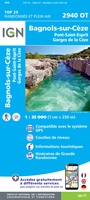 Wandelkaart - Topografische kaart 2940OT Bagnols-sur-Cèze | IGN - Institut Géographique National
 Wandelkaart - Topografische kaart 2942OT Nîmes | IGN - Institut Géographique National
 Wandelkaart - Topografische kaart 3030 Villars-les-Dombes – Villefranche-sur-Saône | IGN - Institut Géographique National
 Wandelkaart - Topografische kaart 3031OT Lyon - Villeurbanne - Mont d'Or | IGN - Institut Géographique National
 Wandelkaart - Topografische kaart 3032 SB - Serie Bleue Vénissieux, Oullins, Givors | IGN - Institut Géographique National★★★★★
 Wandelkaart - Topografische kaart 3033 SB - Serie Bleue Roussillon, Vienne | IGN - Institut Géographique National
 Wandelkaart - Topografische kaart 3035 SB - Serie Bleue Tounon-sur-Rhône – Satillieu | IGN - Institut Géographique National
 Topografische kaart - Wandelkaart 3036OT Valence | IGN - Institut Géographique National
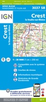 Wandelkaart - Topografische kaart 3037 SB - Serie Bleue Crest – La Voulte-sur-Rhône | IGN - Institut Géographique National
 Wandelkaart - Topografische kaart 3038 SB - Serie Bleue Montélimar | IGN - Institut Géographique National
 Wandelkaart - Topografische kaart 3039ET Valréas | IGN - Institut Géographique National
 Wandelkaart - Topografische kaart 3040OT Orange | IGN - Institut Géographique National
 Wandelkaart - Topografische kaart 3041OT Avignon | IGN - Institut Géographique National
 Wandelkaart - Topografische kaart 2733 SB - Serie Bleue St-Anthème, Arlanc | IGN - Institut Géographique National
 Wandelkaart - Topografische kaart 2735 SB - Serie Bleue Loudes, Le Puy-en-Velay | IGN - Institut Géographique National
 Wandelkaart - Topografische kaart 2831 SB - Serie Bleue Feurs – Boën-sur-Lignon | IGN - Institut Géographique National
 Wandelkaart - Topografische kaart 2832 SB - Serie Bleue Montbrison - Veauche | IGN - Institut Géographique National
 Wandelkaart - Topografische kaart 2833 SB - Serie Bleue Firminy, St-Bonnet-le-Château | IGN - Institut Géographique National
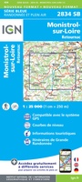 Wandelkaart - Topografische kaart 2834 SB - Serie Bleue Monistrol-sur-Loire, Retournac | IGN - Institut Géographique National
 Wandelkaart - Topografische kaart 2838OT Largentière | IGN - Institut Géographique National★★★★★
Laatste reviews

Prima fietskaart
Ik denk dat ik met deze fietskaart prima uit de voeten kan. Maar dat weet ik pas na de zomer.
★★★★★ door Prins 27 maart 2026 | Heeft dit artikel gekocht
handzame praktische kaart
Heel handige set routekaartjes, gemakkelijk in je jaszak te doen, weerbestendig, veel detailinformatie.
★★★★★ door Marco van Schaik 26 maart 2026 | Heeft dit artikel gekocht
Onweerstaanbaar die OS-kaarten
De topografische kaarten van Ordnance Survey (OS Explorer) op schaal 1:25.000 zijn altijd een genot om mee te werken. Geen detail mist. En dan ook …
★★★★★ door Bert ter Horst 26 maart 2026 | Heeft dit artikel gekocht
Vertrouwd en blijvend actueel
De wegenkaart van West Australie is zeer aan te bevelen.
★★★★★ door Henk 25 maart 2026 | Heeft dit artikel gekocht