Winkelwagen
Geen items in winkelwagen
Ga naar winkelwagen
Kaarten - Pyrénées-Orientales
 Wandelkaart 2547OT Durban-Corbières / Leucate Plages du Roussillon | IGN - Institut Géographique National
 Wandelkaart 2548OT Perpignan / Plages du Roussillon | IGN - Institut Géographique National
 Wandelkaart - Topografische kaart 2549OT Banyuls-sur-Mer | IGN - Institut Géographique National
 Wandelkaart - Topografische kaart 2249ET Font Romeu, Capcir, Olette | IGN - Institut Géographique National★★★★★
 Wandelkaart - Topografische kaart 2249OT Bourg-Madame, Pic Carlit, Col de Puymorens, Port d'Envalira | IGN - Institut Géographique National★★★★★
 Wandelkaart - Topografische kaart 2250ET Bourg-Madame - Mont-Louis | IGN - Institut Géographique National★★★★★
 Wandelkaart - Topografische kaart 2348ET Prades, Sournia, Vinca, St.Paul-de-Fenouillet | IGN - Institut Géographique National
 Wandelkaart - Topografische kaart 2349ET Massif du Canigou, La Preste, Prats-de-Mollo, Vernet-les-Bains | IGN - Institut Géographique National★★★★★
 Wandelkaart - Topografische kaart 2448OT Thuir, Ille-sur-Tet, Latour-de-France, Estagel, Millas | IGN - Institut Géographique National
 Wandelkaart - Topografische kaart 2449OT Céret, Amélie-les-Bains-Palalda, Vallée du Tech | IGN - Institut Géographique National
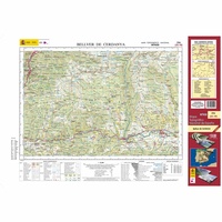 Topografische kaart 216 MT50 Bellver de Cerdanya | CNIG - Instituto Geográfico Nacional1
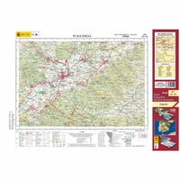 Topografische kaart 217 MT50 Puigcerdá | CNIG - Instituto Geográfico Nacional1
 Topografische kaart 218 MT50 Molló | CNIG - Instituto Geográfico Nacional1
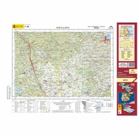 Topografische kaart 220 MT50 Agullana | CNIG - Instituto Geográfico Nacional1
 Topografische kaart 221 MT50 Portbou | CNIG - Instituto Geográfico Nacional1
 Wegenkaart - landkaart 13 TOP 250 Occitanie - Cévennes - Languedoc - Roussillon | IGN - Institut Géographique National
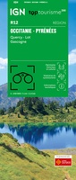 Wegenkaart - landkaart 12 TOP 250 Occitanie - Pyrénées - Quercy | IGN - Institut Géographique National
 Wandelkaart 10 Canigou - Garrotxa | Rando Editions★★★★★★★★★★
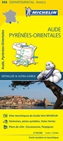 Wegenkaart - landkaart 344 Aude - Pyrenees Orientales | Michelin★★★★★
 Wegenkaart - landkaart - Fietskaart D66 Top D100 Pyrenees Orientales - Oostelijke Pyreneeen | IGN - Institut Géographique National
Laatste reviews

Top gids met alle benodigde informatie.
Prachtige wandelgids voorzien van alle voor de wandelaars benodigde informatie (accommodaties, restaurants en cafés, vervoersmogelijkheden enz.). Ook is de gids beschreven in twee richtingen en …
★★★★★ door Mathie Hoenjet 27 juni 2026 | Heeft dit artikel gekocht
snel bezorgd
Zoals altijd duidelijke en overzichtelijke kaart van Michelin
★★★★★ door Charles Trippelvitz 26 juni 2026 | Heeft dit artikel gekocht
Het was heel leuk om de Vennbahn te fietsen aan de hand van deze handige gids!
Door deze gids konden we ons heel goed voorbereiden op onze fietstocht. En het gebruik onderweg was ook prima. Jammer dat de campings onderweg wat …
★★★★★ door Helma Feenstra 26 juni 2026 | Heeft dit artikel gekocht
Simpele keuze ondersteuning op website en hele snelle levering
Kort voor vakantie naar de Galapagos eilanden toch nog behoefte aan extra reisgids. Simpel kunnen bestellen en snelle levering. Zou niet weten wat er beter …
★★★★★ door Piet Grootenboer 25 juni 2026 | Heeft dit artikel gekocht