Topografische kaarten - Frankrijk
De kaarten van IGN (kort voor Institute Geographique National), wandelkaarten voor Frankrijk, zijn van een ongekend hoog niveau. Met name de wandelkaarten 1:25.000 vinden wij geweldig: werkelijk alles staat erop, de kaarten bevatten zeer veel details en het kleurgebruik is fantastisch, waardoor alles ook nog eens heel goed leesbaar. Je hoort het: wij zijn fan van deze kaarten!
 Topografische kaart - Wandelkaart 2920 SB - Serie Bleue Châtillon-sur-Seine | IGN - Institut Géographique National
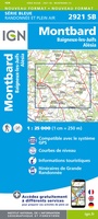 Topografische kaart - Wandelkaart 2921 Baigneux-les-Juifs, Alésia, Montbard | IGN - Institut Géographique National
 Wandelkaart - Topografische kaart 2922 SB - Serie Bleue Semur-en-Auxois – Vitteaux | IGN - Institut Géographique National★★★★★
 Wandelkaart - Topografische kaart 2923 SB - Serie Bleue Pouilly-en-Auxois – Thoisy-la-Berchère | IGN - Institut Géographique National
 Wandelkaart - Topografische kaart 2924 SB - Serie Bleue Arnay-le-Duc – Epignac | IGN - Institut Géographique National★★★★★
 Wandelkaart - Topografische kaart 2925 SB - Serie Bleue Autun - Le Creusot | IGN - Institut Géographique National
 Wandelkaart - Topografische kaart 2926 SB - Serie Bleue Montceau-les-Mines, Ecuisses | IGN - Institut Géographique National
 Wandelkaart - Topografische kaart 2927 SB - Serie Bleue St-Bonnet-de-Joux – Saint-Gengoux-le-National | IGN - Institut Géographique National
 Wandelkaart - Topografische kaart 2928 SB - Serie Bleue Cluny Matour | IGN - Institut Géographique National
 Wandelkaart - Topografische kaart 2929ET Beaujeu - Belleville - Haut Beaujolais – Rhônevallei – Bourgondië | IGN - Institut Géographique National
 Wandelkaart - Topografische kaart 2930ET Villefranche-sur-Saône | IGN - Institut Géographique National
 Wandelkaart - Topografische kaart 2931ET L'Arbresle - Monts de Tarare – Col de la Luère – Rhônevallei - Bourgondië | IGN - Institut Géographique National
 Wandelkaart - Topografische kaart 2932ET Monts du Lyonnais | IGN - Institut Géographique National
 Wandelkaart - Topografische kaart 2933ET Massif du Pilat - St-Etienne - St-Chamond - PNR du Pilat Ardéche | IGN - Institut Géographique National
 Wandelkaart - Topografische kaart 2934ET Bourg-Argental - Col de la République - PNR du Pilat Ardéche | IGN - Institut Géographique National
 Topografische kaart - Wandelkaart 2936 SB - Serie Bleue le Cheylard | IGN - Institut Géographique National★★★★★
 Wandelkaart - Topografische kaart 2937OT Privas – Vals-les-Bains | IGN - Institut Géographique National
 Wandelkaart - Topografische kaart 2938 SB - Serie Bleue Largentière, Aubenas, Villeneuve-de-Berg | IGN - Institut Géographique National★★★★★
 Wandelkaart - Topografische kaart 2942OT Nîmes | IGN - Institut Géographique National
 Wandelkaart - Topografische kaart 2943ET Arles | IGN - Institut Géographique National
Laatste reviews

Deze gids bevat een schat an informatie over talloze rondwandelingen langs de Jurassic Coast, met veel aandacht voor de geologische aspecten van deze kust. De …
★★★★★ door Raymond Franssen 13 juni 2026 | Heeft dit artikel gekocht
In deze nieuwe uitgave ontbreekt de routebeschrijving. Het bevat daar ipv veel info over de omgeving. Dat is leuk. De route is goed te wandelen …
★★★★★ door Irma Smit 13 juni 2026 | Heeft dit artikel gekocht
Duidelijke kaart voor gebied te verkennen met Moto
★★★★★ door Van Puymbroeck René 12 juni 2026 | Heeft dit artikel gekocht
Goede leesbare kaart inclusief route suggesties. Heb alleen op de kaart gelopen, zonder mobiele apparatuur. Heel goed te doen.
★★★★★ door Nick 10 juni 2026 | Heeft dit artikel gekocht