Topografische kaarten - Frankrijk
De kaarten van IGN (kort voor Institute Geographique National), wandelkaarten voor Frankrijk, zijn van een ongekend hoog niveau. Met name de wandelkaarten 1:25.000 vinden wij geweldig: werkelijk alles staat erop, de kaarten bevatten zeer veel details en het kleurgebruik is fantastisch, waardoor alles ook nog eens heel goed leesbaar. Je hoort het: wij zijn fan van deze kaarten!
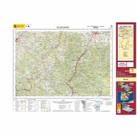 Topografische kaart 91 MT50 Elizondo | CNIG - Instituto Geográfico Nacional1
 Wandelkaart - Topografische kaart 917 SB - Serie Bleue Ploeuc-sur-Lié – Moncontour | IGN - Institut Géographique National
 Topografische kaart - Wandelkaart 918 La Trinité-Porhoët, Loudeac | IGN - Institut Géographique National
 Wandelkaart - Topografische kaart 920 SB - Serie Bleue Elven - Grand-Champ | IGN - Institut Géographique National
 Wandelkaart - Topografische kaart 815 SB - Serie Bleue Paimpol - Pontrieux | IGN - Institut Géographique National
 Wandelkaart - Topografische kaart 816 SB - Serie Bleue Guingamp | IGN - Institut Géographique National
 Wandelkaart - Topografische kaart 817 SB - Serie Bleue Quintin - St-Nicolas-du-Pelem | IGN - Institut Géographique National
 Wandelkaart - Topografische kaart 818 SB - Serie Bleue Pontivy | IGN - Institut Géographique National
 Wandelkaart - Topografische kaart 819 SB - Serie Bleue Pluméliau | IGN - Institut Géographique National
 Wandelkaart - Topografische kaart 82018 Gorges du Verdon | IGN - Institut Géographique National
 Wandelkaart - Topografische kaart 3333OT Massif de la Chartreuse Nord | IGN - Institut Géographique National★★★★★★★★★★
 Wandelkaart - Topografische kaart 3334OT Massif de la Chartreuse Sud | IGN - Institut Géographique National★★★★★
 Wandelkaart - Topografische kaart 1211OT Les Pieux, Barneville, Carteret | IGN - Institut Géographique National
 Wandelkaart - Topografische kaart 0418ET Camaret, Presqu'Île de Crozon, Morgat | IGN - Institut Géographique National★★★★★
 Wandelkaart - Topografische kaart 1123OT Saint-Nazaire - Pornic – Cote de Jade | IGN - Institut Géographique National
 Wandelkaart - Topografische kaart 0921OT Vannes | IGN - Institut Géographique National★★★★★
 Wandelkaart - Topografische kaart 2148OT Vicdessos, Pic d'Estats et de Montcalm, Pyrenees-Ariegeoises | IGN - Institut Géographique National★★★★★
 Wandelkaart - Topografische kaart 2147ET Foix - Tarascon sur Ariege, Ussat, les Monts-d'Olmes | IGN - Institut Géographique National
 Wandelkaart - Topografische kaart 1947OT Aspet, Pic de Mauberme | IGN - Institut Géographique National★★★★★
Laatste reviews

Rother wandelgidsen stellen nooit teleur. Mooie routes, goede opgave kilometers, hoogtemeters en horeca. Een aanrader!
★★★★★ door Anita Geel 13 januari 2026 | Heeft dit artikel gekocht
Mooi boek met prachtige foto’s! Voldoet helemaal aan mijn verwachtingen.
★★★★★ door Hans Eldering 13 januari 2026 | Heeft dit artikel gekocht
het product voldeed aan mijn verwachtingen en was geplastificeerd wat natuurlijk perfect is voor kaart die veel wordt geraadpleegd!
★★★★★ door Peter Lantinga 13 januari 2026 | Heeft dit artikel gekocht
Ik heb de wegenkaart Maleisië aangeschaft om zelf een rondreis per huurauto te kunnen plannen. Deze kaart heeft daar heel goed bij geholpen doordat er …
★★★★★ door M. Rizvi 13 januari 2026 | Heeft dit artikel gekocht