Winkelwagen
Geen items in winkelwagen
Ga naar winkelwagen
Topografische kaarten - Frankrijk
De kaarten van IGN (kort voor Institute Geographique National), wandelkaarten voor Frankrijk, zijn van een ongekend hoog niveau. Met name de wandelkaarten 1:25.000 vinden wij geweldig: werkelijk alles staat erop, de kaarten bevatten zeer veel details en het kleurgebruik is fantastisch, waardoor alles ook nog eens heel goed leesbaar. Je hoort het: wij zijn fan van deze kaarten!
 Wandelkaart - Topografische kaart 3720ET Mulhouse | IGN - Institut Géographique National
 Wandelkaart - Topografische kaart 3721ET Altkirch - Bâle - Sundgau | IGN - Institut Géographique National
 Wandelkaart - Topografische kaart 3741ET Vallée de la Bévera | IGN - Institut Géographique National★★★★★
 Wandelkaart - Topografische kaart 3741OT Vallée de la Vesubie | IGN - Institut Géographique National★★★★★
 Wandelkaart - Topografische kaart 3814ET Hagenau - Lembach - PNR des Vosges du Nord | IGN - Institut Géographique National★★★★★
 Wandelkaart - Topografische kaart 3815 SB - Serie Bleue Bischwiller - Brumath | IGN - Institut Géographique National
 Wandelkaart - Topografische kaart 3816OT Strasbourg | IGN - Institut Géographique National★★★★★
 Wandelkaart - Topografische kaart 3817 SB - Serie Bleue Sélestat - Marckolsheim | IGN - Institut Géographique National
 Wandelkaart - Topografische kaart 3841OT Vallée de la Roya | IGN - Institut Géographique National★★★★★
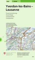 Wandelkaart - Topografische kaart 5020 Yverdon-les-Bains - Lausanne | Swisstopo
 Wandelkaart - Topografische kaart 5024 Neuchâtel - Les Verrières - La Neuveville | Swisstopo
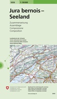 Wandelkaart - Topografische kaart 5026 Jura Bernois - Seeland | Swisstopo
 Wandelkaart - Topografische kaart 4249OT L'Île Rousse | IGN - Institut Géographique National
 Wandelkaart - Topografische kaart 4250OT Corte - Monte Cinto | IGN - Institut Géographique National★★★★★★★★★★
 Wandelkaart - Topografische kaart 4251OT Monte d'Oro - Monte Rotondo | IGN - Institut Géographique National★★★★★
 Wandelkaart - Topografische kaart 4252OT Monte Renoso | IGN - Institut Géographique National
 Wandelkaart - Topografische kaart 4253ET Aiguilles-de-Bavella - Solenzara | IGN - Institut Géographique National
 Wandelkaart - Topografische kaart 4253OT Petreto-Bicchisano - Zicavo | IGN - Institut Géographique National
 Wandelkaart - Topografische kaart 4254ET Porto-Vecchio | IGN - Institut Géographique National
 Wandelkaart - Topografische kaart 4254OT Sartène | IGN - Institut Géographique National
Laatste reviews

Bruikbare kaart
Bruikbare kaart door interessante delen van Spanje. Er moet wel nog informatie bijgezocht worden
★★★★★ door Jef 27 december 2025 | Heeft dit artikel gekocht
Prima kaart
Prima kaart die veel informatie biedt. Goed om ritten te plannen over geasfalteerde wegen
★★★★★ door Jef 27 december 2025 | Heeft dit artikel gekocht
Prima kaart
Goede kaart om ritten over geasfalteerde wegen te plannen. Biedt veel informatie.
★★★★★ door Jef 27 december 2025 | Heeft dit artikel gekocht
adventure ver zoek
Overbodige kaart die niet biedt wat de titel beloofd. Bevat nauwelijks bruikbare informatie
★★★★★ door Jef 27 december 2025 | Heeft dit artikel gekocht