Topografische kaarten - Frankrijk
De kaarten van IGN (kort voor Institute Geographique National), wandelkaarten voor Frankrijk, zijn van een ongekend hoog niveau. Met name de wandelkaarten 1:25.000 vinden wij geweldig: werkelijk alles staat erop, de kaarten bevatten zeer veel details en het kleurgebruik is fantastisch, waardoor alles ook nog eens heel goed leesbaar. Je hoort het: wij zijn fan van deze kaarten!
 Topografische kaart 65 MT50 Bera/Vera de Bidasoa | CNIG - Instituto Geográfico Nacional1
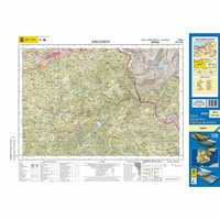 Topografische kaart 65-I Ergoien | CNIG - Instituto Geográfico Nacional1
 Topografische kaart 65-II Bera / Vera de Bidasoa | CNIG - Instituto Geográfico Nacional1
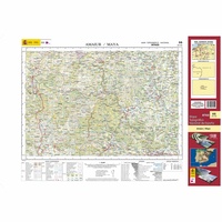 Topografische kaart 66 MT50 Amaiur/Maya | CNIG - Instituto Geográfico Nacional1
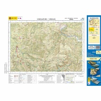 Topografische kaart 66-I Urdazubi / Urdax | CNIG - Instituto Geográfico Nacional1
 Topografische kaart 66-III Amaiur / Maya | CNIG - Instituto Geográfico Nacional1
 Wandelkaart - Topografische kaart 82018 Gorges du Verdon | IGN - Institut Géographique National
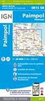 Wandelkaart - Topografische kaart 815 SB - Serie Bleue Paimpol - Pontrieux | IGN - Institut Géographique National
 Wandelkaart - Topografische kaart 816 SB - Serie Bleue Guingamp | IGN - Institut Géographique National
 Wandelkaart - Topografische kaart 817 SB - Serie Bleue Quintin - St-Nicolas-du-Pelem | IGN - Institut Géographique National
 Wandelkaart - Topografische kaart 818 SB - Serie Bleue Pontivy | IGN - Institut Géographique National
 Wandelkaart - Topografische kaart 819 SB - Serie Bleue Pluméliau | IGN - Institut Géographique National
 Wandelkaart - Topografische kaart 715 SB - Serie Bleue Bégard - Lannion | IGN - Institut Géographique National
 Wandelkaart - Topografische kaart 716 SB - Serie Bleue Belle-Isle-en-Terre, Guerlesquin | IGN - Institut Géographique National
 Wandelkaart - Topografische kaart 717 SB - Serie Bleue Carhaix-Plouguer, Maël-Carhaix | IGN - Institut Géographique National
 Wandelkaart - Topografische kaart 718 SB - Serie Bleue Rostrenen | IGN - Institut Géographique National
 Topografische kaart 91 MT50 Elizondo | CNIG - Instituto Geográfico Nacional1
 Wandelkaart - Topografische kaart 917 SB - Serie Bleue Ploeuc-sur-Lié – Moncontour | IGN - Institut Géographique National
 Topografische kaart - Wandelkaart 918 La Trinité-Porhoët, Loudeac | IGN - Institut Géographique National
 Wandelkaart - Topografische kaart 920 SB - Serie Bleue Elven - Grand-Champ | IGN - Institut Géographique National
Laatste reviews

Ik gebruik deze kaart omdat ik een reis wil volgen van meerdere personen. Heb er veel plezier van.
★★★★★ door Loes Vechtmann 15 april 2026 | Heeft dit artikel gekocht
Dit boek heeft me veel inzicht gegeven hoe om te gaan met jezelf in de wildernis. Een fijn, kwetsbaar en oprecht geschreven boek met veel …
★★★★★ door Arnold Jippes 15 april 2026 | Heeft dit artikel gekocht
The DK Eyewitness travel guide for Florence & Tuscany is an excellent guide with lots of details, including helpful photographs maps and diagrams of the …
★★★★★ door Andrew Wedgner 15 april 2026 | Heeft dit artikel gekocht
Wij zijn nu aan het reizen in zuid-west Australië. De kaart is heel goed te gebruiken. Blij mee!
★★★★★ door Wilma van der Maas 15 april 2026 | Heeft dit artikel gekocht