Winkelwagen
Geen items in winkelwagen
Ga naar winkelwagen
Topografische kaarten - Frankrijk
De kaarten van IGN (kort voor Institute Geographique National), wandelkaarten voor Frankrijk, zijn van een ongekend hoog niveau. Met name de wandelkaarten 1:25.000 vinden wij geweldig: werkelijk alles staat erop, de kaarten bevatten zeer veel details en het kleurgebruik is fantastisch, waardoor alles ook nog eens heel goed leesbaar. Je hoort het: wij zijn fan van deze kaarten!
 Topografische kaart - Wandelkaart 1909OT St-Valery-en-Caux | IGN - Institut Géographique National★★★★★★★★★★
 Wandelkaart - Topografische kaart 1910 SB - Serie Bleue Yvetot | IGN - Institut Géographique National
 Wandelkaart - Topografische kaart 1911ET Rouen, Forets Rouennaises, PNR | IGN - Institut Géographique National
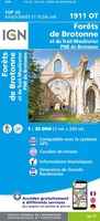 Wandelkaart - Topografische kaart 1911OT Forets De Brotonne | IGN - Institut Géographique National
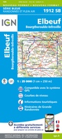 Topografische kaart - Wandelkaart 1912 SB - Serie Bleue Elbeuf | IGN - Institut Géographique National
 Wandelkaart - Topografische kaart 1913 SB - Serie Bleue Evreux - Conches-en-Ouche | IGN - Institut Géographique National
 Wandelkaart - Topografische kaart 1914 SB - Serie Bleue Breteuil – La Neuve-Lyre | IGN - Institut Géographique National
 Wandelkaart - Topografische kaart 1915 SB - Serie Bleue Verneuil-sur-Avre, Bourth | IGN - Institut Géographique National
 Wandelkaart - Topografische kaart 1916 SB - Serie Bleue La Loupe - Rémalard | IGN - Institut Géographique National
 Wandelkaart - Topografische kaart 1917 SB - Serie Bleue Nogent-le-Rotrou, Thiron-Gardais | IGN - Institut Géographique National
 Wandelkaart - Topografische kaart 1918 SB - Serie Bleue Authon-du-Perche, La Bazoche-Gouet | IGN - Institut Géographique National
 Wandelkaart - Topografische kaart 1919 SB - Serie Bleue St-Calais - Droué | IGN - Institut Géographique National
 Wandelkaart - Topografische kaart 1920 SB - Serie Bleue Vendome, Montoire-sur-le-Loir | IGN - Institut Géographique National
 Wandelkaart - Topografische kaart 1921 SB - Serie Bleue Château-Renault, St-Amand-Longpré | IGN - Institut Géographique National
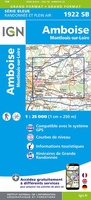 Wandelkaart - Topografische kaart 1922 SB - Serie Bleue Amboise, Montlouis-sur-Loire | IGN - Institut Géographique National
 Wandelkaart - Topografische kaart 1923 SB - Serie Bleue Bléré - Chenonceaux - Veigné | IGN - Institut Géographique National
 Wandelkaart - Topografische kaart 1924 SB - Serie Bleue Loches - Ligueil | IGN - Institut Géographique National
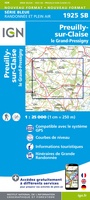 Wandelkaart - Topografische kaart 1925 SB - Serie Bleue Preuilly-sur-Claise, le Grand-Pressigny | IGN - Institut Géographique National
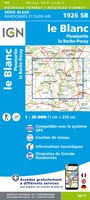 Wandelkaart - Topografische kaart 1926 SB - Serie Bleue Le Blanc, Pleumartin, La Roche-Posay | IGN - Institut Géographique National
 Wandelkaart - Topografische kaart 1927 SB - Serie Bleue La Trimouille | IGN - Institut Géographique National
Laatste reviews

Bruikbare kaart
Bruikbare kaart door interessante delen van Spanje. Er moet wel nog informatie bijgezocht worden
★★★★★ door Jef 27 december 2025 | Heeft dit artikel gekocht
Prima kaart
Prima kaart die veel informatie biedt. Goed om ritten te plannen over geasfalteerde wegen
★★★★★ door Jef 27 december 2025 | Heeft dit artikel gekocht
Prima kaart
Goede kaart om ritten over geasfalteerde wegen te plannen. Biedt veel informatie.
★★★★★ door Jef 27 december 2025 | Heeft dit artikel gekocht
adventure ver zoek
Overbodige kaart die niet biedt wat de titel beloofd. Bevat nauwelijks bruikbare informatie
★★★★★ door Jef 27 december 2025 | Heeft dit artikel gekocht