Topografische kaarten - Frankrijk
De kaarten van IGN (kort voor Institute Geographique National), wandelkaarten voor Frankrijk, zijn van een ongekend hoog niveau. Met name de wandelkaarten 1:25.000 vinden wij geweldig: werkelijk alles staat erop, de kaarten bevatten zeer veel details en het kleurgebruik is fantastisch, waardoor alles ook nog eens heel goed leesbaar. Je hoort het: wij zijn fan van deze kaarten!
 Wandelkaart - Topografische kaart 1710ET Le Havre, Etretat, PNR des Boucles Seine Normandie | IGN - Institut Géographique National★★★★★
 Wandelkaart - Topografische kaart 1711OT Honfleur Deauville | IGN - Institut Géographique National★★★★★
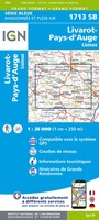 Wandelkaart - Topografische kaart 1713 SB - Serie Bleue Livarot - Beuvillers | IGN - Institut Géographique National★★★★★
 Wandelkaart - Topografische kaart 1714 SB - Serie Bleue Vimoutiers - Trun | IGN - Institut Géographique National
 Wandelkaart - Topografische kaart 1715 SB - Serie Bleue Sées - Gace | IGN - Institut Géographique National
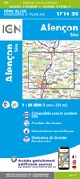 Wandelkaart - Topografische kaart 1716 SB - Serie Bleue Alençon - Sées | IGN - Institut Géographique National
 Wandelkaart - Topografische kaart 1717 SB - Serie Bleue Alençon - Marolles-les-Braults | IGN - Institut Géographique National
 Wandelkaart - Topografische kaart 1718 SB - Serie Bleue Beaumont-sur-Sarthe - Ballon | IGN - Institut Géographique National
 Wandelkaart - Topografische kaart 1719 SB - Serie Bleue Le Mans - La Suze-sur-Sarthe | IGN - Institut Géographique National
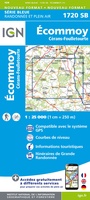 Wandelkaart - Topografische kaart 1720 SB - Serie Bleue Ecommoy – Cérans-Foulletourte | IGN - Institut Géographique National
 Topografische kaart - Wandelkaart 1721 SB - Serie Bleue le Lude | IGN - Institut Géographique National
 Wandelkaart - Topografische kaart 1723ET Chinon | IGN - Institut Géographique National
 Wandelkaart - Topografische kaart 1724 SB - Serie Bleue Loudun – Richelieu | IGN - Institut Géographique National★★★★★
 Wandelkaart - Topografische kaart 1725 SB - Serie Bleue Lencloitre, St-Jean-de-Sauves | IGN - Institut Géographique National
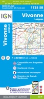 Wandelkaart - Topografische kaart 1728 SB - Serie Bleue Vivonne - Lusignan | IGN - Institut Géographique National
 Wandelkaart - Topografische kaart 1729 SB - Serie Bleue Civray - Sauze - Vaussais | IGN - Institut Géographique National
 Wandelkaart - Topografische kaart 1730 SB - Serie Bleue Ruffec - Villefagnan | IGN - Institut Géographique National
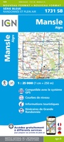 Wandelkaart - Topografische kaart 1731 SB - Serie Bleue Mansle | IGN - Institut Géographique National
 Wandelkaart - Topografische kaart 1732 SB - Serie Bleue Angoulême, Ruelle-sur-Touvre | IGN - Institut Géographique National
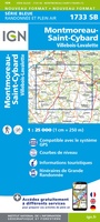 Wandelkaart - Topografische kaart 1733 SB - Serie Bleue Montmoreau-Saint-Cybard | IGN - Institut Géographique National
Laatste reviews

Deze gids bevat een schat an informatie over talloze rondwandelingen langs de Jurassic Coast, met veel aandacht voor de geologische aspecten van deze kust. De …
★★★★★ door Raymond Franssen 13 juni 2026 | Heeft dit artikel gekocht
In deze nieuwe uitgave ontbreekt de routebeschrijving. Het bevat daar ipv veel info over de omgeving. Dat is leuk. De route is goed te wandelen …
★★★★★ door Irma Smit 13 juni 2026 | Heeft dit artikel gekocht
Duidelijke kaart voor gebied te verkennen met Moto
★★★★★ door Van Puymbroeck René 12 juni 2026 | Heeft dit artikel gekocht
Goede leesbare kaart inclusief route suggesties. Heb alleen op de kaart gelopen, zonder mobiele apparatuur. Heel goed te doen.
★★★★★ door Nick 10 juni 2026 | Heeft dit artikel gekocht