Topografische kaarten - Frankrijk
De kaarten van IGN (kort voor Institute Geographique National), wandelkaarten voor Frankrijk, zijn van een ongekend hoog niveau. Met name de wandelkaarten 1:25.000 vinden wij geweldig: werkelijk alles staat erop, de kaarten bevatten zeer veel details en het kleurgebruik is fantastisch, waardoor alles ook nog eens heel goed leesbaar. Je hoort het: wij zijn fan van deze kaarten!
 Wandelkaart - Topografische kaart 1281 Coppet | Swisstopo
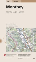 Wandelkaart - Topografische kaart 1284 Monthey | Swisstopo
 Wandelkaart - Topografische kaart 1631 SB - Serie Bleue Matha | IGN - Institut Géographique National
 Wandelkaart - Topografische kaart 1632 SB - Serie Bleue Cognac | IGN - Institut Géographique National
 Wandelkaart - Topografische kaart 1633 SB - Serie Bleue Barbezieux-Saint-Hilaire | IGN - Institut Géographique National
 Wandelkaart - Topografische kaart 1634 SB - Serie Bleue Brossac - Montguyon | IGN - Institut Géographique National
 Wandelkaart - Topografische kaart 1635 SB - Serie Bleue Guîtres - Coutras | IGN - Institut Géographique National
 Wandelkaart - Topografische kaart 1636 SB - Serie Bleue Libourne, Saint-Emilion | IGN - Institut Géographique National★★★★★
 Wandelkaart - Topografische kaart 1637 SB - Serie Bleue Podensac | IGN - Institut Géographique National
 Topografische kaart - Wandelkaart 1638 La Réole - Langon | IGN - Institut Géographique National
 Wandelkaart - Topografische kaart 1639 SB - Serie Bleue Grignols - Bazas | IGN - Institut Géographique National
 Wandelkaart - Topografische kaart 1640 SB - Serie Bleue Losse | IGN - Institut Géographique National
 Wandelkaart - Topografische kaart 1641 SB - Serie Bleue Roquefort | IGN - Institut Géographique National
 Wandelkaart - Topografische kaart 1642 SB - Serie Bleue Villeneuve-de-Marsan | IGN - Institut Géographique National
 Wandelkaart - Topografische kaart 1643 SB - Serie Bleue Aire-sur-l'Adour | IGN - Institut Géographique National
 Wandelkaart - Topografische kaart 1644 SB - Serie Bleue Lembeye | IGN - Institut Géographique National
 Topografische kaart - Wandelkaart 1645 Pontacq - Ossun - Ger | IGN - Institut Géographique National
 Wandelkaart - Topografische kaart 1647ET Lourdes, Argeles-Gazost, Le Lavedan, Pierrefitte-Nestalas, Aucun | IGN - Institut Géographique National★★★★★
 Wandelkaart - Topografische kaart 1647OT Vignemale, Ossau, Cauterets, Gourette | IGN - Institut Géographique National★★★★★
 Wandelkaart - Topografische kaart 1710ET Le Havre, Etretat, PNR des Boucles Seine Normandie | IGN - Institut Géographique National★★★★★
Laatste reviews

Rother wandelgidsen stellen nooit teleur. Mooie routes, goede opgave kilometers, hoogtemeters en horeca. Een aanrader!
★★★★★ door Anita Geel 13 januari 2026 | Heeft dit artikel gekocht
Mooi boek met prachtige foto’s! Voldoet helemaal aan mijn verwachtingen.
★★★★★ door Hans Eldering 13 januari 2026 | Heeft dit artikel gekocht
het product voldeed aan mijn verwachtingen en was geplastificeerd wat natuurlijk perfect is voor kaart die veel wordt geraadpleegd!
★★★★★ door Peter Lantinga 13 januari 2026 | Heeft dit artikel gekocht
Ik heb de wegenkaart Maleisië aangeschaft om zelf een rondreis per huurauto te kunnen plannen. Deze kaart heeft daar heel goed bij geholpen doordat er …
★★★★★ door M. Rizvi 13 januari 2026 | Heeft dit artikel gekocht