Topografische kaarten - Frankrijk
De kaarten van IGN (kort voor Institute Geographique National), wandelkaarten voor Frankrijk, zijn van een ongekend hoog niveau. Met name de wandelkaarten 1:25.000 vinden wij geweldig: werkelijk alles staat erop, de kaarten bevatten zeer veel details en het kleurgebruik is fantastisch, waardoor alles ook nog eens heel goed leesbaar. Je hoort het: wij zijn fan van deze kaarten!
 Wandelkaart - Topografische kaart 1543 SB - Serie Bleue Hagetmau | IGN - Institut Géographique National
 Wandelkaart - Topografische kaart 1544 SB - Serie Bleue Arthez-de-Béarn | IGN - Institut Géographique National
 Wandelkaart - Topografische kaart 1545 SB - Serie Bleue Oloron – Sainte-Marie | IGN - Institut Géographique National
 Wandelkaart - Topografische kaart 1545ET Pau | IGN - Institut Géographique National
 Wandelkaart - Topografische kaart 1546ET Laruns, Gourette | IGN - Institut Géographique National★★★★★
 Wandelkaart - Topografische kaart 1546OT Oloron-Sainte.Marie, Vallee d'Aspe | IGN - Institut Géographique National★★★★★
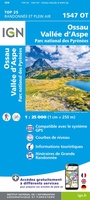 Wandelkaart - Topografische kaart 1547OT Ossau - Vallée D'Aspe | IGN - Institut Géographique National
 Wandelkaart - Topografische kaart 1612OT Caen - Ouistreham , Normandië | IGN - Institut Géographique National
 Topografische kaart - Wandelkaart 1613 SB - Serie Bleue Saint-Pierre-sur-Dives | IGN - Institut Géographique National
 Wandelkaart - Topografische kaart 1614 SB - Serie Bleue Falaise | IGN - Institut Géographique National
 Wandelkaart - Topografische kaart 1615 SB - Serie Bleue Argentan - Putanges-Pont-Ecrepin | IGN - Institut Géographique National
 Wandelkaart - Topografische kaart 1616 SB - Serie Bleue La Ferté-Macé, Pré-en-Pail, Carrouges | IGN - Institut Géographique National
 Wandelkaart - Topografische kaart 1617 SB - Serie Bleue Villaines-la-Juhel, St-Pierre-des-Nids, Alpes Mancelles | IGN - Institut Géographique National
 Wandelkaart - Topografische kaart 1619 SB - Serie Bleue Loué - Brûlon, Noyen-sur-Sarthe | IGN - Institut Géographique National
 Topografische kaart - Wandelkaart 1620 SB - Serie Bleue La Flèche | IGN - Institut Géographique National
 Topografische kaart - Wandelkaart 1622 Longué-Jumelles, Beaufort-en-Vallée | IGN - Institut Géographique National
 Topografische kaart - Wandelkaart 1624 SB - Serie Bleue Thouars | IGN - Institut Géographique National
 Topografische kaart - Wandelkaart 1625 SB - Serie Bleue Thouars | IGN - Institut Géographique National
 Wandelkaart - Topografische kaart 1626 SB - Serie Bleue Parthenay - Thenezay | IGN - Institut Géographique National
 Wandelkaart - Topografische kaart 1627 SB - Serie Bleue Mazieres-en-Gatine, Vasles | IGN - Institut Géographique National
Laatste reviews

Bevat de gehele Picos de Europa. Goed in detail. Alle routes GR en PR-PNPE. Refugres en nog veel meer. Schaal 1 op 25.000 is fijn …
★★★★★ door M H 03 april 2026 | Heeft dit artikel gekocht
De bestelling snel en netjes afgehandeld
★★★★★ door Tiny Waltmans 03 april 2026 | Heeft dit artikel gekocht
Ik ben dol op de veldkaarten over verschillende vogelsoorten, per land of werelddelen. Deze keer de kaart besteld over vogelsoorten in Afrika en tijdens mijn …
★★★★★ door Kelly Bosch 02 april 2026 | Heeft dit artikel gekocht
Precies wat ik zocht. De informatie op de website was duidelijk en klopte. Het was eerst niet leverbaar, maar ik had aangegeven dat ik bericht …
★★★★★ door Mieke van den Broek 01 april 2026 | Heeft dit artikel gekocht