Topografische kaarten - Frankrijk
De kaarten van IGN (kort voor Institute Geographique National), wandelkaarten voor Frankrijk, zijn van een ongekend hoog niveau. Met name de wandelkaarten 1:25.000 vinden wij geweldig: werkelijk alles staat erop, de kaarten bevatten zeer veel details en het kleurgebruik is fantastisch, waardoor alles ook nog eens heel goed leesbaar. Je hoort het: wij zijn fan van deze kaarten!
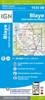 Wandelkaart - Topografische kaart 1535 SB - Serie Bleue Blaye | IGN - Institut Géographique National
 Topografische kaart - Wandelkaart 1536OT Bordeaux / Sud Médoc | IGN - Institut Géographique National
 Topografische kaart - Wandelkaart 1537 SB - Serie Bleue Pessac | IGN - Institut Géographique National
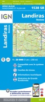 Wandelkaart - Topografische kaart 1538 SB - Serie Bleue Landiras | IGN - Institut Géographique National
 Wandelkaart - Topografische kaart 1539 SB - Serie Bleue St-Symphorien | IGN - Institut Géographique National
 Wandelkaart - Topografische kaart 1540 SB - Serie Bleue Labrit | IGN - Institut Géographique National
 Wandelkaart - Topografische kaart 1541 SB - Serie Bleue Ygos-Saint-Saturnin | IGN - Institut Géographique National
 Wandelkaart - Topografische kaart 1542 SB - Serie Bleue Mont-de-Marsan | IGN - Institut Géographique National
 Wandelkaart - Topografische kaart 1543 SB - Serie Bleue Hagetmau | IGN - Institut Géographique National
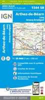 Wandelkaart - Topografische kaart 1544 SB - Serie Bleue Arthez-de-Béarn | IGN - Institut Géographique National
 Wandelkaart - Topografische kaart 1545 SB - Serie Bleue Oloron – Sainte-Marie | IGN - Institut Géographique National
 Wandelkaart - Topografische kaart 1545ET Pau | IGN - Institut Géographique National
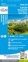 Wandelkaart - Topografische kaart 1546ET Laruns, Gourette | IGN - Institut Géographique National★★★★★
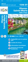 Wandelkaart - Topografische kaart 1546OT Oloron-Sainte.Marie, Vallee d'Aspe | IGN - Institut Géographique National★★★★★
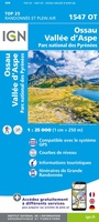 Wandelkaart - Topografische kaart 1547OT Ossau - Vallée D'Aspe | IGN - Institut Géographique National
 Wandelkaart - Topografische kaart 1612OT Caen - Ouistreham , Normandië | IGN - Institut Géographique National
 Topografische kaart - Wandelkaart 1613 SB - Serie Bleue Saint-Pierre-sur-Dives | IGN - Institut Géographique National
 Wandelkaart - Topografische kaart 1614 SB - Serie Bleue Falaise | IGN - Institut Géographique National
 Wandelkaart - Topografische kaart 1615 SB - Serie Bleue Argentan - Putanges-Pont-Ecrepin | IGN - Institut Géographique National
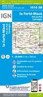 Wandelkaart - Topografische kaart 1616 SB - Serie Bleue La Ferté-Macé, Pré-en-Pail, Carrouges | IGN - Institut Géographique National
Laatste reviews

Rother wandelgidsen stellen nooit teleur. Mooie routes, goede opgave kilometers, hoogtemeters en horeca. Een aanrader!
★★★★★ door Anita Geel 13 januari 2026 | Heeft dit artikel gekocht
Mooi boek met prachtige foto’s! Voldoet helemaal aan mijn verwachtingen.
★★★★★ door Hans Eldering 13 januari 2026 | Heeft dit artikel gekocht
het product voldeed aan mijn verwachtingen en was geplastificeerd wat natuurlijk perfect is voor kaart die veel wordt geraadpleegd!
★★★★★ door Peter Lantinga 13 januari 2026 | Heeft dit artikel gekocht
Ik heb de wegenkaart Maleisië aangeschaft om zelf een rondreis per huurauto te kunnen plannen. Deze kaart heeft daar heel goed bij geholpen doordat er …
★★★★★ door M. Rizvi 13 januari 2026 | Heeft dit artikel gekocht