Topografische kaarten - Frankrijk
De kaarten van IGN (kort voor Institute Geographique National), wandelkaarten voor Frankrijk, zijn van een ongekend hoog niveau. Met name de wandelkaarten 1:25.000 vinden wij geweldig: werkelijk alles staat erop, de kaarten bevatten zeer veel details en het kleurgebruik is fantastisch, waardoor alles ook nog eens heel goed leesbaar. Je hoort het: wij zijn fan van deze kaarten!
 Wandelkaart - Topografische kaart 1325 SB - Serie Bleue Montaigu | IGN - Institut Géographique National
 Wandelkaart - Topografische kaart 1326 SB - Serie Bleue La Roche-sur-Yon | IGN - Institut Géographique National
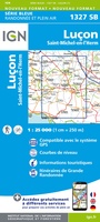 Wandelkaart - Topografische kaart 1327 SB - Serie Bleue Luçon | IGN - Institut Géographique National
 Wandelkaart - Topografische kaart 1329ET La Rochelle - Anse de l'Aiguillon | IGN - Institut Géographique National
 Wandelkaart - Topografische kaart 1329OT Ile De Re | IGN - Institut Géographique National
 Wandelkaart - Topografische kaart 1330OT Ile d'Oleron & Ile d'Aix | IGN - Institut Géographique National
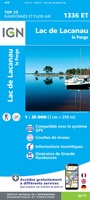 Wandelkaart - Topografische kaart 1336ET Lac de Lacanau & Le Porge | IGN - Institut Géographique National
 Wandelkaart - Topografische kaart 1337ET Bassin D'Arcachon | IGN - Institut Géographique National★★★★★
 Wandelkaart - Topografische kaart 1339ET Biscarrosse | IGN - Institut Géographique National
 Wandelkaart - Topografische kaart 1342 SB - Serie Bleue Dax | IGN - Institut Géographique National
 Wandelkaart - Topografische kaart 1343E SB - Serie Bleue Saint-Geours-de-Maremne | IGN - Institut Géographique National
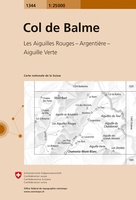 Wandelkaart - Topografische kaart 1344 Col de Balme | Swisstopo
 Wandelkaart - Topografische kaart 1344 SB - Serie Bleue Peyrehorade | IGN - Institut Géographique National
 Wandelkaart - Topografische kaart 1344OT Bayonne | IGN - Institut Géographique National
 Wandelkaart - Topografische kaart 1345OT Cambo-les-Bains – Hasparren | IGN - Institut Géographique National
 Topografische kaart - Wandelkaart 1346ET Forêt d'Iraty - Pic d'Orly | IGN - Institut Géographique National
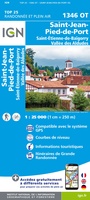 Topografische kaart - Wandelkaart 1346OT St.-Jean-Pied-de-Port | IGN - Institut Géographique National
 Wandelkaart - Topografische kaart 1412OT Pointe Du Hoc - Omaha Beach | IGN - Institut Géographique National★★★★★
 Wandelkaart - Topografische kaart 1413 SB - Serie Bleue Condé-sur-Vire, Caumont- sur-Aure | IGN - Institut Géographique National
 Wandelkaart - Topografische kaart 1414 SB - Serie Bleue Vire Normandie, Souleuvre en Bocage | IGN - Institut Géographique National
Laatste reviews

Keurige levering.
★★★★★ door JP 07 januari 2026 | Heeft dit artikel gekocht
Het zal voor mijn zus een beste uitdaging zijn om deze puzzel te maken. Hopelijk wordt ze bijgestaan door haar dochters. Het was een verjaardagscadeau. …
★★★★★ door Kees 07 januari 2026 | Heeft dit artikel gekocht
Mijn vrouw zit er heerlijk mee op de bank te puzzelen, ideaal tijdens winterweer, ze heeft er veel plezier in! Leuk om zo per trein …
★★★★★ door Kees 07 januari 2026 | Heeft dit artikel gekocht
Snel geleverd zoals gebruikelijk! Het is echt een aanrader om iemand cadeau te geven! In dit geval voor mijn oudste zus!
★★★★★ door Kees 07 januari 2026 | Heeft dit artikel gekocht