Topografische kaarten - Frankrijk
De kaarten van IGN (kort voor Institute Geographique National), wandelkaarten voor Frankrijk, zijn van een ongekend hoog niveau. Met name de wandelkaarten 1:25.000 vinden wij geweldig: werkelijk alles staat erop, de kaarten bevatten zeer veel details en het kleurgebruik is fantastisch, waardoor alles ook nog eens heel goed leesbaar. Je hoort het: wij zijn fan van deze kaarten!
 Topografische kaart - Wandelkaart 1434OT Hourtin, Lacs d'Hourtin Et De Carcans | IGN - Institut Géographique National
 Wandelkaart - Topografische kaart 1436 SB - Serie Bleue St-Médard-en-Jalles | IGN - Institut Géographique National
 Wandelkaart - Topografische kaart 1437 SB - Serie Bleue Saint-Jean-d'Illac | IGN - Institut Géographique National
 Wandelkaart - Topografische kaart 1438 SB - Serie Bleue Belin-Béliet | IGN - Institut Géographique National
 Wandelkaart - Topografische kaart 1439 SB - Serie Bleue Parentis-en-Born | IGN - Institut Géographique National
 Wandelkaart - Topografische kaart 1440 SB - Serie Bleue Labouheyre | IGN - Institut Géographique National
 Wandelkaart - Topografische kaart 1441 SB - Serie Bleue Morcenx | IGN - Institut Géographique National
 Wandelkaart - Topografische kaart 1442 SB - Serie Bleue Tartas, Pontonx-sur-l'Adour | IGN - Institut Géographique National
 Wandelkaart - Topografische kaart 1443 SB - Serie Bleue Dax | IGN - Institut Géographique National
 Wandelkaart - Topografische kaart 1444 SB - Serie Bleue Orthez | IGN - Institut Géographique National
 Wandelkaart - Topografische kaart 1445 SB - Serie Bleue Mauléon-Licharre – St-Palais | IGN - Institut Géographique National
 Wandelkaart - Topografische kaart 1446ET Tardets-Sorholus, Arette | IGN - Institut Géographique National★★★★★
 Topografische kaart 146 MT50 Monte Perdido | CNIG - Instituto Geográfico Nacional1
 Topografische kaart 149 MT50 Salardú | CNIG - Instituto Geográfico Nacional1
 Wandelkaart - Topografische kaart 1512OT Bayeux Arromanches Les Bains Plages - Normandië | IGN - Institut Géographique National★★★★★
 Wandelkaart - Topografische kaart 1513 SB - Serie Bleue Aunay-sur-Odon | IGN - Institut Géographique National
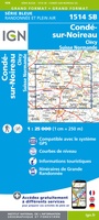 Topografische kaart - Wandelkaart 1514 SB - Serie Bleue Condé-sur-Noireau | IGN - Institut Géographique National★★★★★
 Wandelkaart - Topografische kaart 1515 SB - Serie Bleue Flers | IGN - Institut Géographique National
 Wandelkaart - Topografische kaart 1516 SB - Serie Bleue Domfront | IGN - Institut Géographique National
 Wandelkaart - Topografische kaart 1517 SB - Serie Bleue Mayenne - Le Horps | IGN - Institut Géographique National★★★★★
Laatste reviews

Heel blij mee! Super handzaam, lichtgewicht boekje om mee te nemen op de camino. Alles staat er overzichtelijk in wat nodig is. Deze gaat zeker …
★★★★★ door Greetje 20 april 2026 | Heeft dit artikel gekocht
Handig beknopt boekje met duidelijke kaartjes. Handige tips, ook over OV, musea e.d. Het formaat is passend binnen iedere rugak. Wel in het Engels, maar …
★★★★★ door Frits 20 april 2026 | Heeft dit artikel gekocht
Ik heb een wandelgids besteld bij De Zwerver. Deze lag al heel snel in de brievenbus. Het boekje werd puntgaaf geleverd.
★★★★★ door Arie Verhoef 20 april 2026 | Heeft dit artikel gekocht
Gedetailleerd, maar minder overzichtelijk in dichter bevolkt gebied
★★★★★ door Janine 19 april 2026 | Heeft dit artikel gekocht