Winkelwagen
Geen items in winkelwagen
Ga naar winkelwagen
Topografische kaarten - Frankrijk
De kaarten van IGN (kort voor Institute Geographique National), wandelkaarten voor Frankrijk, zijn van een ongekend hoog niveau. Met name de wandelkaarten 1:25.000 vinden wij geweldig: werkelijk alles staat erop, de kaarten bevatten zeer veel details en het kleurgebruik is fantastisch, waardoor alles ook nog eens heel goed leesbaar. Je hoort het: wij zijn fan van deze kaarten!
 Wandelkaart - Topografische kaart 1441 SB - Serie Bleue Morcenx | IGN - Institut Géographique National
 Wandelkaart - Topografische kaart 1442 SB - Serie Bleue Tartas, Pontonx-sur-l'Adour | IGN - Institut Géographique National
 Wandelkaart - Topografische kaart 1443 SB - Serie Bleue Dax | IGN - Institut Géographique National
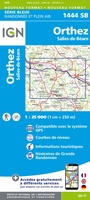 Wandelkaart - Topografische kaart 1444 SB - Serie Bleue Orthez | IGN - Institut Géographique National
 Wandelkaart - Topografische kaart 1445 SB - Serie Bleue Mauléon-Licharre – St-Palais | IGN - Institut Géographique National
 Wandelkaart - Topografische kaart 1446ET Tardets-Sorholus, Arette | IGN - Institut Géographique National★★★★★
 Topografische kaart 146 MT50 Monte Perdido | CNIG - Instituto Geográfico Nacional1
 Wandelkaart - Topografische kaart 0714OT Perros-Guirec, Lannion, Trégastel-Plage, Trébeurden, Côte de Granit Rose | IGN - Institut Géographique National★★★★★
 Wandelkaart - Topografische kaart 0720ET Lorient - Ile de Groix | IGN - Institut Géographique National
 Topografische kaart - Wandelkaart 0814OT Paimpol | IGN - Institut Géographique National★★★★★★★★★★
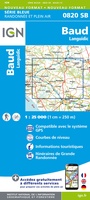 Wandelkaart - Topografische kaart 0820 SB - Serie Bleue Baud - Languidic | IGN - Institut Géographique National
 Wandelkaart - Topografische kaart 0821OT Presqu'Ile de Quiberon - Auray - Carnac Bretagne | IGN - Institut Géographique National
 Wandelkaart - Topografische kaart 0822OT Belle-Ile - Ile d'Houat et d'Hoëdic Bretagne | IGN - Institut Géographique National★★★★★
 Wandelkaart - Topografische kaart 0916ET Erquy - le Val-André | IGN - Institut Géographique National
 Wandelkaart - Topografische kaart 0916OT Saint-Brieuc | IGN - Institut Géographique National★★★★★
 Wandelkaart - Topografische kaart 0921OT Vannes | IGN - Institut Géographique National★★★★★
 Wandelkaart - Topografische kaart 0317OT Île d'Ouessant, Le Conquet | IGN - Institut Géographique National
 Wandelkaart - Topografische kaart 0416ET Plouguerneau, Les Abers, Plabennec, Ploudalmezeau | IGN - Institut Géographique National
 Wandelkaart - Topografische kaart 0417ET Brest, Pointe de St.Mathieu, St.-Renan, Le Conquet, Guipavas | IGN - Institut Géographique National
 Wandelkaart - Topografische kaart 0418ET Camaret, Presqu'Île de Crozon, Morgat | IGN - Institut Géographique National★★★★★
Laatste reviews

Super!
Super, en snel verzonden !
★★★★★ door Miriam 23 juni 2026 | Heeft dit artikel gekocht
Kwaliteit zoals verwacht
Eens met de beschrijving van het product. De schaal van 1:150.000 vind ik zeer prettig als automobilist. Als fietser zou ik een kleinere schaal prefereren. …
★★★★★ door Joop van Meer 23 juni 2026 | Heeft dit artikel gekocht
Super handig om mijn stad te verkennen
Super handig om mijn stad te verkennen met al zijn opbrekingen erop!
★★★★★ door Yolande Selter 23 juni 2026 | Heeft dit artikel gekocht
Prima kaart van baltische landen
Prima kaart van Baltische landen gekocht. Erg jammer dat de winkel dicht is!
★★★★★ door Henk 21 juni 2026 | Heeft dit artikel gekocht