Topografische kaarten - Frankrijk
De kaarten van IGN (kort voor Institute Geographique National), wandelkaarten voor Frankrijk, zijn van een ongekend hoog niveau. Met name de wandelkaarten 1:25.000 vinden wij geweldig: werkelijk alles staat erop, de kaarten bevatten zeer veel details en het kleurgebruik is fantastisch, waardoor alles ook nog eens heel goed leesbaar. Je hoort het: wij zijn fan van deze kaarten!
 Topografische kaart - Wandelkaart 1322 SB - Serie Bleue Ancenis | IGN - Institut Géographique National
 Topografische kaart - Wandelkaart 1323 SB - Serie Bleue Vallet | IGN - Institut Géographique National
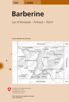 Wandelkaart - Topografische kaart 1324 Barberine | Swisstopo
 Wandelkaart - Topografische kaart 1324 SB - Serie Bleue Clisson | IGN - Institut Géographique National
 Wandelkaart - Topografische kaart 1325 SB - Serie Bleue Montaigu | IGN - Institut Géographique National
 Wandelkaart - Topografische kaart 1326 SB - Serie Bleue La Roche-sur-Yon | IGN - Institut Géographique National
 Wandelkaart - Topografische kaart 1327 SB - Serie Bleue Luçon | IGN - Institut Géographique National
 Wandelkaart - Topografische kaart 1329ET La Rochelle - Anse de l'Aiguillon | IGN - Institut Géographique National
 Wandelkaart - Topografische kaart 1329OT Ile De Re | IGN - Institut Géographique National
 Wandelkaart - Topografische kaart 1330OT Ile d'Oleron & Ile d'Aix | IGN - Institut Géographique National
 Wandelkaart - Topografische kaart 1336ET Lac de Lacanau & Le Porge | IGN - Institut Géographique National
 Wandelkaart - Topografische kaart 1337ET Bassin D'Arcachon | IGN - Institut Géographique National★★★★★
 Wandelkaart - Topografische kaart 1339ET Biscarrosse | IGN - Institut Géographique National
 Wandelkaart - Topografische kaart 1342 SB - Serie Bleue Dax | IGN - Institut Géographique National
 Wandelkaart - Topografische kaart 1343E SB - Serie Bleue Saint-Geours-de-Maremne | IGN - Institut Géographique National
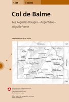 Wandelkaart - Topografische kaart 1344 Col de Balme | Swisstopo
 Wandelkaart - Topografische kaart 1344 SB - Serie Bleue Peyrehorade | IGN - Institut Géographique National
 Wandelkaart - Topografische kaart 1344OT Bayonne | IGN - Institut Géographique National
 Wandelkaart - Topografische kaart 1345OT Cambo-les-Bains – Hasparren | IGN - Institut Géographique National
 Topografische kaart - Wandelkaart 1346ET Forêt d'Iraty - Pic d'Orly | IGN - Institut Géographique National
Laatste reviews

Rother wandelgidsen stellen nooit teleur. Mooie routes, goede opgave kilometers, hoogtemeters en horeca. Een aanrader!
★★★★★ door Anita Geel 13 januari 2026 | Heeft dit artikel gekocht
Mooi boek met prachtige foto’s! Voldoet helemaal aan mijn verwachtingen.
★★★★★ door Hans Eldering 13 januari 2026 | Heeft dit artikel gekocht
het product voldeed aan mijn verwachtingen en was geplastificeerd wat natuurlijk perfect is voor kaart die veel wordt geraadpleegd!
★★★★★ door Peter Lantinga 13 januari 2026 | Heeft dit artikel gekocht
Ik heb de wegenkaart Maleisië aangeschaft om zelf een rondreis per huurauto te kunnen plannen. Deze kaart heeft daar heel goed bij geholpen doordat er …
★★★★★ door M. Rizvi 13 januari 2026 | Heeft dit artikel gekocht