Topografische kaarten - Frankrijk
De kaarten van IGN (kort voor Institute Geographique National), wandelkaarten voor Frankrijk, zijn van een ongekend hoog niveau. Met name de wandelkaarten 1:25.000 vinden wij geweldig: werkelijk alles staat erop, de kaarten bevatten zeer veel details en het kleurgebruik is fantastisch, waardoor alles ook nog eens heel goed leesbaar. Je hoort het: wij zijn fan van deze kaarten!
 Topografische kaart - Wandelkaart 2020 Oucques - Selommes - St-Ouen | IGN - Institut Géographique National
 Wandelkaart - Topografische kaart 2022 SB - Serie Bleue Montrichard, Contres | IGN - Institut Géographique National
 Wandelkaart - Topografische kaart 2023 SB - Serie Bleue Montrichard, St-Aignan | IGN - Institut Géographique National
 Wandelkaart - Topografische kaart 2024 SB - Serie Bleue Chatillon-sur-Indre, Ecueille | IGN - Institut Géographique National
 Wandelkaart - Topografische kaart 2025 SB - Serie Bleue Buzançais, Mézières-en-Brenne | IGN - Institut Géographique National
 Wandelkaart - Topografische kaart 2026 SB - Serie Bleue St-Gaultier, Rosney | IGN - Institut Géographique National
 Wandelkaart - Topografische kaart 2028 SB - Serie Bleue Saint-Sulpice-les-Feuilles | IGN - Institut Géographique National
 Wandelkaart - Topografische kaart 2029 SB - Serie Bleue Bessines-sur-Gartempe | IGN - Institut Géographique National
 Wandelkaart - Topografische kaart 2030 SB - Serie Bleue Ambazac | IGN - Institut Géographique National
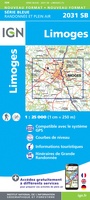 Wandelkaart - Topografische kaart 2031 SB - Serie Bleue Limoges | IGN - Institut Géographique National
 Wandelkaart - Topografische kaart 2032 SB - Serie Bleue Nexon | IGN - Institut Géographique National
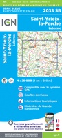 Wandelkaart - Topografische kaart 2033 SB - Serie Bleue Saint-Yrieix-La Perche-Lubersac | IGN - Institut Géographique National
 Wandelkaart - Topografische kaart 2034 SB - Serie Bleue Objat - Hautefort | IGN - Institut Géographique National★★★★★
 Wandelkaart - Topografische kaart 2035 SB - Serie Bleue Terrasson-Lavilledieu, Montignac, Grotte de Lascaux | IGN - Institut Géographique National★★★★★
 Wandelkaart - Topografische kaart 2036ET Sarlat-la-Caneda, Souillac | IGN - Institut Géographique National★★★★★
 Wandelkaart - Topografische kaart 2037OT Roque-Gageac, Domme | IGN - Institut Géographique National★★★★★
 Wandelkaart - Topografische kaart 2038 SB - Serie Bleue Puy l'Evêque, Luzech | IGN - Institut Géographique National
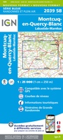 Wandelkaart - Topografische kaart 2039 SB - Serie Bleue Montcuq-en-Quercy-Blanc, Labastide-Marnhac | IGN - Institut Géographique National
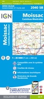 Wandelkaart - Topografische kaart 2040 SB - Serie Bleue Moissac | IGN - Institut Géographique National
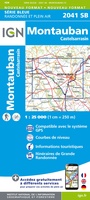 Wandelkaart - Topografische kaart 2041 SB - Serie Bleue Montauban (Tarn-et-Garonne) - Castelsarrasin | IGN - Institut Géographique National
Laatste reviews

De wandelingen worden uitgebreid beschreven. Soms mis je onderweg een pad omdat wegbewijzering ontbreekt waar je hem zou verwachten. Dan loop je maar weer terug …
★★★★★ door Elisabeth Hoeke 16 april 2026 | Heeft dit artikel gekocht
Ik gebruik deze kaart omdat ik een reis wil volgen van meerdere personen. Heb er veel plezier van.
★★★★★ door Loes Vechtmann 15 april 2026 | Heeft dit artikel gekocht
Dit boek heeft me veel inzicht gegeven hoe om te gaan met jezelf in de wildernis. Een fijn, kwetsbaar en oprecht geschreven boek met veel …
★★★★★ door Arnold Jippes 15 april 2026 | Heeft dit artikel gekocht
The DK Eyewitness travel guide for Florence & Tuscany is an excellent guide with lots of details, including helpful photographs maps and diagrams of the …
★★★★★ door Andrew Wedgner 15 april 2026 | Heeft dit artikel gekocht