Topografische kaarten - Frankrijk
De kaarten van IGN (kort voor Institute Geographique National), wandelkaarten voor Frankrijk, zijn van een ongekend hoog niveau. Met name de wandelkaarten 1:25.000 vinden wij geweldig: werkelijk alles staat erop, de kaarten bevatten zeer veel details en het kleurgebruik is fantastisch, waardoor alles ook nog eens heel goed leesbaar. Je hoort het: wij zijn fan van deze kaarten!
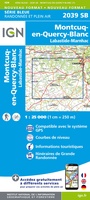 Wandelkaart - Topografische kaart 2039 SB - Serie Bleue Montcuq-en-Quercy-Blanc, Labastide-Marnhac | IGN - Institut Géographique National
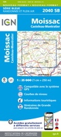 Wandelkaart - Topografische kaart 2040 SB - Serie Bleue Moissac | IGN - Institut Géographique National
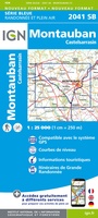 Wandelkaart - Topografische kaart 2041 SB - Serie Bleue Montauban (Tarn-et-Garonne) - Castelsarrasin | IGN - Institut Géographique National
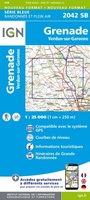 Wandelkaart - Topografische kaart 2042SB SB - Serie Bleue Grenade | IGN - Institut Géographique National
 Wandelkaart - Topografische kaart 2043ET Toulouse | IGN - Institut Géographique National
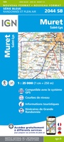 Wandelkaart - Topografische kaart 2044 SB - Serie Bleue Muret, Saint Lys | IGN - Institut Géographique National
 Wandelkaart - Topografische kaart 2045 SB - Serie Bleue Lézat-sur-Lèze, Cazeres | IGN - Institut Géographique National
 Wandelkaart - Topografische kaart 2047ET Massat - Pic des Trois Seigneurs - PNR Pyr. Ariégeoises | IGN - Institut Géographique National
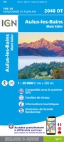 Wandelkaart - Topografische kaart 2048OT Aulus-les-Bains, Mont Valier | IGN - Institut Géographique National
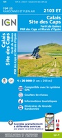 Wandelkaart - Topografische kaart 2103ET Calais | IGN - Institut Géographique National★★★★★
 Wandelkaart - Topografische kaart 2104ET Boulogne-Sur-Mer | IGN - Institut Géographique National★★★★★
 Wandelkaart - Topografische kaart 2106ET Baie de Somme, Le Crotoy, Fort-Mahon-Plage | IGN - Institut Géographique National★★★★★
 Wandelkaart - Topografische kaart 2107OT Le Tréport | IGN - Institut Géographique National★★★★★
 Wandelkaart - Topografische kaart 2108OT Foret d'Eu, Blangy-sur-Bresle, Gamaches | IGN - Institut Géographique National
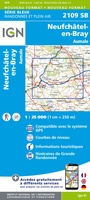 Wandelkaart - Topografische kaart 2109 SB - Serie Bleue Aumale, Neufchâtel-en-Bray | IGN - Institut Géographique National
 Wandelkaart - Topografische kaart 2110 SB - Serie Bleue Formerie, Forges-les-Eaux | IGN - Institut Géographique National
 Wandelkaart - Topografische kaart 2112 SB - Serie Bleue Gisors - Etrépagny | IGN - Institut Géographique National
 Wandelkaart - Topografische kaart 2114 SB - Serie Bleue Houdan - Aubergenville | IGN - Institut Géographique National
 Wandelkaart - Topografische kaart 2115 SB - Serie Bleue Epernon | IGN - Institut Géographique National
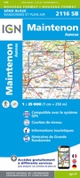 Wandelkaart - Topografische kaart 2116 SB - Serie Bleue Maintenon | IGN - Institut Géographique National
Laatste reviews

Rother wandelgidsen stellen nooit teleur. Mooie routes, goede opgave kilometers, hoogtemeters en horeca. Een aanrader!
★★★★★ door Anita Geel 13 januari 2026 | Heeft dit artikel gekocht
Mooi boek met prachtige foto’s! Voldoet helemaal aan mijn verwachtingen.
★★★★★ door Hans Eldering 13 januari 2026 | Heeft dit artikel gekocht
het product voldeed aan mijn verwachtingen en was geplastificeerd wat natuurlijk perfect is voor kaart die veel wordt geraadpleegd!
★★★★★ door Peter Lantinga 13 januari 2026 | Heeft dit artikel gekocht
Ik heb de wegenkaart Maleisië aangeschaft om zelf een rondreis per huurauto te kunnen plannen. Deze kaart heeft daar heel goed bij geholpen doordat er …
★★★★★ door M. Rizvi 13 januari 2026 | Heeft dit artikel gekocht