Topografische kaarten - Frankrijk
De kaarten van IGN (kort voor Institute Geographique National), wandelkaarten voor Frankrijk, zijn van een ongekend hoog niveau. Met name de wandelkaarten 1:25.000 vinden wij geweldig: werkelijk alles staat erop, de kaarten bevatten zeer veel details en het kleurgebruik is fantastisch, waardoor alles ook nog eens heel goed leesbaar. Je hoort het: wij zijn fan van deze kaarten!
 Topografische kaart - Wandelkaart 2019 SB - Serie Bleue Cloyes-sur-le-Loir | IGN - Institut Géographique National
 Topografische kaart - Wandelkaart 2020 Oucques - Selommes - St-Ouen | IGN - Institut Géographique National
 Wandelkaart - Topografische kaart 2022 SB - Serie Bleue Montrichard, Contres | IGN - Institut Géographique National
 Wandelkaart - Topografische kaart 2023 SB - Serie Bleue Montrichard, St-Aignan | IGN - Institut Géographique National
 Wandelkaart - Topografische kaart 2024 SB - Serie Bleue Chatillon-sur-Indre, Ecueille | IGN - Institut Géographique National
 Wandelkaart - Topografische kaart 2025 SB - Serie Bleue Buzançais, Mézières-en-Brenne | IGN - Institut Géographique National
 Wandelkaart - Topografische kaart 2026 SB - Serie Bleue St-Gaultier, Rosney | IGN - Institut Géographique National
 Wandelkaart - Topografische kaart 2028 SB - Serie Bleue Saint-Sulpice-les-Feuilles | IGN - Institut Géographique National
 Wandelkaart - Topografische kaart 2029 SB - Serie Bleue Bessines-sur-Gartempe | IGN - Institut Géographique National
 Wandelkaart - Topografische kaart 2030 SB - Serie Bleue Ambazac | IGN - Institut Géographique National
 Wandelkaart - Topografische kaart 2031 SB - Serie Bleue Limoges | IGN - Institut Géographique National
 Wandelkaart - Topografische kaart 2032 SB - Serie Bleue Nexon | IGN - Institut Géographique National
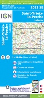 Wandelkaart - Topografische kaart 2033 SB - Serie Bleue Saint-Yrieix-La Perche-Lubersac | IGN - Institut Géographique National
 Wandelkaart - Topografische kaart 2034 SB - Serie Bleue Objat - Hautefort | IGN - Institut Géographique National★★★★★
 Wandelkaart - Topografische kaart 2035 SB - Serie Bleue Terrasson-Lavilledieu, Montignac, Grotte de Lascaux | IGN - Institut Géographique National★★★★★
 Wandelkaart - Topografische kaart 2036ET Sarlat-la-Caneda, Souillac | IGN - Institut Géographique National★★★★★
 Wandelkaart - Topografische kaart 2037OT Roque-Gageac, Domme | IGN - Institut Géographique National★★★★★
 Wandelkaart - Topografische kaart 2038 SB - Serie Bleue Puy l'Evêque, Luzech | IGN - Institut Géographique National
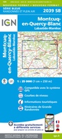 Wandelkaart - Topografische kaart 2039 SB - Serie Bleue Montcuq-en-Quercy-Blanc, Labastide-Marnhac | IGN - Institut Géographique National
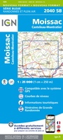 Wandelkaart - Topografische kaart 2040 SB - Serie Bleue Moissac | IGN - Institut Géographique National
Laatste reviews

Rother wandelgidsen stellen nooit teleur. Mooie routes, goede opgave kilometers, hoogtemeters en horeca. Een aanrader!
★★★★★ door Anita Geel 13 januari 2026 | Heeft dit artikel gekocht
Mooi boek met prachtige foto’s! Voldoet helemaal aan mijn verwachtingen.
★★★★★ door Hans Eldering 13 januari 2026 | Heeft dit artikel gekocht
het product voldeed aan mijn verwachtingen en was geplastificeerd wat natuurlijk perfect is voor kaart die veel wordt geraadpleegd!
★★★★★ door Peter Lantinga 13 januari 2026 | Heeft dit artikel gekocht
Ik heb de wegenkaart Maleisië aangeschaft om zelf een rondreis per huurauto te kunnen plannen. Deze kaart heeft daar heel goed bij geholpen doordat er …
★★★★★ door M. Rizvi 13 januari 2026 | Heeft dit artikel gekocht