Topografische kaarten - Frankrijk
De kaarten van IGN (kort voor Institute Geographique National), wandelkaarten voor Frankrijk, zijn van een ongekend hoog niveau. Met name de wandelkaarten 1:25.000 vinden wij geweldig: werkelijk alles staat erop, de kaarten bevatten zeer veel details en het kleurgebruik is fantastisch, waardoor alles ook nog eens heel goed leesbaar. Je hoort het: wij zijn fan van deze kaarten!
 Topografische kaart - Wandelkaart 2523 SB - Serie Bleue La Charité-sur-Loire | IGN - Institut Géographique National
 Wandelkaart - Topografische kaart 2524 SB - Serie Bleue Nevers, Jouet-sur-l'Aubois | IGN - Institut Géographique National
 Wandelkaart - Topografische kaart 2525 SB - Serie Bleue La Guerche-sur-l'Aubois, Sancoins, Magny-Cours | IGN - Institut Géographique National
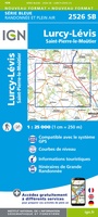 Topografische kaart - Wandelkaart 2526 SB - Serie Bleue Lurcy-Lévis | IGN - Institut Géographique National
 Wandelkaart - Topografische kaart 2528 SB - Serie Bleue Tronget - Montmarault | IGN - Institut Géographique National
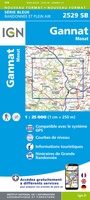 Wandelkaart - Topografische kaart 2529 SB - Serie Bleue Gannat | IGN - Institut Géographique National
 Wandelkaart - Topografische kaart 2531 SB - Serie Bleue Clermont-Ferrand | IGN - Institut Géographique National
 Wandelkaart - Topografische kaart 2531ET Chaîne des Puys | IGN - Institut Géographique National
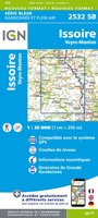 Wandelkaart - Topografische kaart 2532 SB - Serie Bleue Veyre-Monton, Issoire | IGN - Institut Géographique National
 Wandelkaart - Topografische kaart 2534 SB - Serie Bleue Massiac - Ardes | IGN - Institut Géographique National
 Wandelkaart - Topografische kaart 2535 SB - Serie Bleue St-Flour, Murat | IGN - Institut Géographique National
 Wandelkaart - Topografische kaart 2536 SB - Serie Bleue Chaudes-Aigues, Gorges de la Truyère, Faverolles | IGN - Institut Géographique National
 Wandelkaart - Topografische kaart 2539 SB - Serie Bleue Sévérac-le-Château, Lapanouse | IGN - Institut Géographique National
 Wandelkaart - Topografische kaart 2542OT Camarès - Avène | IGN - Institut Géographique National
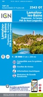 Wandelkaart - Topografische kaart 2543OT Lamalou-les-Bains, Olargues, Roquebrun, Le Caroux, PNR du Haut Languedoc | IGN - Institut Géographique National★★★★★
 Wandelkaart - Topografische kaart 2545OT St-Chinian - L'etang de Montady | IGN - Institut Géographique National
 Wandelkaart - Topografische kaart 2546OT Narbonne | IGN - Institut Géographique National
 Wandelkaart - Topografische kaart 2549OT Banyuls-sur-Mer | IGN - Institut Géographique National
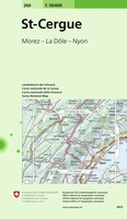 Wandelkaart - Topografische kaart 260 St-Cerque | Swisstopo
 Wandelkaart - Topografische kaart 2605 SB - Serie Bleue Condé-sur-l'Escaut, St-Amand-les-Eaux | IGN - Institut Géographique National
Laatste reviews

Een compact boekje met 6 kaartjes van de voor een toerist belangrijkste Londense buurten met veel details en een overzicht van de metrolijnen. Super handig …
★★★★★ door Corine van der Hoeven 12 januari 2026 | Heeft dit artikel gekocht
Erg blij met het boek onbegrensd fietsen naar Andalusië. We zijn ons nu aan het inlezen en krijgen enorm veel zin om te gaan. Er …
★★★★★ door Monique 12 januari 2026 | Heeft dit artikel gekocht
Heel blij met dit wandelgidsje. Mooie kaartjes, per etappe, ook restaurants en overnachting. Ideaal vooraf om te plannen en onderweg. Mooi compact!
★★★★★ door Peter 12 januari 2026 | Heeft dit artikel gekocht
Gewoon handig boekje voor de info en planning. Route is heel goed gemarkeerd.
★★★★★ door Pieter 12 januari 2026 | Heeft dit artikel gekocht