Topografische kaarten - Frankrijk
De kaarten van IGN (kort voor Institute Geographique National), wandelkaarten voor Frankrijk, zijn van een ongekend hoog niveau. Met name de wandelkaarten 1:25.000 vinden wij geweldig: werkelijk alles staat erop, de kaarten bevatten zeer veel details en het kleurgebruik is fantastisch, waardoor alles ook nog eens heel goed leesbaar. Je hoort het: wij zijn fan van deze kaarten!
 Wandelkaart - Topografische kaart 2513OT Meaux - Vallée de l'Ourcq, Centre | IGN - Institut Géographique National
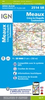 Wandelkaart - Topografische kaart 2514 SB - Serie Bleue Meaux | IGN - Institut Géographique National
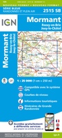 Wandelkaart - Topografische kaart 2515 SB - Serie Bleue Mormant, Rozay-en-Brie, Jouy-le-Châtel | IGN - Institut Géographique National
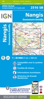 Wandelkaart - Topografische kaart 2516 SB - Serie Bleue Donnemarie-Dontilly, Nangis | IGN - Institut Géographique National
 Wandelkaart - Topografische kaart 2517 SB - Serie Bleue Montereau-Fault-Yonne, Moret-Loing-et-Orvanne | IGN - Institut Géographique National
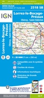 Wandelkaart - Topografische kaart 2518 SB - Serie Bleue Lorrez-le-Bocage-Préaux, Chéroy, St-Valérien | IGN - Institut Géographique National
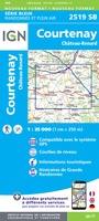 Wandelkaart - Topografische kaart 2519 SB - Serie Bleue Courtenay, Château-Renard | IGN - Institut Géographique National
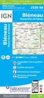 Wandelkaart - Topografische kaart 2520 SB - Serie Bleue Champignelles, Bléneau, Charny Orée de Puisaye | IGN - Institut Géographique National
 Wandelkaart - Topografische kaart 2521 SB - Serie Bleue St-Fargeau, Neuvy-sur-Loire | IGN - Institut Géographique National★★★★★
 Wandelkaart 2522SB Cosne-Cours-sur-Loire - Donzy | IGN★★★★★
 Topografische kaart - Wandelkaart 2523 SB - Serie Bleue La Charité-sur-Loire | IGN - Institut Géographique National
 Wandelkaart - Topografische kaart 2524 SB - Serie Bleue Nevers, Jouet-sur-l'Aubois | IGN - Institut Géographique National
 Wandelkaart - Topografische kaart 2525 SB - Serie Bleue La Guerche-sur-l'Aubois, Sancoins, Magny-Cours | IGN - Institut Géographique National
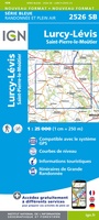 Topografische kaart - Wandelkaart 2526 SB - Serie Bleue Lurcy-Lévis | IGN - Institut Géographique National
 Wandelkaart - Topografische kaart 2528 SB - Serie Bleue Tronget - Montmarault | IGN - Institut Géographique National
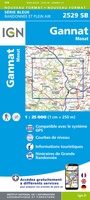 Wandelkaart - Topografische kaart 2529 SB - Serie Bleue Gannat | IGN - Institut Géographique National
 Wandelkaart - Topografische kaart 2531 SB - Serie Bleue Clermont-Ferrand | IGN - Institut Géographique National
 Wandelkaart - Topografische kaart 2531ET Chaîne des Puys | IGN - Institut Géographique National
 Wandelkaart - Topografische kaart 2532 SB - Serie Bleue Veyre-Monton, Issoire | IGN - Institut Géographique National
 Wandelkaart - Topografische kaart 2534 SB - Serie Bleue Massiac - Ardes | IGN - Institut Géographique National
Laatste reviews

Rother wandelgidsen stellen nooit teleur. Mooie routes, goede opgave kilometers, hoogtemeters en horeca. Een aanrader!
★★★★★ door Anita Geel 13 januari 2026 | Heeft dit artikel gekocht
Mooi boek met prachtige foto’s! Voldoet helemaal aan mijn verwachtingen.
★★★★★ door Hans Eldering 13 januari 2026 | Heeft dit artikel gekocht
het product voldeed aan mijn verwachtingen en was geplastificeerd wat natuurlijk perfect is voor kaart die veel wordt geraadpleegd!
★★★★★ door Peter Lantinga 13 januari 2026 | Heeft dit artikel gekocht
Ik heb de wegenkaart Maleisië aangeschaft om zelf een rondreis per huurauto te kunnen plannen. Deze kaart heeft daar heel goed bij geholpen doordat er …
★★★★★ door M. Rizvi 13 januari 2026 | Heeft dit artikel gekocht