Topografische kaarten - Frankrijk
De kaarten van IGN (kort voor Institute Geographique National), wandelkaarten voor Frankrijk, zijn van een ongekend hoog niveau. Met name de wandelkaarten 1:25.000 vinden wij geweldig: werkelijk alles staat erop, de kaarten bevatten zeer veel details en het kleurgebruik is fantastisch, waardoor alles ook nog eens heel goed leesbaar. Je hoort het: wij zijn fan van deze kaarten!
 Wandelkaart - Topografische kaart 3123 SB - Serie Bleue Dijon | IGN - Institut Géographique National
 Wandelkaart - Topografische kaart 3124 SB - Serie Bleue Seurre | IGN - Institut Géographique National
 Wandelkaart - Topografische kaart 3125 SB - Serie Bleue Pierre-de-Bresse, St-Martin-de-Bresse | IGN - Institut Géographique National
 Wandelkaart - Topografische kaart 3126 SB - Serie Bleue Mervans, Montret. Louhans | IGN - Institut Géographique National
 Wandelkaart - Topografische kaart 3127 SB - Serie Bleue Cuiseaux | IGN - Institut Géographique National
 Wandelkaart - Topografische kaart 3128 SB - Serie Bleue Montrevel-en-Bresse, Marboz | IGN - Institut Géographique National
 Wandelkaart - Topografische kaart 3129 SB - Serie Bleue Bourg-en-Bresse | IGN - Institut Géographique National
 Wandelkaart - Topografische kaart 3130 SB - Serie Bleue Ambérieu-en-Bugey | IGN - Institut Géographique National
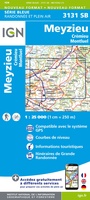 Wandelkaart - Topografische kaart 3131 SB - Serie Bleue Meyzieu | IGN - Institut Géographique National
 Wandelkaart - Topografische kaart 3132 SB - Serie Bleue Bourgoin-Jallieu - La Velpillere | IGN - Institut Géographique National
 Wandelkaart - Topografische kaart 3133 SB - Serie Bleue La Côte-St-André – St-Jean-de-Bournay | IGN - Institut Géographique National
 Topografische kaart - Wandelkaart 3135 Romans-sur-Isère, St-Marcellin | IGN - Institut Géographique National
 Wandelkaart - Topografische kaart 3136 SB - Serie Bleue Bourg-de-Péage – Chabeuil | IGN - Institut Géographique National
 Wandelkaart - Topografische kaart 3136ET Combe Laval | IGN - Institut Géographique National★★★★★
 Wandelkaart - Topografische kaart 3137OT Die – Crest – Saillans | IGN - Institut Géographique National★★★★★
 Wandelkaart - Topografische kaart 3138OT Dieulefit | IGN - Institut Géographique National★★★★★
 Wandelkaart - Topografische kaart 3139OT Nyons - Rémuzat | IGN - Institut Géographique National★★★★★
 Wandelkaart - Topografische kaart 3140ET Mont Ventoux | IGN - Institut Géographique National★★★★★★★★★★
 Wandelkaart - Topografische kaart 3142OT Cavaillon | IGN - Institut Géographique National
 Wandelkaart - Topografische kaart 3143ET Aix-en-Provence | IGN - Institut Géographique National
Laatste reviews

Een compact boekje met 6 kaartjes van de voor een toerist belangrijkste Londense buurten met veel details en een overzicht van de metrolijnen. Super handig …
★★★★★ door Corine van der Hoeven 12 januari 2026 | Heeft dit artikel gekocht
Erg blij met het boek onbegrensd fietsen naar Andalusië. We zijn ons nu aan het inlezen en krijgen enorm veel zin om te gaan. Er …
★★★★★ door Monique 12 januari 2026 | Heeft dit artikel gekocht
Heel blij met dit wandelgidsje. Mooie kaartjes, per etappe, ook restaurants en overnachting. Ideaal vooraf om te plannen en onderweg. Mooi compact!
★★★★★ door Peter 12 januari 2026 | Heeft dit artikel gekocht
Gewoon handig boekje voor de info en planning. Route is heel goed gemarkeerd.
★★★★★ door Pieter 12 januari 2026 | Heeft dit artikel gekocht