Topografische kaarten - Frankrijk
De kaarten van IGN (kort voor Institute Geographique National), wandelkaarten voor Frankrijk, zijn van een ongekend hoog niveau. Met name de wandelkaarten 1:25.000 vinden wij geweldig: werkelijk alles staat erop, de kaarten bevatten zeer veel details en het kleurgebruik is fantastisch, waardoor alles ook nog eens heel goed leesbaar. Je hoort het: wij zijn fan van deze kaarten!
 Wandelkaart - Topografische kaart 3235OT Autrans | IGN - Institut Géographique National★★★★★
 Wandelkaart - Topografische kaart 3237OT Glandasse | IGN - Institut Géographique National
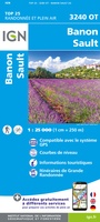 Wandelkaart - Topografische kaart 3240OT Banon - Sault | IGN - Institut Géographique National★★★★★
 Wandelkaart - Topografische kaart 3242OT Apt | IGN - Institut Géographique National
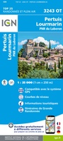 Wandelkaart - Topografische kaart 3243OT Pertuis - Lourmarin | IGN - Institut Géographique National★★★★★
 Wandelkaart - Topografische kaart 3244ET Montagne - Sainte-Victoire | IGN - Institut Géographique National★★★★★
 Topografische kaart - Wandelkaart 3245ET Aubagne - La Ciotat | IGN - Institut Géographique National★★★★★
 Wandelkaart - Topografische kaart 2225 SB - Serie Bleue Issoudun, Neuvy-Paillouxt | IGN - Institut Géographique National
 Wandelkaart - Topografische kaart 2226 SB - Serie Bleue Ardentes - La Berthenoux | IGN - Institut Géographique National
 Wandelkaart - Topografische kaart 2227 SB - Serie Bleue La Châtre, Neuvy-St-Sépulchre | IGN - Institut Géographique National★★★★★
 Wandelkaart - Topografische kaart 2228 SB - Serie Bleue Châtelus-Malvaleix, Aigurande | IGN - Institut Géographique National
 Wandelkaart - Topografische kaart 2229 SB - Serie Bleue Ahun - Gueret | IGN - Institut Géographique National
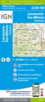 Wandelkaart - Topografische kaart 2230 SB - Serie Bleue Lavaveix-les-Mines, Pontarion | IGN - Institut Géographique National
 Wandelkaart - Topografische kaart 2231 SB - Serie Bleue Gentioux-Pigerolles, Royère-de-Vassivière | IGN - Institut Géographique National
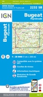 Wandelkaart - Topografische kaart 2232 SB - Serie Bleue Bugeat - Peyrelevade | IGN - Institut Géographique National
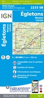 Wandelkaart - Topografische kaart 2233 SB - Serie Bleue Egletons - Meymac - Corrèze | IGN - Institut Géographique National
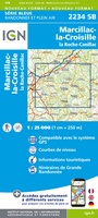 Wandelkaart - Topografische kaart 2234 SB - Serie Bleue Marcillac-la-Croisille, La Roche-Canillac | IGN - Institut Géographique National
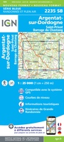 Wandelkaart - Topografische kaart 2235 SB - Serie Bleue Argentat-sur-Dordogne | IGN - Institut Géographique National★★★★★
 Wandelkaart - Topografische kaart 2236 SB - Serie Bleue Saint-Céré, Sousceyrac-en-Quercy | IGN - Institut Géographique National★★★★★
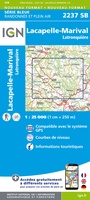 Wandelkaart - Topografische kaart 2237 SB - Serie Bleue Latronquière, Lacapelle-Marival | IGN - Institut Géographique National
Laatste reviews

Bevat de gehele Picos de Europa. Goed in detail. Alle routes GR en PR-PNPE. Refugres en nog veel meer. Schaal 1 op 25.000 is fijn …
★★★★★ door M H 03 april 2026 | Heeft dit artikel gekocht
De bestelling snel en netjes afgehandeld
★★★★★ door Tiny Waltmans 03 april 2026 | Heeft dit artikel gekocht
Ik ben dol op de veldkaarten over verschillende vogelsoorten, per land of werelddelen. Deze keer de kaart besteld over vogelsoorten in Afrika en tijdens mijn …
★★★★★ door Kelly Bosch 02 april 2026 | Heeft dit artikel gekocht
Precies wat ik zocht. De informatie op de website was duidelijk en klopte. Het was eerst niet leverbaar, maar ik had aangegeven dat ik bericht …
★★★★★ door Mieke van den Broek 01 april 2026 | Heeft dit artikel gekocht