Topografische kaarten - Frankrijk
De kaarten van IGN (kort voor Institute Geographique National), wandelkaarten voor Frankrijk, zijn van een ongekend hoog niveau. Met name de wandelkaarten 1:25.000 vinden wij geweldig: werkelijk alles staat erop, de kaarten bevatten zeer veel details en het kleurgebruik is fantastisch, waardoor alles ook nog eens heel goed leesbaar. Je hoort het: wij zijn fan van deze kaarten!
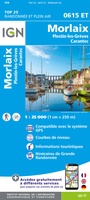 Wandelkaart - Topografische kaart 0615ET Morlaix, Lanmeur, Plougasnou, Taule, Plestin-les-Greves | IGN - Institut Géographique National★★★★★
 Wandelkaart - Topografische kaart 0620ET Quimperlé, Pont-Aven, Tregunc, Bannalec, Clohars-Carnoët | IGN - Institut Géographique National★★★★★
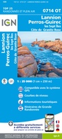 Wandelkaart - Topografische kaart 0714OT Perros-Guirec, Lannion, Trégastel-Plage, Trébeurden, Côte de Granit Rose | IGN - Institut Géographique National★★★★★
 Wandelkaart - Topografische kaart 0720ET Lorient - Ile de Groix | IGN - Institut Géographique National
 Topografische kaart - Wandelkaart 0814OT Paimpol | IGN - Institut Géographique National★★★★★★★★★★
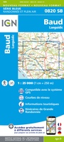 Wandelkaart - Topografische kaart 0820 SB - Serie Bleue Baud - Languidic | IGN - Institut Géographique National
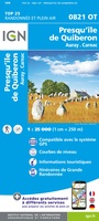 Wandelkaart - Topografische kaart 0821OT Presqu'Ile de Quiberon - Auray - Carnac Bretagne | IGN - Institut Géographique National
 Wandelkaart - Topografische kaart 0822OT Belle-Ile - Ile d'Houat et d'Hoëdic Bretagne | IGN - Institut Géographique National★★★★★
 Wandelkaart - Topografische kaart 0916ET Erquy - le Val-André | IGN - Institut Géographique National
 Wandelkaart - Topografische kaart 0916OT Saint-Brieuc | IGN - Institut Géographique National★★★★★
 Fietskaart - Topografische kaart - Wegenkaart - landkaart 30 Besançon | Swisstopo
 Topografische kaart - Wandelkaart 3008 SB - Serie Bleue Fumay | IGN - Institut Géographique National★★★★★
 Wandelkaart - Topografische kaart 3010 SB - Serie Bleue le Chesne | IGN - Institut Géographique National
 Wandelkaart - Topografische kaart 3011 SB - Serie Bleue Vouziers | IGN - Institut Géographique National
 Topografische kaart - Wandelkaart 3012 SB - Serie Bleue Varennes-en-Argonne | IGN - Institut Géographique National
 Wandelkaart - Topografische kaart 3013 SB - Serie Bleue Ste-Menehould | IGN - Institut Géographique National
 Wandelkaart - Topografische kaart 3014 SB - Serie Bleue Revigny-sur-Ornain | IGN - Institut Géographique National
 Wandelkaart - Topografische kaart 3015 SB - Serie Bleue Saint-Dizier, Pargny-sur-Saulx | IGN - Institut Géographique National
 Wandelkaart - Topografische kaart 3016 SB - Serie Bleue Wassy, Montier-en-Der, Lac du Der-Chantecoq | IGN - Institut Géographique National
 Wandelkaart - Topografische kaart 3017 SB - Serie Bleue Doulevant-le-Chateau, Soulaines, Dhuys | IGN - Institut Géographique National★★★★★
- 1
- 2
- 3
- Volgende >>
- 53
Laatste reviews

Rother wandelgidsen stellen nooit teleur. Mooie routes, goede opgave kilometers, hoogtemeters en horeca. Een aanrader!
★★★★★ door Anita Geel 13 januari 2026 | Heeft dit artikel gekocht
Mooi boek met prachtige foto’s! Voldoet helemaal aan mijn verwachtingen.
★★★★★ door Hans Eldering 13 januari 2026 | Heeft dit artikel gekocht
het product voldeed aan mijn verwachtingen en was geplastificeerd wat natuurlijk perfect is voor kaart die veel wordt geraadpleegd!
★★★★★ door Peter Lantinga 13 januari 2026 | Heeft dit artikel gekocht
Ik heb de wegenkaart Maleisië aangeschaft om zelf een rondreis per huurauto te kunnen plannen. Deze kaart heeft daar heel goed bij geholpen doordat er …
★★★★★ door M. Rizvi 13 januari 2026 | Heeft dit artikel gekocht