Topografische kaarten - Frankrijk
De kaarten van IGN (kort voor Institute Geographique National), wandelkaarten voor Frankrijk, zijn van een ongekend hoog niveau. Met name de wandelkaarten 1:25.000 vinden wij geweldig: werkelijk alles staat erop, de kaarten bevatten zeer veel details en het kleurgebruik is fantastisch, waardoor alles ook nog eens heel goed leesbaar. Je hoort het: wij zijn fan van deze kaarten!
 Wandelkaart - Topografische kaart 0714OT Perros-Guirec, Lannion, Trégastel-Plage, Trébeurden, Côte de Granit Rose | IGN - Institut Géographique National★★★★★
 Wandelkaart - Topografische kaart 0720ET Lorient - Ile de Groix | IGN - Institut Géographique National
 Topografische kaart - Wandelkaart 0814OT Paimpol | IGN - Institut Géographique National★★★★★★★★★★
 Wandelkaart - Topografische kaart 0820 SB - Serie Bleue Baud - Languidic | IGN - Institut Géographique National
 Wandelkaart - Topografische kaart 0821OT Presqu'Ile de Quiberon - Auray - Carnac Bretagne | IGN - Institut Géographique National
 Wandelkaart - Topografische kaart 0822OT Belle-Ile - Ile d'Houat et d'Hoëdic Bretagne | IGN - Institut Géographique National★★★★★
 Wandelkaart - Topografische kaart 0916ET Erquy - le Val-André | IGN - Institut Géographique National
 Wandelkaart - Topografische kaart 0916OT Saint-Brieuc | IGN - Institut Géographique National★★★★★
 Wandelkaart - Topografische kaart 0921OT Vannes | IGN - Institut Géographique National★★★★★
 Wandelkaart - Topografische kaart 2731 SB - Serie Bleue Noirétable | IGN - Institut Géographique National
 Wandelkaart - Topografische kaart 2732 SB - Serie Bleue Ambert | IGN - Institut Géographique National
 Wandelkaart - Topografische kaart 2733 SB - Serie Bleue St-Anthème, Arlanc | IGN - Institut Géographique National
 Wandelkaart - Topografische kaart 2734 SB - Serie Bleue Allègre, La Chaise-Dieu, Craponne-sur-Arzon | IGN - Institut Géographique National
 Wandelkaart - Topografische kaart 2735 SB - Serie Bleue Loudes, Le Puy-en-Velay | IGN - Institut Géographique National
 Wandelkaart - Topografische kaart 2736 SB - Serie Bleue Monistrol d'Allier, Solignac-sur-Loire, Cayres | IGN - Institut Géographique National
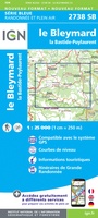 Wandelkaart - Topografische kaart 2738 SB - Serie Bleue Le Bleymard | IGN - Institut Géographique National
 Wandelkaart - Topografische kaart 2740ET Corniche des Cevennes | IGN - Institut Géographique National
 Wandelkaart - Topografische kaart 2741ET Saint-Hippolyte-du-Fort | IGN - Institut Géographique National
 Wandelkaart - Topografische kaart 2742ET St.-Martin-de-Londres, Ganges | IGN - Institut Géographique National
 Wandelkaart - Topografische kaart 2806 SB - Serie Bleue Jeumont - Maubeuge | IGN - Institut Géographique National
- 1
- 2
- 3
- Volgende >>
- 52
Laatste reviews

Precies wat ik zocht. De informatie op de website was duidelijk en klopte. Het was eerst niet leverbaar, maar ik had aangegeven dat ik bericht …
★★★★★ door Mieke van den Broek 01 april 2026 | Heeft dit artikel gekocht
Snelle levering, prima verpakt, en de atlas van Duitsland is precies wat ik had verwacht, heel erg goed.
★★★★★ door Wil Van der Vlist 01 april 2026 | Heeft dit artikel gekocht
Vlotte service en prima kaart van Slovenie
★★★★★ door Bert van Jaarsveld 31 maart 2026 | Heeft dit artikel gekocht
132 dagen GR20 in het voorjaar en alles zelf meenemen, betekent dat iedere gram telt. Deze kaart geeft een mooi overzicht van de hele route …
★★★★★ door Martin-Jan Strebe 31 maart 2026 | Heeft dit artikel gekocht