Winkelwagen
Geen items in winkelwagen
Ga naar winkelwagen
Kaarten - Aquitaine
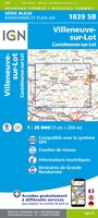 Wandelkaart - Topografische kaart 1839 SB - Serie Bleue Villeneuve sur Lot - Castelmoron sur Lot | IGN - Institut Géographique National
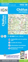 Wandelkaart - Topografische kaart 1932 SB - Serie Bleue Châlus - St-Mathieu | IGN - Institut Géographique National
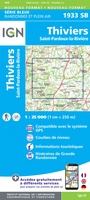 Wandelkaart - Topografische kaart 1933 SB - Serie Bleue Thiviers, St-Pardoux-la-Rivière | IGN - Institut Géographique National
 Wandelkaart - Topografische kaart 1934 SB - Serie Bleue Excideuil - Périgueux | IGN - Institut Géographique National
 Wandelkaart - Topografische kaart 1935 SB - Serie Bleue Vergt | IGN - Institut Géographique National
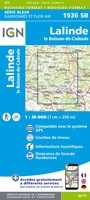 Wandelkaart - Topografische kaart 1936 SB - Serie Bleue Lalinde, le Buisson-de-Cadouin | IGN - Institut Géographique National
 Wandelkaart - Topografische kaart 1936ET Les Eyzies, St.-Cyprien, le Bugue, Beynac | IGN - Institut Géographique National★★★★★
 Wandelkaart - Topografische kaart 1937 SB - Serie Bleue Belves, Beaumont-du-Périgord | IGN - Institut Géographique National★★★★★
 Wandelkaart - Topografische kaart 1938 SB - Serie Bleue Fumel - Monflanquin | IGN - Institut Géographique National
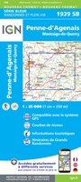 Wandelkaart - Topografische kaart 1939 SB - Serie Bleue Penne-d'Agenais | IGN - Institut Géographique National
 Wegenkaart - landkaart 11 TOP 250 Nouvelle-Aquitaine - Bassin Aquitain | IGN - Institut Géographique National
 Wegenkaart - landkaart 11613 Périgord | Michelin
 Wegenkaart - landkaart 10 TOP 250 Nouvelle-Aquitaine - Limousin - Poitou | IGN - Institut Géographique National
 Wegenkaart - landkaart 524 Aquitaine - Nouvelle-Aquitaine Sud 2026 | Michelin
 Topografische kaart 40/41 MT50 Irun | CNIG - Instituto Geográfico Nacional1
 Topografische kaart 41-III/40-IV Irun | CNIG - Instituto Geográfico Nacional
 Fietskaart Pyrénées-Atlantiques à vélo | IGN - Institut Géographique National
 Wandelkaart P641 Le Béarn... à pied - | FFRP
 Fietskaart VEL13 Velo La Dordogne a Velo | IGN - Institut Géographique National★★★★★
 Fietskaart - Wegenkaart - landkaart D24 Top D100 Dordogne | IGN - Institut Géographique National★★★★★
Laatste reviews

Leuk informatief boek, precieze route goed weergegeven.
Keurig verpakt, snel verzonden. Boek voldoet aan mijn verwachtingen!
★★★★★ door Beatrice 12 mei 2026 | Heeft dit artikel gekocht
Top service en snelle verzending
Zoals altijd een goede ervaring en een perfecte snelle levering
★★★★★ door Perry Miog 12 mei 2026 | Heeft dit artikel gekocht
Mooie fietskaarten snelle verzending
Altijd weer fijn om te vinden wat ik zoek. Ruim aanbod van fietskaarten.
★★★★★ door Trudy 11 mei 2026 | Heeft dit artikel gekocht
Prachtige wandelingen, duidelijk beschreven
Handig formaat wandelgidsje met schitterende wandelingen in noord Portugal. De duidelijke beschrijvingen zijn handig zowel voor het plannen van de wandeling, bij het vinden van …
★★★★★ door Annemieke 11 mei 2026 | Heeft dit artikel gekocht