Winkelwagen
Geen items in winkelwagen
Ga naar winkelwagen
Kaarten - Aquitaine
 Wandelkaart - Topografische kaart 1643 SB - Serie Bleue Aire-sur-l'Adour | IGN - Institut Géographique National
 Wandelkaart - Topografische kaart 1644 SB - Serie Bleue Lembeye | IGN - Institut Géographique National
 Topografische kaart - Wandelkaart 1645 Pontacq - Ossun - Ger | IGN - Institut Géographique National
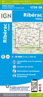 Wandelkaart - Topografische kaart 1734 SB - Serie Bleue Ribérac - Chalais | IGN - Institut Géographique National
 Wandelkaart - Topografische kaart 1735 SB - Serie Bleue Montpon-Ménestérol ,Saint-Médard-de-Mussidan | IGN - Institut Géographique National
 Wandelkaart - Topografische kaart 1736 SB - Serie Bleue Ste-Foy-la-Grande, Vélines | IGN - Institut Géographique National
 Wandelkaart - Topografische kaart 1737 SB - Serie Bleue Monségur | IGN - Institut Géographique National★★★★★
 Wandelkaart - Topografische kaart 1738 SB - Serie Bleue Marmande - Seyches | IGN - Institut Géographique National
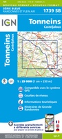 Topografische kaart - Wandelkaart 1739 SB - Serie Bleue Tonneins - Casteljaloux | IGN - Institut Géographique National
 Wandelkaart - Topografische kaart 1740 SB - Serie Bleue Nérac | IGN - Institut Géographique National
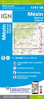 Wandelkaart - Topografische kaart 1741 SB - Serie Bleue Mézin | IGN - Institut Géographique National
 Topografische kaart - Wandelkaart 1742 SB - Serie Bleue Eauze | IGN - Institut Géographique National★★★★★
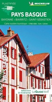 Wegenkaart - landkaart 17619 Pays Basque - Baskenland | Michelin
 Wandelkaart - Topografische kaart 1832 SB - Serie Bleue Montbron, Piégut-Pluviers | IGN - Institut Géographique National★★★★★
 Wandelkaart - Topografische kaart 1833 SB - Serie Bleue Nontron, Brantôme, Mareuil | IGN - Institut Géographique National
 Wandelkaart - Topografische kaart 1834 SB - Serie Bleue Périgueux , Tocane-Saint-Apre | IGN - Institut Géographique National
 Wandelkaart - Topografische kaart 1835 SB - Serie Bleue Villamblard, Saint-Astier, Mussidan | IGN - Institut Géographique National
 Wandelkaart - Topografische kaart 1836 SB - Serie Bleue Creysse - Bergerac | IGN - Institut Géographique National
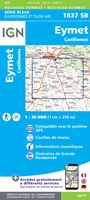 Wandelkaart - Topografische kaart 1837 SB - Serie Bleue Eymet - Castillonnès | IGN - Institut Géographique National
 Wandelkaart 1838 SB - Serie Bleue Cancon - Miramont-de-Guyenne | IGN - Institut Géographique National
Laatste reviews

Leuk informatief boek, precieze route goed weergegeven.
Keurig verpakt, snel verzonden. Boek voldoet aan mijn verwachtingen!
★★★★★ door Beatrice 12 mei 2026 | Heeft dit artikel gekocht
Top service en snelle verzending
Zoals altijd een goede ervaring en een perfecte snelle levering
★★★★★ door Perry Miog 12 mei 2026 | Heeft dit artikel gekocht
Mooie fietskaarten snelle verzending
Altijd weer fijn om te vinden wat ik zoek. Ruim aanbod van fietskaarten.
★★★★★ door Trudy 11 mei 2026 | Heeft dit artikel gekocht
Prachtige wandelingen, duidelijk beschreven
Handig formaat wandelgidsje met schitterende wandelingen in noord Portugal. De duidelijke beschrijvingen zijn handig zowel voor het plannen van de wandeling, bij het vinden van …
★★★★★ door Annemieke 11 mei 2026 | Heeft dit artikel gekocht