Wandelgidsen - South East England
 Wandelgids the New Forest | Hallewell Publications
Walks Malham & The Three Peaks is part of a popular series of A6 pocket walking guides which describe routes which are suitable for walkers of all abilities and to …
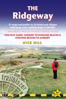 Wandelgids The Ridgeway | Trailblazer Guides
Goede wandelgids waarin met veel details alle etappes zijn beschreven. Tevens informatie over overnachtingen en openbaar vervoer. The go-to, all-in-one guide to walking The Ridgeway path. Running from Wiltshire to …
 Wandelgids Weekend Walks The Surrey Hills | Pocket Mountains
Although Surrey is not far from metropolitan London, it famously has more mature woodland than any other county in England and has long been renowned for its rolling hills and …
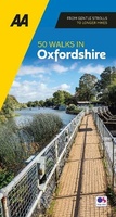 Wandelgids 50 Walks in Oxfordshire | AA Publishing
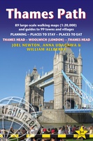 Wandelgids Thames Path | Trailblazer Guides
This book follows the Thames Path National Trail from the river's source in Gloucestershire to the Thames Barrier in London. Officially 184 miles (294km) in length (although the actual distance …
 Wandelgids Walking The Thames Path: From the Sea to the Source | England | Cicerone
Engelstalige beschrijving van een van de mooiste wandeltochten in Engeland: een stuk boordevol cultuur en geschiedenis!. De gids voldoet aan alle verwachtingen die je kunt hebben. Met apart gidjes met …
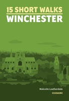 Wandelgids 15 Short Walks Winchester | England | Cicerone
Malcolm Leatherdale has chosen 15 of the best short walks around Winchester and central Hampshire for you to explore. Our guide comes with easy-to-read Ordnance Survey maps and clear route …
 Wandelgids Kent | Pocket Mountains
Situated between the Thames Estuary and the Straits of Dover, the borderland county of Kent is home to tidal saltmarshes, high chalk downs, riverside meadows and ancient woodlands, as well …
 Wandelgids Park Rangers Favourite Walks South Downs | Collins
Compacte wandelgids met 20 wandelingen geselecteerd door park rangers en met duidelijke beschrijvingen en routekaartjes. Walking guide to the South Downs National Park, with 20 best routes chosen by …
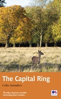 Wandelgids Capital Ring | Aurum Press
The Capital Ring is a 78-mile (125 km) walking route encircling inner London that links the astonishing number of islands of green space - parks, woodlands, abandoned railway lines, towpaths …
 Wandelgids 15 Short Walks in the Surrey Hills | Cicerone
Our authors have chosen 15 of the best short walks around the Surrey Hills for you to explore. Our guide comes with easy-to-read Ordnance Survey maps and clear route descriptions, …
 Wandelgids Hampshire's Test Way | Cicerone
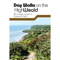 Wandelgids Day Walks on the High Weald | Vertebrate Publishing
Day Walks on the High Weald features 20 circular routes between 6.5 and 13.9 miles (10.5km and 22.4km) in length, spread across this Area of Outstanding Natural Beauty in the …
 Wandelgids 50 Walks in Surrey | AA Publishing
Uitstekende wandelgids met een aantal dagtochten tussen de 5 en 13 kilometer. Niet heel erg lang dus, maar wel op de mooiste plekken en goed beschreven en prima kaartmateriaal. …
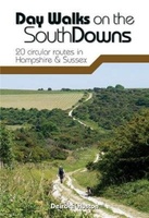 Wandelgids Day Walks n the South Downs | Vertebrate Publishing
Day Walks on the South Downs features 20 circular routes, between 6 and 14 miles (9km and 22km) in length, suitable for hill walkers of all abilities. The routes are …
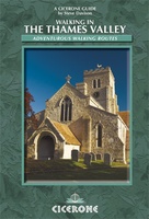 Wandelgids Walking in the Thames Valley | Cicerone
Walking in the Thames Valley offers 25 challenging circular walks around the River Thames and River Kennet in the south of England, taking in the Southern Chilterns, the Berkshire and …
 Wandelgids East Sussex | Pocket Mountains
Sitting alongside the English Channel in the southeast corner of England, East Sussex is famed for its rolling hills and magnificent wealdland, Norman battlefields and charming medieval villages, towering chalk …
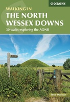 Wandelgids Walking on the North Wessex Downs | England | Cicerone
Guidebook to 30 circular walks in the North Wessex Downs Area of Outstanding Natural Beauty (AONB). The routes, which range from 7 to 21km (4 to 13 miles), take in …
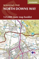 Wandelgids Walking the North Downs Way Map Booklet | England | Cicerone
All the mapping you need to walk the 130 mile (208km) North Downs Way National Trail between Farnham and Dover. One of the easier National Trails, it can be comfortably …
Laatste reviews

Na mijn vraag over welke gids ik het beste kon kopen heb ik de geadviseerde gids gekocht. Het bleek inderdaad de juiste gids voor mijn …
★★★★★ door Jan Kees 12 november 2026 | Heeft dit artikel gekocht
Ik heb al een aantal jaren bij uitgeverij De Zwerver Fietsboeken besteld van Bike-Line, o.a. Wezer Radweg, Donau Radweg, Romantische Strasze Radweg. Onlangs de boeken …
★★★★★ door Wim Wilting 12 november 2026 | Heeft dit artikel gekocht
Mooi uitgevoerd boek met veel achtergrondinformatie. Geen vervanging voor een reisgids, wel ter aanvulling daarop interessant in de voorbereiding van een (trein)reis naar Japan. Aanrader!
★★★★★ door Jolanda 11 november 2026 | Heeft dit artikel gekocht
Communicatie was goed, snel en goed verpakt, de globe is door ons verstuurd naar Estland en goed aangekomen, mijn neefje van 8 jaar is er …
★★★★★ door Bep Houtman 11 november 2026 | Heeft dit artikel gekocht