Collins
Maak je reis compleet met de handige reisgidsen en wegenkaarten van Collins
 Wegenkaart - landkaart Pocket Map Suffolk | Collins
Explore new places with handy pocket maps from Collins. Handy little full-colour map of county of Suffolk. Detailed mapping, photographs, and tourist information. Famed for its archaeological finds, swathes …
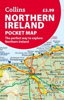 Wegenkaart - landkaart Pocket Map Northern Ireland pocket map | Collins
Handy little full colour map of Northern Ireland. Main features of this map include: • Clear mapping • Main tourist attractions located and described • Ideal for touring with …
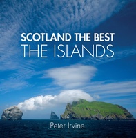 Reisgids Scotland the Best the Islands | Collins
See Scotland's remarkable islands from a new perspective in this beautiful guide curated by celebrated Scotland the Best author, Peter Irvine. Featuring images from acclaimed Scottish and international photographers accompanied …
 Wandelgids Dorset | Collins
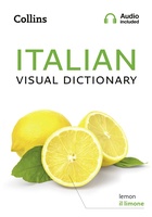 Woordenboek Visual Dictionary Italian - Italiaans taalgids | Collins
Super handig! Een taalgids waarbij naast de gewone vertaling en een fonetische poging daartoe ook een plaatje staat weergegeven. Ideaal voor een moeizame conversatie in een taal die je echt …
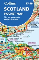 Wegenkaart - landkaart Pocket Map Scotland | Collins
Handy little full colour map of Scotland. Excellent value and very detailed for its size. Double-sided folded map with the Central Belt, southern Scotland and northern England on one side …
★★★★★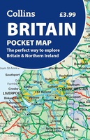 Wegenkaart - landkaart Pocket Map Britain | Collins
Discover new places with trusted mapping from Collins Explore Britain with this handy, full-colour pocket map. Excellent value and very detailed for its size. With two sides of mapping, …
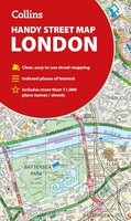 Stadsplattegrond London Handy Street Map | Collins
An essential companion for when you are travelling around London. Clear and easy-to-read map of central London and surrounding area. Contains detailed mapping, presented in a handy compact format. …
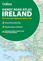 Wegenatlas Handy Road Atlas Ireland - Ierland | Collins
Handzame wegenatlas op A5 formaat van Ierland. Vrij grove schaal maar heel handig door formaat en goed kaartbeeld. Met enkele stadsplattegronden en een paar pagina's met hoogtepunten van het land. …
 Wandelgids York | Collins
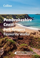 Wandelgids Park Rangers Favourite Walks Pembrokeshire Coast | Collins
The perfect companions for exploring the National Parks. Walking guide to the Pembrokeshire Coast National Park, with 20 best routes chosen by the park rangers. Each walk varies in length …
 Historische Kaart Scotland Clans and Tartans Map | Collins
Prachtige kaart van Schotland waarin duideljk wordt welke cland er zijn geweest en nog zijn. Met een mooi overzicht van alle Tartans (Stoffen) die er aan gekoppeld zijn. Discover …
 Wegenkaart - landkaart Pocket Map Wild Atlantic Way | Collins
Handy full-colour map of Ireland’s Wild Atlantic Way with a high level of detail. Clear mapping of the full 2500 km (over 1500 miles) route, showing the road network and …
★★★★★★★★★★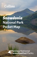 Wegenkaart - landkaart National Park Pocket Map Snowdonia | Collins
Duidelijke pocket wandelkaart met belangrijke toeristische informatie, bezienswaardigheden, campeerplekken e.d. Handy little full colour map and guide of Snowdonia National Park. Detailed mapping and visitor information to the National …
 Wegenatlas Britain & Ireland road atlas | Ringband | A5 Formaat | Collins
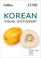 Woordenboek Visual Dictionary Korean - Koreaans taalgids | Collins
Super handig! Een taalgids waarbij naast de gewone vertaling en een fonetische poging daartoe ook een plaatje staat weergegeven. Ideaal voor een moeizame conversatie in een taal die je echt …
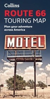 Wandelkaart Route 66 | Collins
Full color, informative map of the famous US Route 66. With detailed mapping, key tourist information and a suggested itinerary, this is a perfect guide for anyone traveling along America’s …
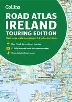 Wegenatlas Road Atlas Ireland | A4-Formaat | Paperback | Collins
Explore Ireland with this accurate and fully updated road atlas. This road atlas is at A4 size, covering the whole of Ireland and features clear and detailed Collins colour mapping …
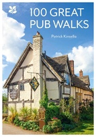 Wandelgids National Trust - Pub Walks | Collins
What better gift for a rambler than this delightful, clearly written and well researched guide to some of the UK's best walks with watering holes en route? .... With 'How …
 Woordenboek Visual Dictionary Mandarin Chinese - Mandarijn Chinees taalgids | Collins
Super handig! Een taalgids waarbij naast de gewone vertaling en een fonetische poging daartoe ook een plaatje staat weergegeven. Ideaal voor een moeizame conversatie in een taal die je echt …
Laatste reviews

Uitstekend
★★★★★ door Nelly van Ginkel 24 juli 2026 | Heeft dit artikel gekocht
Fijne kaart waterafstootend.
★★★★★ door Nicole 21 juli 2026 | Heeft dit artikel gekocht
Mooie helder kaart, netjes bezorgd
★★★★★ door Michael Rijke 21 juli 2026 | Heeft dit artikel gekocht
Fijne wandelkaart, gedetailleerd en met veel extra info. Super fijn om m voor onze vakantie al te kunnen kopen, zo kon de voorpret al beginnen …
★★★★★ door Wille Groenewolt 21 juli 2026 | Heeft dit artikel gekocht